Mount Irish

Last updated

Mount Irish is a summit in the Mount Irish Range, in the U.S. state of Nevada. [1] The elevation is 8,625 feet (2,629 m). [1]

Summit A point on a surface that is higher in elevation than all points immediately adjacent to it, in topography

A summit is a point on a surface that is higher in elevation than all points immediately adjacent to it. The topographic terms acme, apex, peak, and zenith are synonymous.

Mount Irish Range

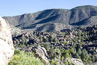
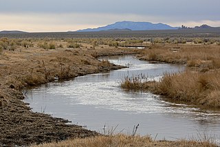
The Mount Irish Range is a mountain range in Lincoln County, Nevada. The range is bounded by the Coal Valley to the north, the Pahranagat Valley to the east, the Tikaboo Valley to the southwest and the Wild Horse Valley to the northwest. Surrounding ranges include the Seaman Range and Hiko Range to the east, the Pahranagat Range and East Pahranagat Range to the south and south east, the Groom Range to the southwest, the Timpahute Range to the west and the Golden Gate Range across Murphy Gap to the northwest.

U.S. state constituent political entity of the United States

In the United States, a state is a constituent political entity, of which there are currently 50. Bound together in a political union, each state holds governmental jurisdiction over a separate and defined geographic territory and shares its sovereignty with the federal government. Due to this shared sovereignty, Americans are citizens both of the federal republic and of the state in which they reside. State citizenship and residency are flexible, and no government approval is required to move between states, except for persons restricted by certain types of court orders. Four states use the term commonwealth rather than state in their full official names.

Mount Irish has the name of O. H. Irish, an Indian Affairs agent. [2]

O. H. Irish American diplomat

Orsamus Hylas Irish (1830–1883) was an official in the United States Department of the Treasury who served as Chief of the Bureau of Engraving and Printing from 1878 to 1883.

Related Research Articles

Gillian Settlement is an unincorporated community in Johnson County, Arkansas, United States. It is located at 35°37′54″N93°24′06″W and has an elevation of 1700 feet.

White River (Nevada) river in Nevada, United States

The White River is a small and discontinuous 138-mile-long (222 km) river located in southeastern Nevada notable for several endemic species of fish.

Pahranagat Valley valley in Nevada, United States of America

The Pahranagat Valley is a Tonopah Basin landform in Lincoln County, Nevada.

Mormon Well Spring is located in the Desert National Wildlife Range and was used from around 1900–1924 for ranching. It is listed on the United States National Register of Historic Places. Nearby is Corn Creek Campsite, another listed historic place.

Logan, Nevada

Logan, Nevada, is a ghost town located in the hills about 9.5 mi (15.3 km) west of Hiko and 2.5 mi (4.0 km) south of Mount Irish Peak. Logan had its brief existence as a mining camp when silver ore was discovered in 1865 in the Mount Irish Range just to the north in Silver Canyon on the east flank of Mount Irish.

Etna is an extinct town in Lincoln County, in the U.S. state of Nevada. The GNIS classifies it as a populated place.

Darlington, California Unincorporated community in California, United States

Darlington is an unincorporated community in El Dorado County, California. It lies at an elevation of 4196 feet.

Angola is an unincorporated community in Cumberland County, in the U.S. state of Virginia. Angola is located at 37°24′06″N78°14′24″W.

Lee Canyon is a canyon containing a small community and recreational area in the Spring Mountains located on Mount Charleston in Clark County, Nevada, United States. Primary access is via Lee Canyon Road. Access to the adjacent Kyle Canyon and Mount Charleston, Nevada is via SR 158. It is 17 acres and is located at latitude: 36-18'31"N Longitude: 115-40'37"W. It is 8,510 ft above sea level.

Lillian is an unincorporated community in Custer County, Nebraska, in the United States.

Bard is an extinct town in Clark County, in the U.S. state of Nevada. The GNIS classifies it as a populated place.

Devil Peak is a summit in the U.S. state of Nevada. The elevation is 5,856 feet (1,785 m).

Alazon is an extinct town in Elko County, in the U.S. state of Nevada. The GNIS classifies it as a populated place.

Black Forest is an extinct town in Elko County, in the U.S. state of Nevada.

Coin is an unincorporated community in Elko County, in the U.S. state of Nevada.

Gold Creek is an extinct town in Elko County, in the U.S. state of Nevada.

Moleen is an extinct town in Elko County, in the U.S. state of Nevada. The GNIS classifies it as a populated place.

Tulasco is an extinct town in Elko County, in the U.S. state of Nevada. The GNIS classifies it as a populated place.

Coal Valley is a valley in the U.S. state of Nevada.

Silver Canyon is a valley in the U.S. state of Nevada.

References