A mountain is a large landform that rises above the surrounding land in a limited area, usually in the form of a peak. A mountain is generally steeper than a hill. Mountains are formed through tectonic forces or volcanism. These forces can locally raise the surface of the earth. Mountains erode slowly through the action of rivers, weather conditions, and glaciers. A few mountains are isolated summits, but most occur in huge mountain ranges.

Mount Kilimanjaro or just Kilimanjaro, with its three volcanic cones, "Kibo", "Mawenzi", and "Shira", is a dormant volcano in Tanzania. It is the highest mountain in Africa, with its summit about 4,900 metres (16,100 ft) from its base, and 5,895 metres (19,341 ft) above sea level. The first people known to have reached the summit of the mountain were Hans Meyer and Ludwig Purtscheller, in 1889. The mountain is part of Kilimanjaro National Park and is a major climbing destination. The mountain has been the subject of many scientific studies because of its shrinking glaciers and disappearing ice fields.

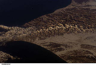
The Karakoram or Karakorum is a large mountain range spanning the borders of Pakistan, India, and China, with the northwest extremity of the range extending to Afghanistan and Tajikistan. It begins in the Wakhan Corridor (Afghanistan) in the west and encompasses the majority of Gilgit–Baltistan (Pakistan) and extends into Ladakh (India), and the disputed Aksai Chin region controlled by China. It is the second highest mountain range in the world, and part of the complex of ranges including the Pamir Mountains, the Hindu Kush and the Himalayan Mountains.. The Karakoram has eight summits over 7,500 m (24,600 ft) height, with four of them exceeding 8,000 m (26,000 ft): K2, the second highest peak in the world at 8,611 m (28,251 ft), Gasherbrum I, Broad Peak and Gasherbrum II.

Aconcagua, with a summit elevation of 6,960.8 metres (22,837 ft), is the highest mountain in both the Southern and Western Hemispheres. It is located in the Andes mountain range, in the Mendoza Province, Argentina, and lies 112 km (70 mi) northwest of its capital, the city of Mendoza, about five km (3.1 mi) from San Juan Province and 15 km (9.3 mi) from the international border with Chile. The mountain itself lies entirely within Argentina, immediately east of Argentina's border with Chile. The nearest higher peak is Tirich Mir in the Hindu Kush, 16,520 kilometres (10,270 mi) away. It is one of the Seven Summits.

The Rwenzori Mountains, previously called the "Ruwenzori Range", is a mountain range of eastern equatorial Africa, located on the border between Uganda and the Democratic Republic of the Congo (DRC). These mountains support glaciers and are one source of the Nile river.
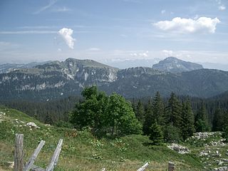
The Chartreuse Mountains is a mountain range in southeastern France, stretching from the city of Grenoble in the south to the Lac du Bourget in the north. It is part of the French Prealps, which continue as the Bauges to the north and the Vercors to the south.

These are lists of mountains and mountain ranges in Ireland. Those within Northern Ireland, or on the border, are marked with an asterisk, while the rest are within the Republic of Ireland. Where mountains are ranked by height, the definition of the "topographical prominence", used to classify the mountain, is noted. In British definitions, a height of 600 metres (1,969 ft) is required for a "mountain", whereas in Ireland, a lower threshold of 500 metres (1,640 ft) is sometimes advocated.
The Wollemi Creek, a partly perennial stream of the Hawkesbury-Nepean catchment, is located in the Central Tablelands and Blue Mountains regions of New South Wales, Australia.

The Brindabella Range, commonly called The Brindabellas, is a mountain range located in Australia, on a state and territory border of New South Wales and the Australian Capital Territory (ACT). The range rises to the west of Canberra, the capital city of Australia, and includes the Namadgi National Park in the ACT and the Bimberi Nature Reserve and Brindabella National Park in New South Wales. The Brindabellas are visible to the west of Canberra and form an important part of the city's landscape.

European highway E 134 is a European highway that crosses Norway starting near the city of Haugesund on the west coast, heading over Haukeli, passing the city of Drammen, and ending in the municipality of Frogn near the national capital of Oslo.

Scotland is the most mountainous country in the United Kingdom. The area north and west of the Highland Boundary Fault is known as the Highlands, and contains the country's main mountain ranges. Scotland's mountain ranges, in a rough north to south direction are: The Highlands & Islands, The Hills of the Central Lowlands, the Southern Uplands. The zone includes Britain's highest peaks, especially Ben Nevis at over 4000 feet, with several similar peaks in the Cairngorms.

Eucumbene Dam is a major gated earthfill embankment dam with an overflow ski-jump and bucket spillway with two vertical lift gates across the Eucumbene River in the Snowy Mountains of New South Wales, Australia. The dam's main purpose is for the generation of hydro-power and is one of the sixteen major dams that comprise the Snowy Mountains Scheme, a vast hydroelectricity and irrigation complex constructed in south-east Australia between 1949 and 1974 and now run by Snowy Hydro.

The Albertine Rift is the western branch of the East African Rift, covering parts of Uganda, the Democratic Republic of the Congo (DRC), Rwanda, Burundi and Tanzania. It extends from the northern end of Lake Albert to the southern end of Lake Tanganyika. The geographical term includes the valley and the surrounding mountains.

The mountains and hills of the British Isles are categorised into lists based on elevation, prominence, and other criteria. These lists are used for peak bagging, whereby hillwalkers attempt to reach all the summits on a list, the oldest and best-known, being the 282 § Munros in Scotland, which amongst other criteria, must be above 3,000 feet (914.4 m).

Lefka Ori or Madares is a mountain range located in Western Crete, in the Chania prefecture. The White Mountains or Lefka Ori occupy a large part of the centre of West Crete and are the main feature of the region. They consist mainly of limestone, from light grey to bluish or black color. The "White Mountains" have got their name from the perpetual white or off white color of their peaks as the off white of limestone during the summer and fall interchanges with the snow that covers the peaks until late in spring.

An ultra-prominent peak, or Ultra for short, is a mountain summit with a topographic prominence of 1,500 metres (4,900 ft) or more; it is also called a P1500. There are approximately 1,524 such peaks on Earth. Some well-known peaks, such as the Matterhorn and Eiger, are not Ultras because they are connected to higher mountains by high cols and therefore do not achieve enough topographic prominence.