Related Research Articles

Malawi, officially the Republic of Malawi and formerly known as Nyasaland, is a landlocked country in Southeastern Africa. It is bordered by Zambia to the west, Tanzania to the north and northeast, and Mozambique to the east, south and southwest. Malawi spans over 118,484 km2 (45,747 sq mi) and has an estimated population of 19,431,566. Malawi's capital and largest city is Lilongwe. Its second-largest is Blantyre, its third-largest is Mzuzu and its fourth-largest is its former capital, Zomba. It was the first capital city of Malawi before being changed to Lilongwe.

Blantyre is Malawi's centre of finance and commerce, and its second largest city, with a population of 800,264 as of 2018. It is sometimes referred to as the commercial and industrial capital of Malawi as opposed to the political capital, Lilongwe. It is the capital of the country's Southern Region as well as the Blantyre District.

Brachystegia is a genus of tree of the subfamily Detarioideae that is native to tropical Africa.

The Zomba Plateau, also called the Zomba Massif, is a mountain of the Shire Highlands in southern Malawi. Its total area is about 130 square kilometres (50 sq mi), with a highest point of 2,087 metres (6,847 ft).
Blantyre is a district in the Southern Region of Malawi. The capital is Blantyre, a commercial city where most Malawian industrial and business offices are. The district covers an area of 2,012 km² and has a population of 809,397. It was named after Blantyre, the birth village of David Livingstone in Scotland, one of the first missionary explorers who came to Nyasaland, as Malawi was called before independence in 1964. It is also a main trading point besides the other large cities in Malawi. The other large cities are Lilongwe, which is located in the central region, and Mzuzu, which is in the northern part of Malawi.
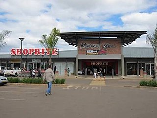
Mzimba is a district in the Northern Region of Malawi. The capital is Mzimba and the biggest town is Mzuzu, which is also the administrative headquarters of the Northern Region. The district covers an area of 10,473 km2 and has a population of 1,017,701 (2023). It is the largest district in Malawi. The district is inhabited by descendants of Tumbuka and few Ngoni people. Chitumbuka is the predominant language spoken in the district.

The University of Malawi (UNIMA) is a public university established in 1965 and until 4 May 2021, when the university underwent a delinking, was composed of four constituent colleges located in Zomba, Blantyre, and Lilongwe. Of the four colleges, the largest is Chancellor College in Zomba. It is part of the Malawian government educational system. The last Vice-Chancellor was Professor John Kalenga Saka.

Mulanje Mountain Forest Reserve is a nature reserve founded in 1927 in Malawi. The reserve covers 56,317 hectares. It is operated by the Mulanje Mountain Conservation Trust. The reserve was designated a biosphere reserve by UNESCO in 2000.

Frank Mkalawile Chipasula is a Malawian writer, editor and university professor, "easily one of the best of the known writers in the discourse of Malawian letters".

Chiradzulu Mountain is located in the Shire Highlands of Malawi, approximately 20 km to the north-east of Blantyre, Malawi's main commercial centre. The administrative district of Chiradzulu in southern Malawi was named after this mountain. Chiradzulu Mountain rises to a peak of 1,773m above sea level and is the third highest mountain peak in southern Malawi, after Mulanje Mountain, whose famous Sapitwa peak rises to 3,002m above sea level, and Zomba Mountain, which rises to 2,085m above sea level at its peak.
CURE International, based in Grand Rapids, MI, is a Christian nonprofit organization that owns and operates eight charitable children's hospitals around the world. CURE provides medical care to pediatric patients with orthopedic, reconstructive plastic, and neurological conditions. The organization's stated mission is to "heal the sick and proclaim the kingdom of God." The organization currently operates hospitals in Ethiopia, Kenya, Malawi, Niger, the Philippines, Uganda, Zambia and Zimbabwe.
St. Andrew's International School in Blantyre, Malawi, was founded 1938 by the Church of Scotland Mission in Blantyre. The high school in its present form was established in 1958. SAIntS is a British International School offering (i) GCSE, A Level and BTEC qualifications and a wealth of extra-curricular opportunities.
Ken Diston Lipenga is a Malawian politician, journalist, and writer. He was the Member of Parliament for Phalombe East from 1997 to 2014. He has served in various ministerial positions.
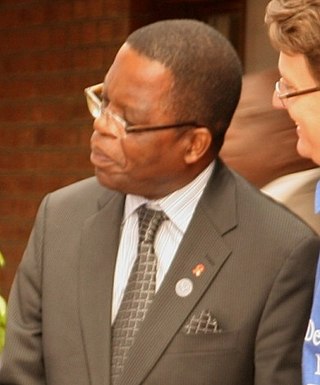
Professor Peter Nelson Mwanza is a Malawian politician. He was appointed Minister of Lands, Housing and Urban Development in the government of President Bingu wa Mutharika of Malawi on 17 June 2009. He was reassigned to become Minister of Agriculture and Food Security in a cabinet reshuffle on 9 August 2010.
Michiru Mountain is located about 5 miles north of the city of Blantyre, Malawi, on the edge of the Great Rift Valley. The summit sits at an elevation of 3,925 feet, although because it rises from a high plateau its prominence is only a few hundred feet. The mountain is known for its many species of birds. The road to Michiru is uneven and can only be accessed by off-road vehicles.
Soche is a 3,955-metre-high (12,976 ft) dacitic volcano in Ecuador and is located on the northern end of a secondary volcanic chain. Constructed on a Paleozoic substratum, it contains an eastwards-opening caldera in the summit region. A large eruption in 6650 BCE generated ashfall into Colombia and two lava domes in the caldera. The ash- and lapilli-fall is about a metre thick in the Interandean valley and the neighbouring cordilleras and most likely represented a long-lasting obstacle for human population. Earlier eruptive events involving a lava flow that was subsequently offset by a fault zone named the Cayambe-Chingual fault by 110m occurred 9.67 ka BP, and another involving a pyroclastic flow was dated at 37.22 ± 0.63 ka BP.

The Matundwe Range is a range of mountains in southernmost Malawi and adjacent Tete Province of Mozambique. The range is located between the Zambezi and Shire rivers just north of their confluence, and the Malawi-Mozambique border runs along the divide between the two rivers' watersheds.
Dedza Mountain is a mountain in central Malawi. It is located in Dedza District, just north of the town of Dedza.
The Zambezian region is a large biogeographical region in Africa. The Zambezian region includes woodlands, savannas, grasslands, and thickets, extending from east to west in a broad belt across the continent. The Zambezian region lies south of the rainforests of the Guineo-Congolian region. The Zambezian region is bounded by deserts and xeric shrublands on the southwest, the Highveld grasslands of South Africa to the south, and the subtropical Maputaland forests on the southeast.
References
- ↑ Mauambeta, Daulos (2010). Status of Forests and Tree Management in Malawi: A Position Paper Prepared for the Coordination Union for Rehabilitation of the Environment (CURE). CURE Technical Report. September 2010 DOI: 10.13140/2.1.3497.7926
| | This Malawi location article is a stub. You can help Wikipedia by expanding it. |
| | This Africa mountain, mountain range, or peak related article is a stub. You can help Wikipedia by expanding it. |