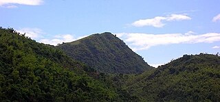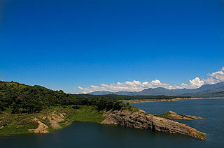
Calabarzon, sometimes referred to as Southern Tagalog and designated as Region IV‑A, is an administrative region in the Philippines. The region comprises five provinces: Batangas, Cavite, Laguna, Quezon, and Rizal; and one highly urbanized city, Lucena. It is the most populous region in the Philippines, according to the Philippine Statistics Authority (PSA), having over 16.1 million inhabitants in 2020, and is also the country's second most densely populated after the National Capital Region. It is situated southeast of Metro Manila, and is bordered by Manila Bay and South China Sea to the west, Lamon Bay and the Bicol Region to the east, Tayabas Bay and the Sibuyan Sea to the south, and Central Luzon to the north. It is home to places like Mount Makiling near Los Baños, Laguna, and Taal Volcano in Batangas.

Occidental Mindoro, officially the Province of Occidental Mindoro, is a province in the Philippines located in the Mimaropa region. The province occupies the western half of the island of Mindoro. Its capital is Mamburao, but the largest municipality is San Jose occupying almost half of the entire province. As of 2020, Occidental Mindoro has 525,354 inhabitants.

Rodriguez, officially the Municipality of Rodriguez, is a 1st class urban municipality in the province of Rizal, Philippines. According to the 2020 census, it has a population of 443,954 people making it the most populous municipality in the country. Pending an affirmation through plebiscite, Republic Act No. 11812 repealed Batas Pambansa Blg. 275 and intend to revert to its original municipal name Montalban.

Tanay, officially the Municipality of Tanay, is a 1st class municipality in the province of Rizal, Philippines. According to the 2020 census, it has a population of 139,420 people.

Rizal, officially the Municipality of Rizal, is a 5th class municipality in the province of Cagayan, Philippines. According to the 2020 census, it has a population of 19,077 people.

Sapang Dalaga, officially the Municipality of Sapang Dalaga, is a 4th class municipality in the province of Misamis Occidental, Philippines. According to the 2020 census, it has a population of 20,490 people.

Maria Makiling, more properly Mariang Makiling, is a diwatà (anito) in Philippine mythology, associated with Mount Makiling in Laguna, Philippines. She is the most widely known diwatà in Philippine mythology and was venerated in pre-colonial Philippines as a goddess known as Dayang Masalanta or Dian Masalanta who was invoked to stop deluges, storms, and earthquakes.

Talim Island is the largest lake island in Laguna de Bay, the largest lake in the Philippines. The hilly island is within the boundaries of the Province of Rizal, under the jurisdiction of two municipalities. The western side is part of the municipality of Binangonan, while the eastern section is part of Cardona.

Mount Sembrano is a volcano located between Rizal and Laguna of the Calabarzon region in the Philippines. It is situated about 60 kilometers (37 mi) east by road from the capital city of Manila.

Mount Mantalingahan is the highest mountain in the island province of Palawan in the Philippines, with an elevation of 6,844 ft (2,086 m) above sea level, its ranked 68th-highest peak of an island on Earth and 10th-most prominent mountain in the Philippines. Located in the southern part of Palawan Island that forms the highest part of the Beaufort Mountains Ultramafics geological region, a series of ultramafic outcrops of Eocene origin, of which Mount Victoria forms the largest contiguous land area. The peak of the mountain is the highest point on Palawan island.
Enrique Gayoso Magalona Jr., popularly known as Pancho Magalona, was a Filipino actor from the 1940s to the 1970s.

A breast-shaped hill is a hill in the shape of a breast. Some such hills are named "Pap", an archaic word for the breast or nipple of a woman. Such anthropomorphic geographic features are found in different places of the world and in some cultures they were revered as the attributes of the Mother Goddess, such as the Paps of Anu, named after Anu, an important female deity of pre-Christian Ireland.

Malepunyo Range is an extinct volcano located in Luzon. The mountain range is located between the provinces of Batangas, Laguna and Quezon. It is popular among mountaineers, and has three interconnected destinations: Mt. Malepunyo, the highest; Bagwis Peak ; and Mount Dalaga.

Biak-na-Bato National Park is a protected area of the Philippines located almost entirely within Barangay Biak-na-Bato in San Miguel, Bulacan from where it derives its name. The park also extends to the nearby municipalities of San Ildefonso and Doña Remedios Trinidad covering a total area of 2,117 hectares. It was declared a national park in 1937 by President Manuel L. Quezon by virtue of its association with the history and site of the Biak-na-Bato Republic. The park consists of a cave network and a system of rivers and trails of both historical and ecological importance. Situated only 80 kilometers (50 mi) northeast from Manila, it is fast becoming a popular weekend eco-adventure destination for the city dwellers.

Mount Tagapo, also known as Susong Dalaga, is a conical peak on the lake island of Talim on Laguna de Bay, the largest lake in the Philippines. The mountain ridge is 438 m (1,437 ft) in elevation and the highest point of Talim Island. The peak falls under the jurisdiction of the towns of Binangonan and Cardona in Rizal province,Calabarzon region

Mounts Banahaw–San Cristobal Protected Landscape is a protected landscape park in the Calabarzon region of the Philippines, 120 kilometres (75 mi) south of Manila. It is the second largest protected area in Calabarzon, after the Upper Marikina River Basin Protected Landscape, with an area of 10,900.59 hectares. The park is located at the border of Laguna and Quezon provinces and includes the features it is named after: Mount Banahaw and, 7 kilometres (4.3 mi) to its west, Mount San Cristobal.

The Angat Watershed Forest Reserve is a conservation area that protects the drainage basin in the southern Sierra Madre range north of Metro Manila in the Philippines where surface water empties into the Angat River and its distributaries. It is spread over an area of 62,309 hectares in the eastern portion of Bulacan and northern Rizal province at an altitude of between 490 and 1,206 metres. The conservation area also extends to the provinces of Nueva Ecija and Quezon and is centered on an artificial lake created by the Angat Dam which, together with the Ipo Dam located 7.5 kilometres (4.7 mi) downstream, supply 97% of the water requirement of Metro Manila via an aqueduct system to the La Mesa Dam and Reservoir and the Balara Filtration Plant in Quezon City. The Angat Dam and Reservoir is also a major source of hydroelectricity for Metro Manila and surrounding provinces, contributing some 200 megawatts to the Luzon grid. The watershed is a popular birdwatching site and is a biodiversity hotspot containing most of the remaining closed-canopy forests in Central Luzon.

The Pantabangan–Carranglan Watershed Forest Reserve is a conservation area located in the upper reaches of the Pampanga River in Nueva Ecija, Philippines, and borders the Sierra Madre and Caraballo Mountains in Aurora and Nueva Vizcaya. It encompasses 84,500 hectares of the drainage basin surrounding the Pantabangan Lake, an impoundment of the Pampanga River by the Pantabangan Dam. The multi-purpose dam is situated at the confluence of Pampanga River's two headwaters, namely the Pantabangan and Carranglan Rivers in the municipality of Pantabangan. It stretches above the dam site for 21 kilometres (13 mi) to where Carranglan River originates in the Caraballo on the north, and for 18 kilometres (11 mi) to where Pantabangan River originates in the Sierra Madre on the east. It is considered a critical watershed for the agricultural economy and hydroelectric power generation in the region of Central Luzon.

Mount Batulao is an inactive stratovolcano in the Calabarzon region of the Philippines, located in northwest Batangas province along its border with Cavite. It is a dissected andesitic stratovolcano at the northwestern rim of the Taal Caldera which began to form in the late Pliocene period, about 3.4 million years ago. The mountain is a prominent landmark of jagged peaks, rolling to rugged ridges and deep gorges situated just west of the hill station of Tagaytay at the southwestern end of the Tagaytay Ridge. It is well known for its scenery, as well as its retreat centers and resorts located just 85 kilometres (53 mi) south of Manila.


