Geography | |
---|---|
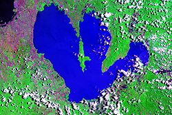
Location | Laguna de Bay |
Coordinates | 14°21′7″N121°13′54″E / 14.35194°N 121.23167°E |
Administration | |
Region | Calabarzon |
Province | Rizal |
Municipalities | |
Demographics | |
Population | 40,018 (as of 2020) |
Additional information | |
Talim Island is the largest lake island in Laguna de Bay, the largest lake in the Philippines. The hilly island is within the boundaries of the Province of Rizal, under the jurisdiction of two municipalities. The western side is part of the municipality of Binangonan, while the eastern section is part of Cardona.
The island is volcanic in origin and forms the southwest rim of the Laguna Caldera. Volcanism after the formation of the caldera created the maars and volcanic craters at the southern end of Talim Island, [1] the largest of which is a 3-kilometre (1.9 mi) crater surrounding Brgys. Balibago and Tuna. [2]
The island consists of 24 barangays that lie along its shores, 17 belong to the town of Binangonan and 7 to Cardona.
| Map of Rizal highlighting Talim Island |
Marking's Guerrillas operated on the island in 1943, during WWII. [3] [4]
Talim Island is located almost at the center of Laguna de Bay, a three-lobed lake the center of which is the Laguna Caldera. The northernmost tip of the island is separated from the mainland by Diablo Pass, which is only about 240 meters (790 ft) at the narrowest. The southernmost tip of the island is called Talim Point.
The highest point of the island is Mount Tagapo, known locally as "Bundok ng Susong Dalaga" (Maiden's breast mountains) for the conical hill at its peak resembling the female breast. The hill is among the several in the Tagalog region that are called as such because of its shape. This feature is best observed from neighboring Mount Sembrano in the Jalajala peninsula across the lake. [5]
The island is rich in bamboo, which the islanders make into different types of furniture such as bamboo sofas, cabinets, tables, chairs and a lot more. It is their main source of living, while lake fishing is only secondary.
Also, along the lake are fish pens that supports the everyday needs of the islanders.
Three Roman Catholic parish churches are located on the island. [6] The Santo Domingo Parish Church is in Janosa, Binangonan, Our Lady of Lourdes Parish Church in Navotas, Cardona, and San Francisco de Asis Parish Church in Habagatan, Binangonan. Also, a few Jehovah's Witnesses [7] [8] live on the island, and they have three meeting places called Kingdom Halls. [9] [10] The Iglesia ni Cristo [11] has a place of worship [12] in Barangay Subay, Cardona. And also two Unida Christian Church which is located in Bombong, Binangonan and Kinagatan, Binangonan
A caldera is a large cauldron-like hollow that forms shortly after the emptying of a magma chamber in a volcano eruption. When large volumes of magma are erupted over a short time, structural support for the rock above the magma chamber is gone. The ground surface then collapses into the emptied or partially emptied magma chamber, leaving a large depression at the surface. Although sometimes described as a crater, the feature is actually a type of sinkhole, as it is formed through subsidence and collapse rather than an explosion or impact. Compared to the thousands of volcanic eruptions that occur each century, the formation of a caldera is a rare event, occurring only a few times per century. Only seven caldera-forming collapses are known to have occurred between 1911 and 2016. More recently, a caldera collapse occurred at Kīlauea, Hawaii in 2018.
Laguna, officially the Province of Laguna, is a province in the Philippines located in the Calabarzon region in Luzon. Its capital is Santa Cruz while its largest city is the City of Calamba and the province is situated southeast of Metro Manila, south of the province of Rizal, west of Quezon, north of Batangas and east of Cavite. Laguna hugs the southern shores of Laguna de Bay, the largest lake in the country. As of the 2020 census, the province's total population is 3,382,193. It is the seventh richest province in the country.
Rizal, officially the Province of Rizal, is a province in the Philippines located in the Calabarzon region in Luzon. Its capital is the city of Antipolo. It is about 16 kilometres (9.9 mi) east of Manila. The province is named after José Rizal, one of the main national heroes of the Philippines. It is bordered by Metro Manila to the west, Bulacan to the north, Quezon to the east and Laguna to the southeast. The province also lies on the northern shores of Laguna de Bay, the largest lake in the country. Rizal is a mountainous province perched on the western slopes of the southern portion of the Sierra Madre mountain range.
Laguna de Bay, also known as Laguna Lake, is the largest lake in the Philippines. It is located southeast of Metro Manila, between the provinces of Laguna to the south and Rizal to the north. A freshwater lake, it has a surface area of 911–949 km², with an average depth of about 2.8 meters and an elevation of about one meter above sea level. The lake is shaped like a crow's foot, with two peninsulas jutting out from the northern shore and filling the large volcanic Laguna Caldera. In the middle of the lake is the large island of Talim.
Los Baños, officially the Municipality of Los Baños, colloquialy 'elbi' or simply LB, is a 1st class municipality in the province of Laguna, Philippines. According to the 2020 census, it has a population of 115,353 people.
Lubao, officially the Municipality of Lubao, is a 1st class municipality in the province of Pampanga, Philippines. According to the 2020 census, it has a population of 173,502 people.
Santa Rosa, officially the City of Santa Rosa, is a 1st class component city in the province of Laguna, Philippines. According to the 2020 census, its population was 414,812 people.
San Leonardo, officially the Municipality of San Leonardo, is a 1st class municipality in the province of Nueva Ecija, Philippines. According to the 2020 census, it has a population of 68,536 people.
Cabuyao, officially the City of Cabuyao, is a 1st class component city in the province of Laguna, Philippines. According to the 2020 census, it has a population of 355,330 people.
Angono, officially the Municipality of Angono, is a 1st class municipality in the province of Rizal, Philippines. According to the 2020 census, it has a population of 130,494 people.
Binangonan, officially the Municipality of Binangonan, is a 1st class municipality in the province of Rizal, Philippines. According to the 2020 census, it has a population of 313,631 people.
Cardona, officially the Municipality of Cardona, is a 3rd class municipality in the province of Rizal, Philippines. According to the 2020 census, it has a population of 50,143 people.
Morong, officially the Municipality of Morong, is a 2nd class municipality located in the province of Rizal, Philippines. As per the 2020 census, Morong has a population of 71,151 people.
Bato, officially the Municipality of Bato, is a 3rd class municipality in the province of Camarines Sur, Philippines. According to the 2020 census, it has a population of 52,155 people.
Iriga, officially the City of Iriga, is component city in the province of Camarines Sur, Philippines. According to the 2020 census, it has a population of 114,457 people.
Lopez, officially the Municipality of Lopez, is a 1st class municipality in the province of Quezon, Philippines. According to the 2020 census, it has a population of 94,657 people.
Mount Sembrano is a volcano located between Rizal and Laguna of the Calabarzon region in the Philippines. Mt. Sembrano is situated about 60 kilometres (37 mi) east by road from the capital city of Manila.
Laguna Caldera is a potentially active volcanic caldera and a geographical depression in Rizal, Philippines. It is broadly elliptical in shape, with dimensions of 20 by 10 km. It has a summit elevation of 743 metres (2,438 ft). The caldera forms the middle lobe of Laguna de Bay, bound by the Morong Peninsula and Talim Island to the west, and the Jalajala Peninsula to the east.
Mount Tagapo, also known as Susong Dalaga mountain, is a conical peak on the lake island of Talim on Laguna de Bay, the largest lake in the Philippines. The mountain ridge is 438 m (1,437 ft) in elevation and the highest point of Talim Island. The peak falls under the jurisdiction of the towns of Binangonan and Cardona in Rizal province,Calabarzon region
Mayapa–Canlubang Cadre Road, also known as Mayapa Road, is a two- to four-lane, tertiary national road, located in Calamba, Laguna in the Philippines. It spans 2.768 kilometers (1.720 mi) stretching from the "Checkpoint" area at the intersection with Manila South Road in barangay Paciano Rizal to Jose Yulo Sr. Avenue and Silangan Industrial Park Road in barangay Canlubang. This road adjoins the Canlubang Exit of South Luzon Expressway.
{{cite web}}
: CS1 maint: archived copy as title (link)