Location, mouth and headwaters
The Sapang Baho river originates in the mountains of Rizal province, including upper portions of the city of Marikina, which has since become part of the Metro Manila. Its mouth, which once released water directly into Laguna de Bay, has been obscured by the construction of the Manggahan Floodway, into whose East bank it now drains at the barangay of San Francisco, Cainta, somewhere near San Francisco Elementary School. [3]
The portion of the river cut off by the floodway still exists, visible at the opposite bank of the floodway at the Greenwoods Executive Village in Cainta, and ending at the original rivermouth where the shore of Taytay, Rizal meets Laguna de Bay.
The main body of the river actually meanders only a short distance between Taytay and Cainta, Rizal, where it branches out into smaller creeks at Village East Subdivision, near the LLDA water sampling station. [3]
Creeks further upstream which serve as the headwaters of the Sapang Baho include (from West to East): Hakbangan Creek in Marikina; a creek at Barangay Mayamot, Antipolo; and furthest to the Southeast, the Taktak River and Hinulugang Taktak falls in Antipolo. [3]

Rizal, officially the Province of Rizal, is a province in the Philippines located in the Calabarzon region in Luzon. Its capital is the city of Antipolo. It is about 16 kilometers (9.9 mi) east of Manila. The province is named after José Rizal, one of the main national heroes of the Philippines. It is bordered by Metro Manila to the west, Bulacan to the north, Quezon to the east and Laguna to the southeast. The province also lies on the northern shores of Laguna de Bay, the largest lake in the country. Rizal is a mountainous province perched on the western slopes of the southern portion of the Sierra Madre mountain range.

Laguna de Bay, also known as Laguna Lake and alternatively spelled "Laguna de Bae", is the largest lake in the Philippines. It is located southeast of Metro Manila, between the provinces of Laguna to the south and Rizal to the north. A freshwater lake, it has a surface area of 911–949 km2, with an average depth of about 2.8 meters and an elevation of about one meter above sea level. The lake is shaped like a crow's foot, with two peninsulas jutting out from the northern shore and filling the large volcanic Laguna Caldera. In the middle of the lake is the large island of Talim.

The Pasig River is a water body in the Philippines that connects Laguna de Bay to Manila Bay. Stretching for 25.2 kilometers (15.7 mi), it bisects the Philippine capital of Manila and its surrounding urban area into northern and southern halves. Its major tributaries are the Marikina River and San Juan River. The total drainage basin of the Pasig River, including the basin of Laguna de Bay, covers 4,678 square kilometers (1,806 sq mi).

Pasig, officially the City of Pasig, is a highly urbanized city in the National Capital Region of the Philippines. According to the 2020 census, it has a population of 803,159 people.

Marikina, officially the City of Marikina, is a 1st class highly urbanized city in the National Capital Region of the Philippines. According to the 2020 census, it has a population of 456,159 people.
Antipolo, officially the City of Antipolo, is a 1st class component city and capital of the province of Rizal, Philippines. According to the 2020 census, it has a population of 887,399 people. It is the most populous city in Rizal Province and in Calabarzon region, and the seventh most-populous city in the Philippines. It is also the most populated city under the component city status.

Cainta, officially the Municipality of Cainta, is a 1st class urban municipality in the province of Rizal, Philippines. According to the 2020 census, it has a population of 376,933 people.

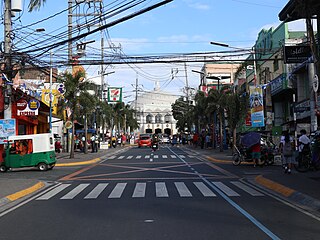
Taytay, officially the Municipality of Taytay, is a 1st class urban municipality in the province of Rizal, Philippines. It is also known as the Garments Capital of the Philippines.
The Laguna Lake Development Authority (LLDA), one of the attached agencies of the Department of Environment and Natural Resources (DENR), is responsible for the preservation, development, and sustainability of Laguna de Bay and its 21 major tributary rivers.
The Marikina River is a river in eastern Metro Manila, Philippines. It is the largest tributary of the Pasig River, with headwaters located in the Sierra Madre Mountains in Rodriguez, Rizal province.

Hinulugang Taktak Protected Landscape, also known as Hinulugan Taktak, is a protected area located in Rizal, Philippines. Initially assigned as a recreation area, the waterfall area has been designated as a national park by virtue of Republic Act No. 6964 in 1990. Ten years later, it became a protected landscape in accordance to Proclamation No. 412. It is being managed by the Department of Environment and Natural Resources and the Rizal Provincial Government. As of 2003 and 2004, Hinulugang Taktak is the second most popular national park in the Philippines in terms of number of visitors.
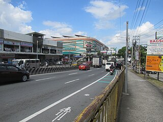
The Marikina–Infanta Highway, also known as Marilaque Highway, Marilaque Road, Marikina-Infanta Road, or its former name Marcos Highway, is a 117.5-kilometer (73.0 mi) highway that connects Quezon City, Metro Manila with Infanta, Quezon in the Philippines. Motorists colloquially refer to the road as Marilaque Highway.

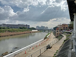
The Manggahan Floodway is an artificially constructed waterway in Metro Manila, Philippines. The floodway was built in 1986, with the cost of 1.1 billion pesos, in order to reduce flooding along the Pasig River during the rainy season, by diverting the peak water flows of the Marikina River to Laguna de Bay, which serves as a temporary reservoir. In case the water level on the lake is higher than the Marikina River, the floodway can also reverse the flow.
The geography of the City of Manila is characterized by its coastal position at the estuary of the Pasig River that flows to Manila Bay. The city is located on a naturally protected harbor, regarded as one of the finest harbors in Asia. The scarce availability of land is a contributing factor that makes Manila the densest populated city in the world.

Manila, also known as Tondo until 1859, was a province of the Philippines that encompassed the former pre-Hispanic polities of Tondo, Maynila, and Namayan. In 1898, it comprised the city of Manila and 23 other municipalities. In 1901, the province was dissolved, with the city of Manila absorbing six of its smaller neighboring municipalities. The remaining part was merged with the adjacent district of Morong to form the province of Rizal.

Ortigas Avenue is a 12.1 km (7.5 mi) highway running from eastern Metro Manila to western Rizal in the Philippines. It is one of the busiest highways in Metro Manila, serving as the main thoroughfare of the metro's east–west corridor, catering mainly to the traffic to and from Rizal.

The Manila East Road, also known as National Road and National Highway, is a two-to-four lane primary and secondary highway connecting Metro Manila to the provinces of Rizal and Laguna in the Philippines.

The Upper Marikina River Basin Protected Landscape is a protected area in the Province of Rizal in the Philippines, which forms the upper area of the drainage basin of the Marikina River.
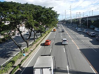
Radial Road 5, more commonly referred to as R-5, is a network of roads and bridges that all together form the fifth radial road of Manila in the Philippines. The road links the City of Manila with Mandaluyong and Pasig in the east, leading out of Metro Manila into the province of Rizal and south towards Laguna. It is the only arterial road traversing the east side of Laguna de Bay.

The following is an alphabetical list of articles related to the Philippine capital region of Metro Manila.


