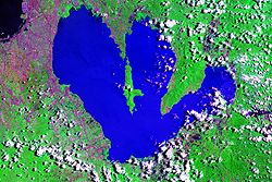
San Cristobal River

Last updated
San Cristobal River
Matang Tubig Down Falls.jpg
San Cristobal River, the boundary shore of Calamba City
Philippines relief location map (Luzon).svg
Red pog.svg
Philippines relief location map (square).svg
Red pog.svg
Native nameMatang Tubig River  (Tagalog)
Location
Country Philippines
Region Calabarzon
Province Laguna
Cities
Physical characteristics
Mouth  
  coordinates
14°13′49.5″N121°11′12.4″E / 14.230417°N 121.186778°E / 14.230417; 121.186778 Coordinates: 14°13′49.5″N121°11′12.4″E / 14.230417°N 121.186778°E / 14.230417; 121.186778
  elevation
less than 2 meters (6.6 ft) above sea level

The San Cristobal River (Tagalog : Ilog ng San Cristobal) commonly known as Matang Tubig River is a river system in the cities of Calamba and Cabuyao, Laguna, Philippines. [1] [2] The river is one of 21 major tributaries of Laguna de Bay.

Contents

Hydrology

The main source of the San Cristobal River is Mount Sungay, the highest mountain of Cavite province, where the main stem and its tributaries drain the northern and eastern side of the mountain. [3] Its watershed area covers Calamba and Cabuyao in Laguna, Tagaytay and municipality of Silang in Cavite. The river system of San Cristobal from Mount Sungay is connected to the Matang Tubig located in Casile and Canlubang. [4]

Water quality

Along with the San Juan River, the two rivers act as natural drainage systems by receiving and conveying Calamba's (and Cabuyao's for San Cristobal) liquid wastes and storm surface runoff to the nearby Laguna de Bay. Both rivers are very polluted as a result, thus, affecting the water quality of the lake as well. [1]

Although a 1991 study cited the San Pedro River and Morong River as the sources of eutrophication-causing minerals in Laguna de Bay, the Laguna Lake Development Authority (LLDA) has noted that more recent deterioration of the San Cristobal River in Calamba have made it one of the lake's major sources of nutrient loading. [5] The LLDA's conservation efforts for the major tributaries and watersheds of Laguna de Bay have led to the creation of the Laguna de Bay River Basin Councils, of which the San Cristobal River Enhancement Defenders (SACRED) is particularly tasked with conservation of the San Cristobal. [6]

See also

Related Research Articles

Laguna (province) Landlocked province in Calabarzon, Philippines

Laguna, officially the Province of Laguna, is a province in the Philippines located in the Calabarzon region in Luzon. Its capital is Santa Cruz and the province is situated southeast of Metro Manila, south of the province of Rizal, west of Quezon, north of Batangas and east of Cavite. Laguna hugs the southern shores of Laguna de Bay, the largest lake in the country. As of the 2020 census, the province's total population is 3,382,193 . It is the seventh richest province in the country.

Calabarzon Administrative region of the Philippines

Calabarzon, formally known as the Southern Tagalog Mainland, is an administrative region in the Philippines, designated as Region IV-A. The region comprises five provinces: Batangas, Cavite, Laguna, Quezon, and Rizal; and one highly urbanized city, Lucena. The region is the most populous region in the Philippines according to the Philippine Statistics Authority, having over 14.4 million inhabitants in 2020, and is also the country's second most densely populated after the National Capital Region. 

Laguna de Bay Largest lake in the Philippines

Laguna de Bay, also known as Laguna Lake, is the largest lake in the Philippines. It is located southeast of Metro Manila, between the provinces of Laguna to the south and Rizal to the north. A freshwater lake, it has a surface area of 911–949 km², with an average depth of about 2.8 meters and an elevation of about one meter above sea level. The lake is shaped like a crow's foot, with two peninsulas jutting out from the northern shore and filling the large volcanic Laguna Caldera. In the middle of the lake is the large island of Talim.

Tagaytay City in the Philippines

Tagaytay, officially known as the City of Tagaytay, is a 2nd class component city in the province of Cavite, Philippines. According to the 2020 census, it has a population of 85,330 people. 

Calamba, Laguna Component city in Calabarzon, Philippines

Calamba, officially known as the City of Calamba, is a 1st class component city in the province of Laguna, Philippines. According to the 2020 census, it has a population of 539,671 people. 

Cabuyao Component city in Calabarzon, Philippines

Cabuyao, officially known as the City of Cabuyao, is a 1st class component city in the province of Laguna, Philippines. According to the 2020 census, it has a population of 355,330 people. 

Mount Makiling Volcano in the Philippines

Mount Makiling, or Mount Maquiling, is an inactive stratovolcano located in the provinces of Laguna and Batangas on the island of Luzon, Philippines. The mountain rises to an elevation of 1,090 m (3,580 ft) above mean sea level and is the highest feature of the Laguna Volcanic Field. The volcano has no recorded historic eruption but volcanism is still evident through geothermal features like mud spring and hot springs. South of the mountain is the Makiling-Banahaw Geothermal Plant. The Philippine Institute of Volcanology and Seismology (PHIVOLCS) classifies the volcano as "Inactive".

Canlubang Barangay in Luzon, Philippines

Canlubang is a major industrial zone located in the province of Laguna, southwest of Metro Manila in the Philippines. It was once a hacienda during the Spanish colonial period. Canlubang straddles two component cities of Laguna: Cabuyao, Calamba and the municipality of Silang in Cavite.

Laguna Lake Development Authority

The Laguna Lake Development Authority (LLDA), one of the attached agencies of the Department of Environment and Natural Resources (DENR), is responsible for the preservation, development, and sustainability of Laguna de Bay and its 21 major tributary rivers.

Bumbungan River

The Bumbungan River is a river in the province of Laguna in the Philippines. It is commonly referred to as the Pagsanjan River because of the popularity of the municipality of Pagsanjan and Pagsanjan Falls, one of the province's tourist destinations. The municipality of Pagsanjan was named so because it is where the Balanac River, originating from Mount Banahaw, joins the Bumbungan. Its old name, Pinagsangahan, which literally means branching, was changed to Pagsanjan during the Spanish Colonial Era.

The Morong River, also referred to as the Morong-Teresa River, is a river system in Rizal, Philippines. It is one of 21 major tributaries of Laguna de Bay. It covers 14 barangays and stretches 10 kilometres (6.2 mi) from Antipolo City down to Teresa, Rizal, Morong, Rizal and finally to Laguna de Bay.

The Sapang Baho River is a river system that runs through Rizal Province and Marikina in the Philippines. The name, when literally translated, means "smelly creek." It is one of 21 tributaries of Laguna de Bay and is regularly monitored by the Laguna Lake Development Authority (LLDA) through one of its 15 river monitoring stations. Among its headwaters are the Hinulugang Taktak falls on the Taktak River in Antipolo city, once a famed tourist destination in the days before urbanization and pollution.

San Juan River (Calamba)

The San Juan River, also known as Calamba River, is a river system in Calamba, Laguna, Philippines. It is one of 21 major tributaries of Laguna de Bay and is regularly monitored by the Laguna Lake Development Authority (LLDA) through one of its 15 river monitoring stations.

Pangil River

The Pangil River, also known as the Bambang Hari River, is a river system that runs through Pangil, Laguna in the Philippines. It is one of 21 River tributaries of Laguna de Bay and is regularly monitored by the Laguna Lake Development Authority(LLDA) through one of its 15 river monitoring stations.

Siniloan River

The Siniloan River, also known as the Romelo River, is a river system that runs through Siniloan, Laguna on the island of Luzon, in the Philippines. It is one of 21 tributaries of Laguna de Bay and is regularly monitored by the Laguna Lake Development Authority (LLDA) through one of its 15 river monitoring stations.

Barangay Casile is an upland barangay and one of the 18 urbanized barangays comprising the City of Cabuyao in the province of Laguna, Philippines. It is about twenty three kilometres away from the city proper of Cabuyao and is situated at the western and high elevation portion of the city averaging 352 meters. According to the 2010 Census, it has a population of 2,128 inhabitants. Casile is ranked second to last when it comes to population among the barangays of the town.

The Laguna Lakeshore Expressway Dike is a proposed expressway in the Philippines that will start from the coastal area of Laguna de Bay from Taguig in Metro Manila to Calamba and Los Baños in Laguna.

Mount Sungay Volcanic mountain in the Philippines

Mount Sungay, also known as Mount Gonzales, is a mountain in the province of Cavite in the Philippines. Located in eastern Tagaytay, the inactive stratovolcano is the highest point of the province of Cavite, at 709 metres. The slopes of the mountain are the source of the San Cristobal River that flows from the mountain to Silang, Cavite down to its mouth at Laguna de Bay in Calamba, Laguna.

Matang Tubig

Matang Tubig is a cold spring and tourist spot in Laguna, Philippines it is bounded by Cabuyao and Calamba cities. It slopes to the foot of Casile Valley. The Matang Tubig water source is from Tagaytay in the province of Cavite, The cave is close adjacent beside in Canlubang Golf & Country Club, along the valley fault.

The Tagaytay–Calamba Road is a two- to four-lane, secondary and tertiary road in Laguna and Cavite, Philippines. Albeit discontinuous, it connects the city of Calamba in Laguna and the city of Tagaytay in Cavite. The road's missing link that will connect its Tagaytay and Calamba sections is under construction.

References

  1. 1 2 World Bank Environmental Assessment Report: Calamba, Laguna, August 1997, retrieved 2007-09-30
  2. REPUBLIC ACT NO. 9024: AN ACT CONVERTING THE MUNICIPALITY OF CALAMBA, PROVINCE OF LAGUNA INTO A COMPONENT CITY TO BE KNOWN AS THE CITY OF CALAMBA., 5 March 2001, retrieved 2007-09-30
  3. "Mount Sungay". Google Maps. Retrieved on 2014-09-19.
  4. Final List of Watersheds Supporting 140 River Irrigation System of the NIA (PDF), 2006, retrieved 2012-08-15
  5. The Laguna de Bay Masterplan, 1995, archived from the original on 2007-09-29, retrieved 2007-09-30
  6. Project to protect waterways: Assistance for the San Cristobal, 11 January 2007, archived from the original on 2007-11-01, retrieved 2007-09-30