Related Research Articles
Year 69 BC was a year of the pre-Julian Roman calendar. At the time it was known as the Year of the Consulship of Hortensius and Metellus. The denomination 69 BC for this year has been used since the early medieval period, when the Anno Domini calendar era became the prevalent method in Europe for naming years.

Chania, also spelled Hania, is a city in Greece and the capital of the Chania regional unit. It lies along the north west coast of the island Crete, about 70 km (43 mi) west of Rethymno and 145 km (90 mi) west of Heraklion.

Britomartis was a Greek goddess of mountains and hunting, who was primarily worshipped on the island of Crete. She was sometimes believed to be an oread, or a mountain nymph, but she was often conflated or syncretized with Artemis and Aphaea, the "invisible" patroness of Aegina. She is also known as Dictynna or as a daughter of Dictynna.
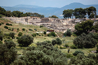
Phaistos ), also transliterated as Phaestos, Festos and Latin Phaestus, is a Bronze Age archaeological site at modern Faistos, a municipality in south central Crete. It is notable for the remains of a Minoan palace and the surrounding town.
Apollonia or Apolonia may refer to :

Hersonissos, also transliterated as Chersonissos and Hersónisos, is a town and a local government unit in the north of Crete, bordering the Mediterranean / Aegean Sea. The town is about 25 kilometers east of Heraklion and west of Agios Nikolaos. What is usually called Hersonissos is in fact its peninsula and harbour. It is part of the Heraklion regional unit. It is situated 25 km from the Heraklion airport and 27 km from the Heraklion port. The seat of the local government unit is the village of Gournes.
Cydonia may refer to:

Akrotiri is a peninsula and former municipality in the Chania regional unit, Crete, Greece. Since the 2011 local government reform it is part of the municipality Chania, of which it is a municipal unit. The municipal unit has an area of 112.644 km2 (43.492 sq mi). Its ancient name was Kiamon while the Byzantines called it Charaka. The largest town in the peninsula is Kounoupidiana. The beach at Stavros became famous because of the film Zorba the Greek.

Kydonia or Cydonia was an ancient city-state on the northwest coast of the island of Crete. It is at the site of the modern-day Greek city of Chania. In legend Cydonia was founded by King Cydon (Κύδων), a son of Hermes or Apollo and of Akakallis, the daughter of King Minos. According to Pausanias he was son of king Tegeates.
Olous or Olus was a city of ancient Crete; now sunken, it was situated at the present day town of Elounda, Crete, Greece. According to the Stadiasmus Maris Magni, it had a harbour and was located 260 stadia from Chersonasus and 15 stadia from Camara.

Souda Bay is a bay and natural harbour near the town of Souda on the northwest coast of the Greek island of Crete. The bay is about 15 km long and only two to four km wide, and a deep natural harbour. It is formed between the Akrotiri peninsula and Cape Drapano, and runs west to east. The bay is overlooked on both sides by hills, with a relatively low and narrow isthmus in the west near Chania.
Phalaecus was the ruler of Phocis in Greece during the Third Sacred War before he was ousted. After he was ousted he became the leader of a group of mercenaries, whose services were sought by Knossos in Crete. Once in Crete. The leaders of Knossos ordered him to attack their enemy, the city of Lyttus. The Lyttians appealed to the Spartans who came to Crete with an army under their king Archidamus III. As Phalaecus was besieging Lyttus, the Spartans arrived and relieved the siege. Later in 343 BC Phalaecus attacked and laid siege to Kydonia, where he was routed and he lost his life.
Nea Kydonia is a former municipality in the Chania regional unit, Crete, Greece. Since the 2011 local government reform it is part of the municipality Chania, of which it is a municipal unit. The municipal unit has an area of 21.457 km2 (8.285 sq mi). It is situated on the western outskirts of Chania. It saw fierce fighting during the Battle of Crete during World War II and there the main prisoner of war camp for Allied soldiers in Western Crete was in Galatas.
The Gulf of Chania is an embayment of the Sea of Crete in the northwestern region of the island of Crete in present-day Greece. One headland forming the Gulf of Chania is the promontory known as the Akrotiri Peninsula.

Elyrus or Elyros was a town of ancient Crete, which the Periplus of Pseudo-Scylax places between Cydonia and Lissus. It had a harbour, Syia (Συΐα), situated on the south coast of the island, 60 stadia west of Poecilassus. Pausanias states that the city existed in his time in the mountains of Crete. He adds that he had seen at Delphi the bronze goat which the Elyrians had dedicated, and which was represented in the act of giving suckle to Phylacis and Phylander, children of Apollo and the nymph Acacallis, whose love had been won by the youthful god at the house of Casmanor at Tarrha. It was the birthplace of Thaletas, who was considered as the inventor of the Cretic rhythm, the national paeans and songs, with many of the institutions of his country. Elyrus appears in Hierocles' list of Cretan cities, then reduced in number to twenty-one. The coins of this city have the type of a bee upon them.

Aptera or Apteron was an ancient city, now an archaeological site in western Crete, a kilometre inland from the southern shore of Souda Bay, about 13 km east of the city of Chania in the municipality of Chania.
Malaxa is a village in the Chania regional unit on Crete in Greece. The 2011 census counted a population of 115 people in the village. In ancient times the Malaxa area was under the sphere of influence of the nearby powerful city of Kydonia. Malaxa lies on the feet of the Lefka Ori, and is separated from the large city of Chania by the Chania Plain.
Kastri is a village in the island of Cythera, Islands regional unit, Greece. Kastri has been occupied by humans since the Bronze Age, and was an important settlement of the Early Helladic/Minoan Period of Crete. Kastri is thought to have been an early settlement of Minoan Crete. Kastri on Cythera is considerably but directly north of the ancient site of Kydonia, which was the major northwestern Cretan ancient city.
The Chania Plain is a relatively level landform spreading southward from the city of Chania on the island of Crete in the present day country of Greece. The Chania Plain has been used as a logical study area for air pollution transport in the vicinity of Chania. In ancient times the city of Kydonia, the site of present-day Chania, controlled an expansive area which included the Chania Plain lying to its south at least to Malaxa Mountain.
Malaxa Mountain is a mountain at Malaxa on the island of Crete in the country of Greece. This mountain feature is situated in northwestern coastal Crete in the vicinity of the city of Chania. Trypali limestone is a dominant rock of Malaxa Mountain. The ancient city of Kydonia held sway over lands to the south of it across the Chania Plain all the way to Malaxa Mountain.
References
- ↑ Strabo (7 BC) Geographica
- ↑ Robert Pashley (1837) Travels in Crete, J. Murray
- ↑ C. Michael Hogan, Cydonia, The Modern Antiquarian, Jan. 23, 2008
| Authority control databases: Geographic |
|---|
| | This Crete location article is a stub. You can help Wikipedia by expanding it. |