Related Research Articles
The Lugbara live in the Democratic Republic of the Congo, Uganda , and South Sudan. Their number totaled approximately 240,000, with around 180,000 residing in north-western Uganda, with the remaining population spread across bordering areas of the modern-day Democratic Republic of Congo and South Sudan. The Lugbara people speak in a Sudanese language. The basic social and economic unit found in Lugbara culture is a lineage group under the authority of a male genealogical elder called ba wara, meaning "big man". These lineage groups, often referred to as sub-tribes, typically lived in a village built atop a hillside or ridge. In addition to the male elder, other religious leaders include diviners, oracles, and rain men.

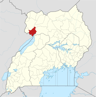
Arua District is a district in the Northern Region of Uganda. Like many Ugandan districts, it too shares its name with its administrative center of Arua. The name Arua is said to be derived from the Lugbara name for prison (Arujo) and prisoner (Aru), since the white settlers had a detention center at Arua Hill.
Nebbi District is a district in Northern Uganda. It is named after its main municipal, commercial and administrative centre, Nebbi, the location of the district headquarters.

Yumbe District is a district in Northern Region, Uganda. Like most other Ugandan districts, it is named after its 'chief town', Yumbe, where the district headquarters are located.

The Mà'dí are a Central Sudanic speaking people that live in Magwi County in Eastern Equatoria, South Sudan and the districts of Adjumani and Moyo in Uganda. From south to north, the area runs from Nimule, at the South Sudan Uganda border, to Nyolo River where the Ma’di mingle with the Acholi, the Bari, and the Lolubo. From the east to west, it runs from Parajok/Magwi to Uganda across the River Nile.

The Lugbara are a Central Sudanic ethnic group who live primarily in the West Nile region of Uganda, in the adjoining area of the Democratic Republic of the Congo (DRC) with a few living in South Sudan. They speak the Lugbara language, a Central Sudanic language similar to the language spoken by the Madi, with whom they also share many cultural similarities.
Articles related to Uganda include:

Tourism in Uganda is focused on Uganda's landscape and wildlife. It is a major driver of employment, investment and foreign exchange, contributing USh 4.9 trillion to Uganda's GDP in the financial year 2012–2013.
The Moru–Madi languages of the Central Sudanic language family are a cluster of closely related languages spoken in South Sudan, the Democratic Republic of Congo, and Uganda. Moru is spoken by 100,000 people, and Ma'di is spoken by twice that number. The most populous languages are Aringa of Uganda, with close to a million speakers, and Lugbara, with 1.6 million.

Lugbara cuisine is one of the meals of East Africa and the ancient Lado Enclave. The Lugbara people of northwestern Uganda and northeastern DR Congo eat not only vegetable dishes, but also animals like goats, cows plus ope (guineafowls) and catch insects like onya for food which is called nyaka in the standard Lugbara language used in Arua. Cassava flour, sometimes mixed with millet or sorghum like posho or ugali, is the staple food and is called enya(sa) and accompanied with a range of soup dishes. Rice, yams, potatoes and matoke are also eaten. Below is a list of some of the Lugbara-styled delicacies found in West Nile Restaurants, Ariwara Town, Arua Park in Kampala and many homes or cafeterias that cherish traditional Lugbara cuisine.
Tara is a subcounty at the north-eastern end of Maracha District of Uganda. It is an area endowed with rocks and is neighboured in the Northwest by Koboko; to the Northeast by Yumbe; to the East by Omugo subcounty plus to the South by Nyadri. Other subcounties in Maracha include Yivu, Aiivu, Oleba, Uriama, Omugo and Nyadri.
Lugbara music refers to music performed in Lugbara. It can be a folk song, musical proverb or modern pop music. The general term for music in Lugbara is ongo.

Rhino Camp Refugee Settlement is a refugee camp located in the districts of Madi-Okollo and Terego District in North Western Uganda.
Christopher Israel Umba Gore, also known as Gadwin Gore, was an Ugandan military officer who served as head of the Uganda Army Air Force during the last stages of President Idi Amin's dictatorship. He disappeared during the Uganda–Tanzania War, with some sources claiming that he either died in combat in 1979 or escaped to southern Sudan.
The Uganda Army, also known as Uganda Armed Forces, served as the national armed forces of Uganda during the dictatorship of Idi Amin (1971–1979). It mostly collapsed during the Uganda–Tanzania War, but remnants continued to operate in exile from 1979. These pro-Amin rebel forces continued to be called the "Uganda Army" and maintained a semblance of cohesion until 1980, when they fully fractured into rival factions.
The Arube uprising, also known as Arube mutiny and Arube Coup, was a military coup d'état attempt organized on 23–24 March 1974 by discontented elements of the Uganda Army to overthrow Ugandan President Idi Amin. Led by Brigadier Charles Arube, the coupists aimed not only for a government takeover, but also to remove many influential foreign-born soldiers from the Ugandan military. Although the rebels initially succeeded in capturing much of Uganda's capital Kampala, Arube was killed by Amin as he attempted to capture him, resulting in the gradual collapse of the coup. With the aid of loyal troops from outside the capital, the President was able to put down the coup after two days of heavy fighting.
Lugbara Kari refers to the official traditional and cultural institution of all Lugbara people on Earth and headed by the Agofe.
In October 1980, Uganda's West Nile Region was the site of a major military campaign, as Uganda Army (UA) remnants invaded from Zaire as well as Sudan and seized several major settlements, followed by a counteroffensive by the Uganda National Liberation Army (UNLA) supported by militias and Tanzanian forces. The campaign resulted in large-scale destruction and massacres of civilians, mostly perpetrated by the UNLA and allied militants, with 1,000 to 30,000 civilians killed and 250,000 displaced. The clashes mark the beginning of the Ugandan Bush War.
Ojapi is a parish in the northwestern subregion of Uganda. Originally part of Tara Subcounty, it was carved out in 2006 to form Ajira Subcounty in the Maracha East Constituency, Maracha District.
River Enyau is one of the longest rivers in West Nile; it empties into the White Nile after flowing from Vurra through Arua City, Ayivu and Terego.
References
- ↑ "Mount Wati and Miriadua Falls are West Nile's Best-Kept Secret. Observer (4 October 2022)
- ↑ "Mt. Wati: West Nile's Hidden Tourism Gem". Daily Monitor (Wednesday 16 October 2024)
- ↑ "Mt. Wati - The Oli Banyale Epic". Sunny Outdoors
- ↑ "Wati (Mi Ngoni, West Nile)". Mountain Slayers Uganda
- ↑ "Across Mt. Wati" Redefines West Nile Film Industry. Tone Touch Music