Mousaitbeh

Last updated
Mousaitbeh
المصيطبة
Beirut location map.svg
Red pog.svg
Mousaitbeh
Coordinates: 33°53′01″N35°29′44″E / 33.8836°N 35.4955°E / 33.8836; 35.4955
CountryFlag of Lebanon.svg  Lebanon

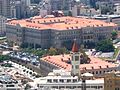
al-Mousaitbeh is a quarter in Beirut, the Lebanese capital. [1] [2] It is a mixed area of Sunni Muslims and Greek Orthodox Christians. [3]

Demographics

Religion in Mousaitbeh (2014) [4]
ReligionPercent
Sunni Islam
58.22%
Shia Islam
16.02%
Christian
22.20%
Others
3.56%

In 2014, Muslims made up 74.29% and Christians made up 22.20% of registered voters in Mousaitbeh. 58.22% of the voters were Sunni Muslims, 16.02% were Shiite Muslims, 7.78% were Greek Orthodox and 5,45% were Syriac Orthodox. [5]

Related Research Articles

<span class="mw-page-title-main">South Governorate</span> Governorate of Lebanon

South Governorate is one of the governorates of Lebanon, with a population of 590,000 inhabitants and an area of 929.6 km2. The capital is Sidon. The lowest elevation is sea-level; the highest is 1,000 meters. The local population is religiously diverse and includes Shia and Sunni Muslims, Druze, Eastern Orthodox, Maronite, Protestant, and Greek Catholic Christians. Temperatures can drop to 4 °C during winter with much rain and snow on the higher ground. In the humid summer, temperatures can rise to 30 °C in the coastal areas. The governorate has several rivers: the Litani, Deir El Zahrani, Naqoura, Awali, Qasmiye, and Hasbani. The area is famous for its citrus and banana farms. Its main cities are Sidon, Tyre and Jezzine.

<span class="mw-page-title-main">Beirut Governorate</span> Governorate of Lebanon

Beirut Governorate is a Lebanese governorate that consists of one district and one city, Beirut, which is also its capital, and the capital of Lebanon.

<span class="mw-page-title-main">Choueifat</span> Place in Mount Lebanon Governorate, Lebanon

Choueifat is one of the biggest and most important cities in southeast of Beirut in Lebanon. The city is a Druze enclave that lies on the eastern side of Beirut's airport. The local population of the city is made up of mostly Druze and Christians minority, but in the last 25 years, many Beirutis have moved in to escape the capital's high rents, while many southerners have found Choueifat a good alternative to the crowded southern suburb known as Dahieh.

<span class="mw-page-title-main">Halba, Lebanon</span> Town in Akkar Governorate

Halba is the capital of Akkar Governorate in northern Lebanon, close to the border with Syria. It is located at around 34°33′2″N36°4′41″E. Its population is divided between Sunni Muslim, Greek Orthodox Christians, Maronites, and followers of other religions.

Al-Kfeir is a municipality nestled 900 m above sea level, in Hasbaiya District (Qada'a), an administrative division of Nabatiyeh Governorate (Mohafazah) along the steep slopes of the top of the Jebel Sheikh in Lebanon.

<span class="mw-page-title-main">Saifi Village</span>

Saifi Village is an upscale residential neighbourhood in Beirut, Lebanon. Saifi Village is located at the southeastern periphery of Centre Ville. The village is bordered by Rue Charles Debbas to the south, Rue George Haddad to the east, Rue Gouraud to the north and Rue Ariss & Kanaani to the west. Its location is at the beginning of the former Green Line, which was the main frontline in Beirut during the Lebanese Civil War.

Jdeideh, also Jdayde, Jdaideh and Jdeidet el-Matn, is a coastal municipality and the administrative capital of the Matn District in the Mount Lebanon Governorate.

<span class="mw-page-title-main">Rmeil</span> Quarter of Beirut

Rmeil is one of the neighborhoods of Beirut, the capital of Lebanon. It is located near Ashrafieh, Medawar and Saifi. The neighborhood is known for its Greek Orthodox churches such as Saint Georges and Saint Nicolas. Cultural areas are located in Rmeil, like the Sursock Museum.

Hadath is a municipality in the Baabda District of the Mount Lebanon Governorate in Lebanon. It borders the southern periphery of the Lebanese capital Beirut and is considered part of its metropolitan area.

Miniyeh or Minya is the capital of the Miniyeh-Danniyeh District in North Governorate of Lebanon. Minya is located 96 km from Beirut at an altitude of 20 m above sea level.

<span class="mw-page-title-main">Zuqaq al-Blat</span> Quarter of Beirut

Zuqaq al-Blat is one of the twelve quarters of Beirut.

Fnaidek, Fnaydeq, is a village in Akkar Governorate, Lebanon. Its inhabitants are Sunni Muslims.

Bebnine is a town located in the Akkar District of the Akkar Governorate in Lebanon. Its inhabitants are primarily Sunni Muslims.

<span class="mw-page-title-main">Bachoura, Beirut</span> Place

Al Bachoura is a neighbourhood in Beirut, the capital of Lebanon.

Al Mazraa is a neighborhood in Beirut, the capital of Lebanon. It is predominantly Sunni with some Sunni-Shia mixed areas.

Ad-Duhairah is a municipality in Southern Lebanon, located in Tyre District, Governorate of South Lebanon.

Al-Bustan or Boustane is a municipality in Southern Lebanon, located in Tyre District, Governorate of South Lebanon.

Dar el-Mraisseh is a neighborhood in Beirut, the capital of Lebanon.

Minet el-Hosn is a neighborhood in Beirut, the capital of Lebanon.

Medawar is a neighborhood in Beirut, the capital of Lebanon.

References

  1. "نحن التراث: مرويّات عن السكن" [We are the heritage: narratives about housing]. مرصد السكن (in Arabic). Retrieved 24 October 2024.
  2. "Another City Series". مرصد السكن. Retrieved 2024-10-24.
  3. "nka pamphlets: mousseitbeh" (PDF). Housing Monitor (in Arabic). Retrieved 24 October 2024.
  4. https://lub-anan.com/المحافظات/بيروت/بيروت-الثالثة/المصيطبة/المذاهب/
  5. https://lub-anan.com/المحافظات/بيروت/بيروت-الثالثة/المصيطبة/المذاهب/