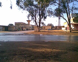
Msus or Zawiyat Msus (Arabic: زاوية مسوس), also Masous is a village in eastern Libya. It's located 130km (81mi) on the southeast of Benghazi, and far from Suluq on the same direction by 80km (50mi).[1]
Suluq is a town in the Benghazi District of the Cyrenaica region in northeastern Libya. It is located about 53 kilometers to the south-east of Benghazi.
There is a road linking her to Suluq. It's also linked with Charruba (about 69km (43mi) to the north) by another road.
Charruba or Kharruba is a village in Libya. It is located 66 kilometres (41 mi) south of Al Marj, and 186 kilometres (116 mi) west of Timimi. It’s linked with Timimi by the Charruba-Timimi desert road, and with Tacnis by another road.
Msus had been a site of several battles between Italian colonial forces and Libyan resistance fighters, like the one took place on March 3; 1914, between the latter (withdrawing from the Battle of Sceleildima) and the former.[2]
Notes
↑ Salem Mohammed ez Zawam, “Mu’jam al Amakin al Jughrafiya fi Libia”, Dar wa Maktabat ash Sha’b, Misratah, 2005, p.75.
↑ Kalifa Tillisi, “Mu’jam Ma’arik Al Jihad fi Libia1911-1931”, Dar Ath Thaqafa, Beirut, Lebanon, 1973, p.263.
This page is based on this Wikipedia article Text is available under the CC BY-SA 4.0 license; additional terms may apply. Images, videos and audio are available under their respective licenses.
Related Research Articles
Germa, known in ancient times as Garama, is an archaeological site in Libya. It was the capital of the Garamantian Kingdom.
Zuwarah, or Zuwara or Zwara, is a port city in northwestern Libya, with a population of around 32,893, famous for its beaches and seafood. It is situated 102 km (63 mi) west of Tripoli and 60 km (37 mi) from the Tunisian border. It is the capital of the Nuqat al Khams district. Its population speaks Zuwara Berber, a Zenati Berber language.
Mohieddin Fikini, last name also spelled Fekini, was the Prime Minister of Libya from 19 March 1963 to 22 January 1964. He was also the Minister of foreign affairs from 19 March 1963 to 22 January 1964.
Gazala, or Ain el Gazala, is a small Libyan village near the coast in the northeastern portion of the country. It is located 60 kilometres (37 mi) west of Tobruk.
Italian Tripolitania was an Italian colony, located in present-day western Libya, that existed from 1912 to 1934. It was part of the Italian North African territory conquered from the Ottoman Empire in 1911. Italian Tripolitania included the western northern half of Libya, with Tripoli as its main city.
Marada is a desert oasis in the Al Wahat District, Cyrenaica region, in northeastern Libya.
Zawiat at-Taban, or Taban ; also An-Nayan or Wadi Sammalus, is a check point in the District of Jabal al Akhdar in north-eastern Libya. It is located on the cross-roads between the Charruba–Mechili–Timimi desert road and the Marawa–Wadi Sammalus.
Marawa is a town in the District of Jabal al Akhdar in north-eastern Libya, about 65 km south of Bayda. It is located on the cross-roads between the Marj-Lamluda inner road, and the Qasr Libya-Taban road.
Timimi, At Timimi or Tmimi, is a small village in Libya about 75 km east of Derna and 100 km west of Tobruk. It is on the eastern shores of the Libyan coastline of the Mediterranean Sea.
Ahmed Sharif as-Senussi was the supreme leader of the Senussi order (1902–1933), although his leadership in the years 1917–1933 could be considered nominal. His daughter, Fatimah el-Sharif was the Queen consort of King Idris I of Libya.
Qaminis or Ghemines is a small town adjacent to the Gulf of Sidra in the Cyrenaica region of northwestern Libya. It is located about 50 km (31 mi) to the south of Benghazi, and 23 km (14 mi) west of Suluq.
El Magrun(Arabic: المقرون) is a village in the Benghazi District, of the Cyrenaica region in northeastern Libya.
Farzougha is a village in the Jebel Akhdar landscape in the Marj District in the northern Cyrenaica region of northeastern Libya.
El Uweilia is a village in the Jebel Akhdar mountains foothills region in Libya. It is located some 16 km (9.9 mi) east of Marj and 89 km (55 mi) west of Bayda.
Umm al Rizam is a town in eastern Libya. It is located some 48 km (30 mi) south of Derna. It is linked to Ras et Teen beach by a road which is 16 km (10 mi) long.
Bomba is a village in eastern Libya on the Gulf of Bomba. It is located 61 km (38 mi) south of Derna.
Tacnis or Taknis, Tècnis, also is a small town in Jebel Akhdar region in north eastern Cyrenaica, Libya. It's located 127 km (79 mi) east of Benghazi. It is on the inner road between Marj and Lamluda. There is a minor road connecting the town to the north with Libyan Coastal Highway. There also an indirect road connecting it with Charruba to the south.
Al Fejeij, or Al Fjeij is an oasis in southwestern Libya. It is located 52 km (32 mi) east of Ubari, on the crossroads between Sabha-Ubari road, and the south road to Tesawa, and Murzuk.
Zwila, also Zuila, Zweila, Zawila, Zawilah or Zuweila, is a village in southwestern Libya.
Battah or Batta is a village in eastern Libya, almost 34 km (21 mi) northeast of Al Marj.