Mt. Lebanon Tunnel

Last updated
Mt. Lebanon Tunnel
Lebo tunnel trolley arriving jeh.jpg
South end
Overview
Line
  Red Line – Castle Shannon
  Red Line – South Hills Village
LocationAllegheny County, Pennsylvania
Statusoperational
System Pittsburgh Light Rail
Start Dormont Junction
End Mt. Lebanon
No. of stations0
Operation
Constructed New Austrian Tunnelling method
Owner Port Authority of Allegheny County
OperatorPort Authority of Allegheny County
Technical
Length3,000 feet (910 m)
No. of tracks 2
Track gauge 5 ft 2 12 in (1,588 mm)
Electrified overhead catenary

The Mt. Lebanon Tunnel is a light rail tunnel in Allegheny County, Pennsylvania, also known as the Dormont/Mt. Lebanon Transit Tunnel, part of the Pittsburgh Light Rail system.

Light rail typically an urban form of public transport using steel-tracked fixed guideways

Light rail, light rail transit (LRT), or fast tram is a form of urban rail transit using rolling stock similar to a tramway, but operating at a higher capacity, and often on an exclusive right-of-way.

Allegheny County, Pennsylvania County in the United States

Allegheny County is a county in the southwest of the U.S. state of Pennsylvania. As of 2017 the population was 1,223,048, making it the state's second-most populous county, following Philadelphia County. The county seat is Pittsburgh. Allegheny County is included in the Pittsburgh, PA Metropolitan Statistical Area, and in the Pittsburgh Designated Market Area.

Pittsburgh Light Rail light rail system in Allegheny County, Pennyslvania

The Pittsburgh Light Rail is a 26.2-mile (42.2 km) light rail system in Pittsburgh, Pennsylvania; it becomes a subway in Downtown Pittsburgh and largely as an at-grade in the suburbs south of the city. The system is largely linear in a north-south direction, with one terminus just north of Pittsburgh's central business district and two termini in the South Hills. The system is owned and operated by the Port Authority of Allegheny County. It is the successor system to the streetcar network formerly operated by Pittsburgh Railways, the oldest portions of which date to 1903. The Pittsburgh light rail lines are vestigial from the city's streetcar days, and is one of only three light rail systems in the United States that continues to use the Pennsylvania Trolley (broad) gauge rail on its lines instead of 4 ft 8 12 instandard gauge. Pittsburgh is one of the few North American cities that have continued to operate light rail systems in an uninterrupted evolution from the first-generation streetcar era, along with Boston, Cleveland, New Orleans, Newark, Philadelphia, San Francisco and Toronto.

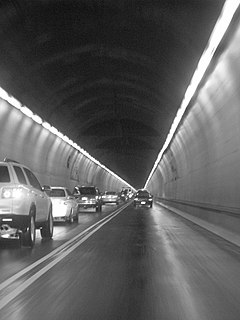
The 3,000-foot (910 m) long tunnel connects the Dormont Junction and Mt. Lebanon stations beneath Washington Road & West Liberty Ave. from Shady Drive East to McFarland Road at a maximum depth of 100 feet (30 m), and runs beneath a cemetery.

Dormont Junction station Pittsburgh Light Rail station

Dormont Junction is a station on the "Beechview" branch of the Port Authority of Allegheny County's light rail network. It is located in Dormont, Pennsylvania. The station is an important park and ride facility, featuring 132 spaces. West Liberty Avenue, Dormont's main artery, is located one block from the station, in a portion of the street that is lined with automobile dealerships. Opposite the commercial sector, a densely populated residential area is located with many homes within walking distance of the station.

Mt. Lebanon station Pittsburgh Light Rail station

Mt. Lebanon is a station on the Red Line of the Port Authority of Allegheny County's light rail system, serving Mt. Lebanon, Pennsylvania. Opened in 1987, as of 2005 it serves an average of up to 2,000 passengers a day through both rail and bus connections.

The pre-tunnel trolley street line, which ended in 1984, ran from the long-removed Clearview Loop stop on Alfred St. (Mt. Lebanon) to the intersection of McFarland Rd. and Raleigh Ave. (Dormont).

The tunnel was constructed by a technique called the New Austrian Tunnelling method, a tunneling process developed in the early 1960s that has become the primary tunneling practice in Europe. This is the first time that this money-saving technique was used for transit construction in the United States. [1]

The difference with NATM lies in the means of support required to maintain the rock cavity and the configuration of the tunnel structure. With conventional tunneling, support of the rock cavity consists of a rib cage framework of steel beams and horizontal wooden planks. A reinforced steel concrete lining is added to create a perfectly shaped tunnel. With NATM, the rock surrounding the hole becomes the support system. This is done by lining the tunnel cavity with several thin layers of shotcrete, concrete that is blown on under air pressure. [2]

Shotcrete building material

Shotcrete, gunite or sprayed concrete is concrete or mortar conveyed through a hose and pneumatically projected at high velocity onto a surface, as a construction technique. It is typically reinforced by conventional steel rods, steel mesh, or fibers.

The tunnel has continuous television surveillance. [3]

Related Research Articles

Dormont, Pennsylvania Borough in Pennsylvania, United States

Dormont is a borough in Allegheny County, Pennsylvania, United States and is part of the Pittsburgh Metro Area. The population was 8,593 at the 2010 census. Dormont is a home to a diverse population including young professionals, working families, and retirees. Dormont's economic stability can be attributed to this diversity along with its close proximity to jobs in Downtown Pittsburgh, access to The "T", diverse housing stock, and historically low crime rates. Dormont is mixed use and urban and features a pedestrian friendly business district, with bars, coffee shops, restaurants, and retail stores. It is famous for one of the largest municipal pools in Pennsylvania, the historic Dormont Pool. Loosely translated, Dormont means "Mountain of Gold" in French.

Mt. Lebanon, Pennsylvania Home Rule Municipality in Pennsylvania, United States

Mt. Lebanon is a township with home rule status in Allegheny County, Pennsylvania, United States. The population was 33,137 at the 2010 census. It is a suburb of Pittsburgh.

The New Austrian tunneling method (NATM), also known as sequential excavation method (SEM), is a method of modern tunnel design and construction. This technique first gained attention in the 1960s based on the work of Ladislaus von Rabcewicz, Leopold Müller, and Franz Pacher between 1957 and 1965 in Austria. The name NATM was intended to distinguish it from the old Austrian tunnelling approach. The fundamental difference between this new method of tunneling, as opposed to earlier methods, comes from the economic advantages made available by taking advantage of the inherent geological strength available in the surrounding rock mass to stabilize the tunnel.

Fort Pitt Tunnel

The Fort Pitt Tunnel carries traffic on Interstate 376 (I-376), U.S. Route 22, US 30, and US 19 Truck between Downtown Pittsburgh and the West End neighborhood in the U.S. state of Pennsylvania. Traveling beneath Mount Washington, the structure is divided into a two lane inbound tunnel and two lane outbound tunnel. The inbound tunnel flows onto the top deck of the double-deck Fort Pitt Bridge, opposite traffic from the lower deck using the outbound tunnel. To accommodate the bridge, the northeast portals of the parallel tunnels open at two levels. "FORT PITT TUNNEL" is mounted in brushed steel letters on a grey granite facade above the southwest portals, with larger scaled capital letters used on the facade above the northeast portals.

Transportation in Pittsburgh

Pittsburgh, surrounded by rivers and hills, has a unique transportation infrastructure that includes roads, tunnels, bridges, railroads, inclines, bike paths, and stairways.

The Iwate-Ichinohe Tunnel is a 25.810 km terrestrial railway tunnel in Japan — part of the Tōhoku Shinkansen, linking Tokyo with Aomori. When opened in 2002 it was the longest in-use terrestrial tunnel in world, but the title was overtaken by the Lötschberg Base Tunnel in June 2007.

Liberty Tunnel

The Liberty Tunnels are a pair of tunnels located in Pittsburgh, Pennsylvania, United States that allow motorists to travel between the South Hills of Pittsburgh and the city, beneath Mt. Washington. The tunnels were vital in the expansion of the South Hills suburbs by providing a direct route to the city, eliminating the time-consuming task of navigating around or over Mt. Washington and its inclines. Opening in 1924, the Liberty Tunnels are the longest automobile tunnel in the City of Pittsburgh.

South Hills (Pennsylvania)

The South Hills is the southern suburbs of Pittsburgh, Pennsylvania, and the neighborhoods in the City of Pittsburgh south of the South Side Slopes. The Pittsburgh neighborhoods include Knoxville, Mt. Oliver, Mt. Washington, Beltzhoover, Allentown, Banksville, Beechview, Brookline, Carrick, and Overbrook. Two suburban municipalities that are included in the South Hills outside of Pittsburgh are Bethel Park and Mt. Lebanon, as well as the boroughs of Castle Shannon, Dormont, and Green Tree. The South Hills also includes the townships of Baldwin, Collier, Peters, Scott, South Park, and Upper St. Clair, plus the boroughs of Baldwin, Brentwood, Bridgeville, Mt. Oliver, Heidelberg, Whitehall, Pleasant Hills, Jefferson Hills, and West Mifflin. Much of the South Hills was originally a land grant to John Ormsby.

Red Line (Pittsburgh) line on the Pittsburgh Light Rail system

The Red Line is a line on the Pittsburgh Light Rail system that runs between South Hills Village and Downtown Pittsburgh via the Beechview neighborhood. The companion route, the Blue Line, branches off north of Martin Villa and runs through Overbrook. In March 2007, the closure of the Palm Garden Bridge for refurbishment suspended the Red Line for five months; it resumed service in September.

South Hills Junction station Port Authority of Allegheny County transit station

South Hills Junction is a station on the Port Authority of Allegheny County's light rail network. This station served as the original "merge point" of the inbound Beechview and Overbrook branches of the light rail system, just before the run under Mount Washington through the Mount Washington Transit Tunnel and into downtown Pittsburgh. In 1993 the Overbrook (Blue) Line was shut down for complete reconstruction to serve the modern-day light rail cars. During construction, it was found that a segment of track between the Boggs Ave. stop and South Hills Junction was too narrow for the larger vehicles; this was bypassed with two wide-curved rail ramps built between the Beechview (Red) Line's Palm Garden stop and South Hills Junction where the two branches now merge.

Wabash Tunnel

The Wabash Tunnel is a former railway tunnel and presently an automobile tunnel through Mt. Washington in the city of Pittsburgh, Pennsylvania, United States. Constructed early in the 20th century by railroad magnate George J. Gould for the Wabash Railroad, it was closed to trains and cars between 1946 and 2004.

Mount Washington Transit Tunnel tunnel in Pittsburgh, Pennsylvania

Mount Washington Transit Tunnel is an important public transportation link in Pittsburgh, Pennsylvania, United States. The approximately 3,500-foot (1,100 m) tunnel connects Station Square to South Hills Junction, and is used only by Pittsburgh Light Rail cars and buses of the Port Authority of Allegheny County.

Pitcher Park Memorial Skate Park organization

Pitcher Park Memorial Skate Park is a skatepark that was built in Carnegie, Pennsylvania. Members of the community of the South Hills of Pittsburgh undertook a grass roots effort to build this as a memorial to honor two brothers, Vincent and Stephen Pitcher, who drowned together on July 15, 2008, while on a camping trip at the Kinzua Dam next to the Allegheny Reservoir.

Roseville Tunnel

Roseville Tunnel is a 1,024-foot (312 m) two-track railroad tunnel on the Lackawanna Cut-Off in Byram Township, Sussex County, New Jersey. It is on a straight section of railroad between mileposts 51.6 and 51.8 (83 km), about 6 miles (9.7 km) west of Port Morris Junction. The tunnel was built between 1908 and 1911 by the Delaware, Lackawanna & Western Railroad (DL&W) as part of the Lackawanna Cut-Off, an immense, spare-no-expense project intended to create the straightest, flattest route practicable for its main line through the mountains of northwestern New Jersey. The contractor was David W. Flickwir of Roanoke, Virginia.

Transit Expressway Revenue Line

The Transit Expressway Revenue Line (TERL), commonly known as Skybus, was a proposed people mover rapid transit system developed by Westinghouse for the city of Pittsburgh, Pennsylvania during the 1960s–1970s. In contrast to the traditional streetcars then in use, the technology used a dedicated elevated concrete track and rubber-tired driverless cars. A demonstrator was built and operated in the South Hills area but political opposition killed the deployment of a larger system.

Tunnel construction

Tunnels are dug in types of materials varying from soft clay to hard rock. The method of tunnel construction depends on such factors as the ground conditions, the ground water conditions, the length and diameter of the tunnel drive, the depth of the tunnel, the logistics of supporting the tunnel excavation, the final use and shape of the tunnel and appropriate risk management.

Mount Washington, Pittsburgh (mountain) mountain ridge in Pittsburgh, Pennsylvania

Mount Washington is a hill in Pittsburgh, on the southern banks of the Monongahela River and Ohio River.

References

  1. Ozdemir, Levent (17–22 April 2004). North American tunneling: proceedings of the North American Conference Tunneling Conference 2004. CRC Press. p. 473. ISBN   9789058096692.
  2. "Mt. Lebanon Tunnel: What Went Wrong". Tunnels & Tunnelling. 21 (4): 61–62. April 1989.
  3. Joe Grata (10 July 2005). "Getting Around: In Pittsburgh's mini-subway, eyes are always watching". Pittsburgh Post Gazette. Retrieved 1 March 2009.