The Arabah, or Arava / Aravah, as it is known by its respective Arabic and Hebrew names, is a geographic area south of the Dead Sea basin, which forms part of the border between Israel to the west and Jordan to the east.
Wadi, alternatively wād, North African Arabic Oued, is the Arabic term traditionally referring to a valley. In some instances, it may refer to a dry (ephemeral) riverbed that contains water only when heavy rain occurs.

Taiz is a governorate of Yemen. The governorate's capital is Taiz, which is the third largest city in Yemen. Today it is the most important commercial centre in Yemen owing to its proximity to the richest farmland in the nation and to the important Red Sea port of Mocha. It also has an international airport, Taiz International Airport, with numerous services within Yemen and to neighbouring countries.
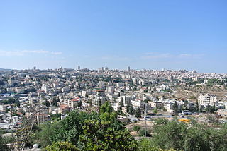
Wadi al-Joz, also Wadi Joz, meaning Valley of the Walnuts, is a Palestinian neighborhood in East Jerusalem, located at the head of the Kidron Valley, north of the Old City. The population of Wadi Joz is 13,000.

Hamaam, or Wadi Hamam, is an Arab village in northern Israel, located near the Sea of Galilee, at the foot of Mount Nitai and across the Wadi Hamam valley from Mount Arbel. It is the easternmost part of the al-Batuf Regional Council. It contains one fairly modern mosque and the trail head for the steep ascent of Mount Arbel. In 2019 its population was 1,503.
Muqbil bin Hadi bin Muqbil bin Qa’idah al-Hamdani al-Wadi’i al-Khallali was an Islamic scholar and considered to be the reviver of Salafism in Yemen. He was the founder of a Madrasa in Dammaj which was known as a centre for Salafist ideology and its multi-national student population.
Wadi Degla Sporting Club is an Egyptian football club based in Cairo. In 2009–10, it was promoted to the Egyptian Premier League for the first time in its history.
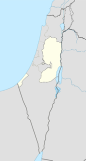
Wadi al-Far'a is a Palestinian village in the Tubas Governorate in the northeastern West Bank located five kilometers southwest of Tubas. It has a land area of 12,000 dunams, of which 337 is built-up and 10,500 are for agricultural purposes. It is under the complete control of the Palestinian National Authority and is adjacent to the Far'a refugee camp. According to the Palestinian Central Bureau of Statistics, Wadi al-Far'a had a population of 2,340 inhabitants.

Wadi al-Hawarith was a Palestinian bedouin camping site in the Tulkarm Subdistrict. It was depopulated at the outbreak of the 1948 Arab–Israeli War on March 15, 1948 following the 1947–48 Civil War in Mandatory Palestine. It was located 16.5 km northwest of Tulkarm. Wadi al-Hawarith was mostly destroyed with the exception of four houses.
Ash Shihr District is a district of the Hadhramaut Governorate, Yemen. As of 2003, the district had a population of 73,482 people.
Third Expedition of Wadi al Qura, also known as the Campaign of Wadi al Qura or Ghazwah of Wadi al Qura took place in June 628 AD, 2nd month of 7AH, of the Islamic calendar.

Wadi al-'Uyun is a town in northwestern Syria, administratively part of the Hama Governorate, located west of Hama.

Jdeidat al-Wadi or Jdeidat Wadi Barada is a village adjacent to the town of Qudsaya and just north of the Mezzeh district of Damascus in Syria. The village is administratively part of the Qudsaya District of the Rif Dimashq Governorate in southern Syria. Nearby localities include al-Hamah to the east, Ashrafiyat al-Wadi to the north, the affluent suburbs of al-Sabboura and Yaafour to the west and Dahiyat Qudsaya to the south. According to the Syria Central Bureau of Statistics, Jdeidat al-Wadi had a population of 5,227 in the 2004 census. Its inhabitants are predominantly Sunni Muslims.

The Siege of Wadi Deif refers to the siege of two Syrian Army bases, Wadi Deif and Hamadiyah, by rebel forces, starting on 11 October 2012, during the Idlib Governorate clashes of the Syrian civil war.
The Siege of Wadi Deif refers to the siege of two Syrian Army bases, Wadi Deif and Hamadiyah, by rebel forces, during the 2014 Idlib offensive of the Syrian Civil War. The first siege of these two bases was broken by the Syrian Army on 18 April 2013. During the siege, rebels detonated several 'tunnel bombs' underneath Army positions surrounding the bases, which was similar to the tactics used during the First World War.

The Wadi Barada offensive (2016–2017) was a military operation against rebel-held villages in the Barada River valley by the Syrian Army and allied forces, including pro-government militias and Lebanese Hezbollah between December 2016 and January 2017. The Barada River valley includes the village of Ain al-Fijah which holds a water spring that provides drinking water to towns throughout the Rif Dimashq Governorate.