
Muscliff and Strouden Park is a ward in Bournemouth, Dorset. Since 2019, the ward has elected 3 councillors to Bournemouth, Christchurch and Poole Council. [1]
Muscliff and Strouden Park is a ward in Bournemouth, Dorset. Since 2019, the ward has elected 3 councillors to Bournemouth, Christchurch and Poole Council. [1]
In August 2024, councillor Brian George Castle died. [2]
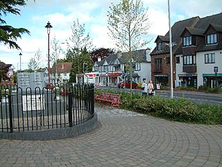
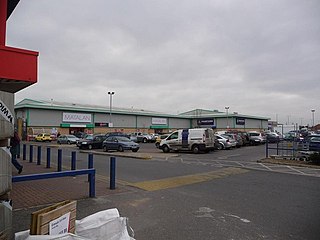
The ward is located in the north eastern suburbs of Bournemouth, including some rural green belt areas of the South East Dorset conurbation. The ward takes its name from the areas of Muscliff and Strouden Park. Other areas in the ward include Holdenhurst, Townsend and Throop. The largest employer in the ward is the Castlepoint Shopping Centre.
| Party | Candidate | Votes | % | ±% | |
|---|---|---|---|---|---|
| Conservative | Toby Slade | 1,008 | 43.4 | ||
| Labour | Eyyup Kilinc | 434 | 18.7 | ||
| Independent | Julie-Anne Houldey | 406 | 17.5 | ||
| Liberal Democrats | Richard Blackwell Whitehead | 174 | 7.5 | ||
| Independent | Peter Rogers | 118 | 5.1 | ||
| Independent | Conor O'Luby | 100 | 4.3 | ||
| Green | Roger Mann | 84 | 3.6 | ||
| Majority | 574 | 26.7 | |||
| Turnout | 2,150 | ||||
| Conservative gain from Independent | Swing | ||||
| Party | Candidate | Votes | % | ±% | |
|---|---|---|---|---|---|
| Independent | Kieron Wilson‡ | 1,595 | 44.8 | −6.7 | |
| Independent | Lisa Northover‡ | 1,227 | 34.4 | −3.9 | |
| Independent | Brian George Castle | 1,058 | 29.7 | N/A | |
| Conservative | Ian Charles Clark | 894 | 25.1 | +1.6 | |
| Independent | Liz Lucas | 879 | 24.7 | N/A | |
| Conservative | Derek Frank Borthwick‡ | 870 | 24.4 | −0.3 | |
| Conservative | Kierran Lister Paxton | 817 | 22.9 | +2.6 | |
| Labour | Farah Bassinder | 724 | 20.3 | +7.5 | |
| Labour | Robert Bassinder | 703 | 19.7 | +9.4 | |
| Labour | Johny M Skaria | 640 | 18.0 | +8.1 | |
| Liberal Democrats | Oliva Sidaway | 195 | 5.5 | N/A | |
| Liberal Democrats | Brian James Palmer | 188 | 5.3 | N/A | |
| Liberal Democrats | Martin Michael Sheppard | 157 | 4.4 | N/A | |
| Majority | |||||
| Turnout | 3,562 | 28.41 | |||
| Independent hold | Swing | ||||
| Independent hold | Swing | ||||
| Independent gain from Conservative | Swing | ||||
| Party | Candidate | Votes | % | ±% | |
|---|---|---|---|---|---|
| Independent | Kieron Wilson | 2,129 | |||
| Independent | Lisa Northover | 1,581 | |||
| Conservative | Derek Borthwick | 1,022 | |||
| Conservative | Ian Clark | 973 | |||
| Independent | John Trickett | 846 | |||
| Conservative | Michael Weinhonig | 841 | |||
| Green | Peter Lucas | 694 | |||
| Independent | John Adams | 652 | |||
| UKIP | Fiona Dougherty | 621 | |||
| Labour | Jilly Grower | 531 | |||
| Labour | Paul Forsdick | 427 | |||
| Labour | Steve Laughton | 410 | |||
| Majority | |||||
| Turnout | |||||
| Independent win (new seat) | |||||
| Independent win (new seat) | |||||
| Conservative win (new seat) | |||||
Verwood is a town and civil parish in eastern Dorset, England. The town lies 10 miles (16 km) north of Bournemouth and 13 miles (21 km) north east of Poole as the crow flies. The civil parish comprises the town of Verwood together with the extended village of Three Legged Cross, and in 2014 had a population of 15,170. Verwood is the largest town in Dorset without an upper school.

Chickerell is a town and parish in Dorset, England. In the 2011 census the parish and the electoral ward had a population of 5,515.

Bournemouth East is a parliamentary constituency in Dorset represented in the House of Commons of the UK Parliament since 2024 by Tom Hayes, of the Labour Party.
Bournemouth Borough Council was the local authority for Bournemouth in Dorset, England between 1974 and 2019. Prior to 1974 Bournemouth had been a county borough within Hampshire. Under the Local Government Act 1972 Bournemouth became a non-metropolitan district within Dorset on 1 April 1974, with the same boundaries as the former county borough. On 1 April 1997 it became a unitary authority, taking over the functions previously provided for the area by Dorset County Council. In 2019 the council was abolished, merging with Christchurch and Poole to form Bournemouth, Christchurch and Poole.

Littledown is a suburb of Bournemouth, in Dorset, England. Originally it was a small settlement to the south of the much more important Holdenhurst Village, and for centuries it existed as a huddle of farm buildings on the edge of heathland. As the town of Bournemouth expanded, Littledown remained as a farming community with areas of open fields on the town's northern edge, with the Cooper-Dean family residing in Littledown House. Eventually however the only Cooper-Dean descendants were two spinster sisters who sold Littledown House, with the surrounding farmland, to Bournemouth Council in the early 1980s. After public discussion on what the Council would do with the area, eventually much of the land was sold off for housing, although a large section was set by for a park and a sports centre.
Throop is a village in the civil parish of Throop and Holdenhurst, in the Bournemouth, Christchurch and Poole district, in Dorset, England, situated on the outskirts of Bournemouth. It is renowned for its expansive fishing industry.

Bournemouth, Christchurch and Poole (BCP) is a unitary authority area in the ceremonial county of Dorset, England. The district was created on 1 April 2019 by the merger of the areas that were previously administered by the unitary authorities of Bournemouth and Poole, and the non-metropolitan district of Christchurch. The authority covers much of the area of the South Dorset conurbation.

Dorset Council is the local authority for the non-metropolitan county of Dorset in England. It is a unitary authority, being a district council which also performs the functions of a county council. The non-metropolitan county is smaller than the ceremonial county of Dorset, which also includes Bournemouth, Christchurch and Poole. The council was created in 2019 when local government across Dorset was reorganised.

Townsend is a area of Bournemouth, Dorset. It is located in the suburbs along the north eastern boundary of the town and is close to the Royal Bournemouth Hospital.

Strouden Park or Strouden is an area of Bournemouth, Dorset, England.
Turbary Park is an area of West Howe, Bournemouth in Dorset. Turbary Park is south of Kinson and north of Wallisdown.

Richmond Hill is an area of Bournemouth, Dorset, England. It is to the north of Bournemouth Town Centre, south of Richmond Park and west of Lansdowne. The area is located around the road of the same name.

Canford Cliffs is a ward of Poole, Dorset. Since 2019, the ward has elected 2 councillors to Bournemouth, Christchurch and Poole Council.
Bournemouth, Christchurch and Poole Council is a unitary authority in Dorset, England. It was formed in April 2019, with the inaugural elections held in May of that year. The council is made up of 76 councillors from 33 wards, elected for a four-year term, with the next elections due take place in 2027.

Highcliffe and Walkford is a ward in Christchurch, Dorset. Since 2019, the ward has elected 2 councillors to Bournemouth, Christchurch and Poole Council.

Queen's Park is a ward in Bournemouth, Dorset. Since 2019, the ward has elected 2 councillors to Bournemouth, Christchurch and Poole Council.

Redhill and Northbourne is a ward in Bournemouth, Dorset. Since 2019, the ward has elected 2 councillors to Bournemouth, Christchurch and Poole Council.

Wallisdown and Winton West is a ward in Bournemouth, Dorset. Since 2019, the ward has elected 2 councillors to Bournemouth, Christchurch and Poole Council.
