Related Research Articles

The East Village is a neighborhood on the East Side of Lower Manhattan in New York City. It is roughly defined as the area east of the Bowery and Third Avenue, between 14th Street on the north and Houston Street on the south. The East Village contains three subsections: Alphabet City, in reference to the single-letter-named avenues that are located to the east of First Avenue; Little Ukraine, near Second Avenue and 6th and 7th Streets; and the Bowery, located around the street of the same name.

Corona is a neighborhood in the borough of Queens in New York City. It is bordered by Flushing and Flushing Meadows–Corona Park to the east, Jackson Heights to the west, Forest Hills and Rego Park to the south, Elmhurst to the southwest, and East Elmhurst to the north. Corona's main thoroughfares include Corona Avenue, Roosevelt Avenue, Northern Boulevard, Junction Boulevard, and 108th Street.

Borough Park is a neighborhood in the southwestern part of the borough of Brooklyn, in New York City. The neighborhood is bordered by Bensonhurst to the south, Bay Ridge to the southwest, Sunset Park to the west, Kensington and Green-Wood Cemetery to the northeast, Flatbush to the east, and Midwood to the southeast.

The Lower East Side, sometimes abbreviated as LES and sometimes referred to as Loisaida, is a neighborhood in the southeastern part of the New York City borough of Manhattan, roughly between the Bowery and the East River from Canal to Houston streets. Traditionally an immigrant, working-class neighborhood, it began rapid gentrification in the mid-2000s, prompting the National Trust for Historic Preservation to place the neighborhood on their list of America's Most Endangered Places.

Sunset Park is a neighborhood in the southwestern part of the borough of Brooklyn in New York City, bounded by Park Slope and Green-Wood Cemetery to the north, Borough Park to the east, Bay Ridge to the south, and Upper New York Bay to the west. The neighborhood is named after a 24.5-acre (9.9 ha) public park of the same name, located between 41st and 44th Streets and Fifth and Seventh Avenues. The region north of 36th Street is also known as Greenwood Heights or South Slope.

Fresh Meadows is a neighborhood in the northeastern section of the New York City borough of Queens. Fresh Meadows used to be part of the broader town of Flushing and is bordered to the north by the Horace Harding Expressway; to the west by Pomonok, St. John's University and the sub-neighborhoods of Hillcrest and Utopia; to the east by Cunningham Park and the Clearview Expressway; and to the south by the Grand Central Parkway.

Bayside Cemetery is a Jewish cemetery at 80-35 Pitkin Avenue in Ozone Park, Queens, New York City. It covers about 12 acres (4.9 ha) and has about 35,000 interments. It is bordered on the east by Acacia Cemetery, on the north by Liberty Avenue, on the west by Mokom Sholom Cemetery, and on the south by Pitkin Avenue.

The Eldridge Street Synagogue is a synagogue and National Historic Landmark in Chinatown, Manhattan, New York City. Built in 1887, it is one of the first synagogues erected in the United States by Eastern European Jews.

Doyers Street is a 200-foot-long (61 m) street in the Chinatown neighborhood of Manhattan in New York City. It is one block long with a sharp bend in the middle. The street runs south and then southeast from Pell Street to the intersection of Bowery, Chatham Square, and Division Street. Doyers Street contains several restaurants, barber shops, and hair stylists, as well as the Chinatown branch of the United States Postal Service. The Nom Wah Tea Parlor opened at 13 Doyers Street in 1920, and is still in operation; other longstanding business include Ting's Gift Shop at 18 Doyers.

Ansche Chesed is a synagogue on the Upper West Side of the New York City borough of Manhattan.

Mapleton is a neighborhood in southern Brooklyn, New York City, bounded by 16th Avenue on the west, Dahill Road on the east, 57th Street on the north, and 65th Street on the south. It borders Bensonhurst and Borough Park to the west, and Midwood to the east.

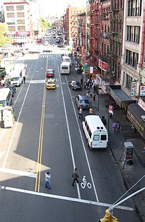
East Broadway is a two-way east–west street in the Chinatown, Two Bridges, and Lower East Side neighborhoods of the New York City borough of Manhattan.

Utopia Parkway is a major street in the New York City borough of Queens. Starting in the neighborhood of Beechhurst and ending in the Jamaica Estates neighborhood, the street connects Cross Island Parkway and Northern Boulevard in the north to Union Turnpike, Grand Central Parkway and Hillside Avenue in the south.
Jing Fong is a Chinese dim sum restaurant that was originally located on the second floor of 20 Elizabeth Street in Chinatown, Manhattan, New York City. It had a large seating capacity accommodating over 800 seats with 20,000 square feet.

Sutton Place Synagogue is a Traditional Jewish congregation located at 225 East 51st Street in Midtown Manhattan, New York City.

Eldridge Street is a street in Manhattan's Lower East Side and Chinatown, running from Houston Street south to East Broadway. Originally called Third Street according to the numbering system for the Delancey Farm Grid, it was named in 1817 for Lt. Joseph C. Eldridge, whose unit was ambushed by Indian allies of the British in Upper Canada during the War of 1812.

The Reconstructionist Synagogue of the North Shore is a Reconstructionist Jewish synagogue located in Plandome, on Long Island, in New York.
The following is a timeline of the COVID-19 pandemic in New York City.
References
- ↑ Gross, Rachel B. (2021-01-12). Beyond the Synagogue: Jewish Nostalgia as Religious Practice. NYU Press. ISBN 978-1-4798-0340-8.
- 1 2 Dunlap, David W. (2014-06-11). "In Chinatown, Remembering the Origins of a 126-Year-Old Synagogue". The New York Times. ISSN 0362-4331 . Retrieved 2021-12-03.
- ↑ "The Oldest Eastern European Synagogue in the U.S." Retrieved 2021-12-03.
- ↑ Rothstein, Edward (2007-12-01). "Return of a Long-Dormant Island of Grace". The New York Times. ISSN 0362-4331 . Retrieved 2021-12-03.
- ↑ "Video: A New East Window on Eldridge Street". 2010-10-18. Retrieved 2021-12-03.
- ↑ Meier, Allison (2018-06-05). "Kiki Smith Takes Over the Eldridge Street Synagogue with 50 Artworks" . Retrieved 2021-12-03.
- ↑ "NYC's Museum at Eldridge Street Celebrates Restoration of the Eldridge Street Synagogue in a New Exhibition". 2017-09-05. Retrieved 2021-12-03.
- ↑ Robbins, Liz (2020-03-10). "New York City Museums Teach the History of Immigration". The New York Times. ISSN 0362-4331 . Retrieved 2021-12-03.
- ↑ Ziri, Danielle (2017-07-30). "New York exhibit revives Europe's lost synagogues". Jerusalem Post. Retrieved 2021-12-03.
- ↑ Sheidlower, Noah (2020-02-03). "Step Back in NYC History at the Exhibition, Pressed: Images from the Jewish Daily Forward" . Retrieved 2021-12-03.
- ↑ Litvak, Ed (2018-06-12). "Egg Rolls, Egg Creams and Empanadas Festival is Happening Sunday" . Retrieved 2021-12-03.