
Rwanda, officially the Republic of Rwanda, is a landlocked country in the Great Rift Valley of East Africa, where the African Great Lakes region and Southeast Africa converge. Located a few degrees south of the Equator, Rwanda is bordered by Uganda, Tanzania, Burundi, and the Democratic Republic of the Congo. It is highly elevated, giving it the sobriquet "land of a thousand hills", with its geography dominated by mountains in the west and savanna to the southeast, with numerous lakes throughout the country. The climate is temperate to subtropical, with two rainy seasons and two dry seasons each year. It is the most densely populated mainland African country; among countries larger than 10,000 km2, it is the fifth-most densely populated country in the world. Its capital and largest city is Kigali.
Rwanda is a de facto one-party state ruled by the Rwandan Patriotic Front and its leader Paul Kagame since the end of the 1994 genocide against members of the Tutsi ethnic group. Although Rwanda is nominally democratic, elections are manipulated in various ways, which include banning opposition parties, arresting or assassinating critics, and electoral fraud.

Kigali is the capital and largest city of Rwanda. It is near the nation's geographic centre in a region of rolling hills, with a series of valleys and ridges joined by steep slopes. As a primate city, Kigali is a relatively new city. It has been Rwanda's economic, cultural, and transport hub since it was founded as an administrative outpost in 1907, and became the capital of the country at independence in 1962, shifting focus away from Huye.

Rwanda is located in East Africa, to the east of the Democratic Republic of the Congo, at the co-ordinates 2°00′S30°0′E.

Paul Kagame is a Rwandan politician and former military officer who has been the President of Rwanda since 2000. He was previously a commander of the Rwandan Patriotic Front (RPF), a rebel armed force which invaded Rwanda in 1990. The RPF was one of the parties of the conflict during the Rwandan Civil War and the armed force which ended the Rwandan genocide. He was considered Rwanda's de facto leader when he was Vice President and Minister of Defence under President Pasteur Bizimungu from 1994 to 2000 after which the vice-presidential post was abolished.

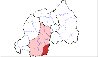
Bugesera is a district (akarere) in Eastern Province, Rwanda. Its capital is Nyamata. The district is named after the old Kingdom of Bugesera.

Onna-musha (女武者) is a term referring to female warriors in pre-modern Japan, who were members of the bushi (warrior) class. They were trained in the use of weapons to protect their household, family, and honour in times of war; many of them fought in battle alongside samurai men.

Rwamagana is a district (akarere) in Eastern Province, Rwanda. Its capital is Rwamagana city, which is also the provincial capital.it has 14 sectors which are Gishali,fumbwe,mwurire, Kigabiro,...it is found in eastern province of Rwanda.muri Rwamagana harimo ibikorwa remezo nka IPRC gishari, gishari health center, RNP police training school,Lake Muhazi.

Burera is a district (Akarere) in Northern Province, Rwanda. Its capital is Cyeru.
Gisagara is a district (akarere) in Southern Province, Rwanda. Its headquarters is Ndora.

Huye is one of the eight districts (Akarere) that make up Rwanda's Southern Province. It has a total surface area of 581.6 square Kilometers. It has thirteen sectors and 77 cells with a total of 508 umudugudus (villages) in total. The district has a population of 381,900, with an average of 660 inhabitants per square kilometer. The largest city in the province is Butare.

Nyarugenge is a district (akarere) in Kigali Province, Rwanda. Its heart is the city centre of Kigali, and contains most of the city's businesses.

Rutsiro is a district (akarere) in Western Province, Rwanda. Its headquarter is located in Gihango sector.

The African Union-United Nations Hybrid Operation in Darfur was a joint African Union (AU) and United Nations (UN) peacekeeping mission formally approved by United Nations Security Council Resolution 1769 on 31 July 2007, to bring stability to the war-torn Darfur region of Sudan while peace talks on a final settlement continue.

Rwanda faces a generalized epidemic, with an HIV prevalence rate of 3.1 percent among adults ages 15 to 49. The prevalence rate has remained relatively stable, with an overall decline since the late 1990s, partly due to improved HIV surveillance methodology. In general, HIV prevalence is higher in urban areas than in rural areas, and women are at higher risk of HIV infection than men. Young women ages 15 to 24 are twice as likely to be infected with HIV as young men in the same age group. Populations at higher risk of HIV infection include people in prostitution and men attending clinics for sexually transmitted infections.
Gatunda is one of the 14 sectors (imirenge) of Nyagatare District, Eastern Province, Rwanda. It is located in the central West of the district, and North East of Rwanda. It is the second smallest sector in Nyagatare District and the third most densely populous with the density of almost twice the district average. This high density of the population is the result of the fertile soil found in the sector. The main economic activity is agriculture. Beans, maize, peanuts, sorghum, pineapples are grown there. The sector contains large banana plantations. As part of the Umutara region, the sector is also known for cattle husbandry. Gatunda Sector is divided into seven cells: Nyangara, Nyarurema, Cyagaju, Rwensheke, Nyamikamba, Nyamirembe and Kabeza. The office of Gatunda Sector is located in Nyamirembe Cell in the extreme North East section of the Sector.

Nyamata is a town and sector in the Bugesera District, southeastern Rwanda. Nyamata literally means 'place of milk' from the two Kinyarwanda words nya- 'of' and amata 'milk'. It is the location of the Nyamata Genocide Memorial, commemorating the Rwandan genocide of 1994.
Kabarore is a town and sector in Rwanda. It is the headquarters of Gatsibo District.

Save is a small town and sector in Rwanda. It is located a few miles north of the town of Butare, and in the west of the Gisagara District of Southern Province. There is a church, several schools and a health centre. It is also home to the Mother House of the Benebikira Sisters.
Milunga is a town and commune of Angola, located in the province of Uíge.