
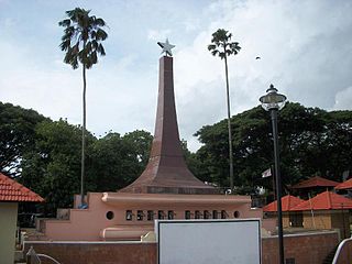
Patan is the administrative seat of Patan district in the Indian state of Gujarat and is an administered municipality. It was the capital of Gujarat's Chavda and Chaulukya dynasties in medieval times, and is also known as Anhilpur-Patan to distinguish it from Prabhas Patan. During the rule of Gujarat Sultanate, it was the capital from 1407 to 1411.

Bowenpally is a locality in Secunderabad in the City of Hyderabad, India. It is predominantly an upper middle class area. It has some of the best residential colonies. It is located on the northwest fringe of secunderabad city. Bowenpally is part of the secunderabad area, where the British held sway for several years. The old village of Bowenpally with its people-friendly streets still exist. One among the few old structures left is an old shrine with some rough sculptures of a bull with distinct Kakatiyan design, near the Bowenpally Police Station. It is a juncture connecting different parts of the city.

Ranaghat is a city and a municipality in Nadia district in the state of West Bengal, India. It is the headquarters of the Ranaghat subdivision. It is compact but one of the densely populated cities of West Bengal. It is known for its handloom industry, various types of flowers and floriculture and a flower market.

Guntur is a city and the administrative headquarters of Guntur district in the Indian state of Andhra Pradesh. Guntur is a central part of the state and city is spread across 198.7 km square and is the third-largest city in the state. It is situated 64 kilometres (40 mi) to the west of the Bay of Bengal, on the Eastern Coastal Plains. The city is the heartland of the state, located in the centre of Andhra Pradesh and making it a central part connecting different regions. It serves as a major hub for exports chilli, cotton and tobacco and has the largest chili market yard in Asia. It is a major transportation, education ,medical and commercial hub for the state.
Kuthuparamba or Koothuparamba is a town and a municipality in the Kannur district, state of Kerala, India. It is about 24 km south-east of Kannur and 14 km east of Thalassery.
Panoor is a Municipality in the district of Kannur in the state of Kerala, India. The town is the main market place for the farmer communities in the surrounding regions. Panoor is one of the main suburbs of the City of Thalassery. Panoor got municipal status when the Government of Kerala decided to upgrade Panoor Grama Panchayat and added with other Panchayats, as Panoor Municipality in 2015.

Rishra is a city and a municipality in Srirampore subdivision of Hooghly district in the Indian state of West Bengal. It is a part of the area covered by Kolkata Metropolitan Development Authority (KMDA). For Latest News Visit rishrasamachar.in

Anjarakandy is a census town and grama panchayat in Kannur district of Kerala, India. Anjarakandy river is flowing through Anjarakandy town.

Sreekandapuram is a municipality in Kannur district, in the Indian state of Kerala.

Nayarambalam is a suburb of Cochin city and coastal village on Vypin island in Ernakulam district in the state of Kerala, India.
Raver is a city and municipal council in Jalgaon district in the Indian state of Maharashtra. It is the administrative center of Raver Taluka. Raver is famous for the Bhagvan Dattatreya-temple which is 200 years old and was founded by Sachidanand Swami Maharaj. Built in the old Mughal Kaleen tradition, it also has some ancient photos of Bhagvan Dattreyay in form of Malaang Fakir, Bhagwan Dattreyay's Charan Paduka. It is part of the Khandesh region or North Maharashtra region.
Alipor is a village near Chikhli, Bilimora in the state of Gujarat in western India. The village is on the Indian National Highway 8, which leads to areas such as Ahwa via Waghai and Vansda, and to the hill station of Saputara.

Nediyiruppu was the capital of the Zamorin's kingdom in colonial Kerala. At the time, it was known as Nediyiruppu Swaroopam. It is a region of the Kondotty municipality in Malappuram district, Kerala, India. It is situated 24 kilometres (15 mi) from Malappuram, the district headquarters.
Chathangottunada is a small village in Calicut district. It is located in Kavilumpara panchayath. Wayanad Road goes through the town. A. J. John Memorial High School, one of the oldest education schools, is located here. Nearby towns include Thottilpalam and Kuttiyadi. The village's residents include Hindus, Christians and Muslims. The principal political parties are CPI(M), Indian National Congress, Kerala Congress (M) and IUML
Chamakeri is a village in the Belgaum district of Athani Taluk in the southern Indian state of Karnataka.
Balutungi is a village in Lalgola CD Block in Lalbag subdivision of Murshidabad district in West Bengal.
Ranjangaon Mashid is a village in Parner taluka in Ahmednagar district of state of Maharashtra, India.
Samta is a village and a gram panchayat in the Howrah district of West Bengal, India, on the banks of the Rupnarayan river. Samta is noted for being the home of Sarat Chandra Chattopadhyay for twelve years, starting from the year 1923. The terracotta temple of Madangopal jiu is located in the neighbouring village of Mellak. Samta is connected to the state capital, Kolkata, through the National Highway 6, that also connects it to the nearby towns of Bagnan and Kolaghat. Samta hosts few educational facilities including the Samta Sarat Chandra Girls High School, among others.
Hindu High School, Muthukrishnaperi is a high school in Muthukrishnaperi, Tirunelveli District, Tamil Nadu, India. It was established in 1929.
Karinkallathani is a town in Perinthalmanna taluk of the Malappuram district of the Indian state of Kerala.

