Related Research Articles

Commencement Bay is a bay of Puget Sound in the U.S. state of Washington. The city of Tacoma is located on the bay, with the Port of Tacoma occupying the southeastern end. A line drawn from Point Defiance in the southwest to Browns Point in the northeast serves to mark the generally accepted division between the bay and the open sound. Commencement Bay has become home to one of the most active commercial ports in the world. The Port of Tacoma is the main port facility.
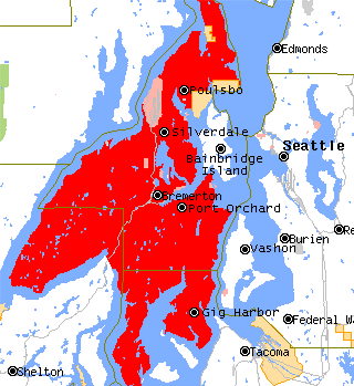
The Kitsap Peninsula lies west of Seattle across Puget Sound, in Washington state in the Pacific Northwest. Hood Canal separates the peninsula from the Olympic Peninsula on its west side. The peninsula, a.k.a. "Kitsap", encompasses all of Kitsap County except Bainbridge and Blake Islands, as well as the northeastern part of Mason County and the northwestern part of Pierce County. The highest point on the Kitsap Peninsula is Gold Mountain. The U.S. Navy's Puget Sound Naval Shipyard, and Naval Base Kitsap are on the peninsula. Its main city is Bremerton.
Port Orchard, part of Washington state's Puget Sound, is the strait that separates Bainbridge Island on the east from the Kitsap Peninsula on the west. It extends from Liberty Bay and Agate Pass in the north to Sinclair Inlet and Rich Passage in the south. It was named in May 1792 by George Vancouver after Harry Masterman Orchard, ship's clerk of Vancouver's ship Discovery.
Stretch Island is an island in Case Inlet in the southern part of Puget Sound in the U.S. state of Washington. It forms part of the unincorporated Mason County community of Allyn-Grapeview. The island has a land area of 1.2179 km2 and a population of 162 persons as of the 2010 census. On the island's north side, it has buoys for overnight mooring, and Stretch Point State Park, a small state park only accessible by boat.

Saratoga Passage lies in Puget Sound between Whidbey Island and Camano Island.
Skull Island is the name of two small islands in the San Juan Archipelago in the U.S. state of Washington. The northernmost Skull Island is located off the coast of Orcas Island in Massacre Bay, the most northern extension of the island's West Sound. It is identified as 3.2-acre (1.3 ha) Skull Island State Park Property by the Washington State Parks and Recreation Commission. It was named for holding skulls and bones of a band of Lummi who were killed by raiding Haida in 1858. Since 2013, it has been part of the San Juan Islands National Monument.
Carr Inlet, in southern Puget Sound in the U.S. state of Washington, is an arm of water between Key Peninsula and Gig Harbor Peninsula. Its southern end is connected to the southern basin of Puget Sound. Northward, it separates McNeil Island and Fox Island. The northern end of Carr Inlet is named Henderson Bay, which feeds into Burley Lagoon.
Case Inlet, in southern Puget Sound in the U.S. state of Washington, is an arm of water between Key Peninsula to the east and Harstine Island to the west. Its northern end, called North Bay, reaches nearly to Hood Canal, creating the defining isthmus of Kitsap Peninsula. Case Inlet is the boundary between Pierce County and Mason County. The southern end of Case Inlet connects to Nisqually Reach, part of the southern basin of Puget Sound. Herron Island lies in Case Inlet.

San Rafael Bay is an embayment of San Pablo Bay, located in Marin County and the northern San Francisco Bay Area, California.
The Raccoon Strait is a waterway of the San Francisco Bay between Angel Island and the Tiburon Peninsula, mainland Marin County, California, United States. During the ice ages, when sea levels were considerably lower and San Francisco Bay was a grassy valley, the combined Sacramento-San Joaquin river flowed through what is now Raccoon Strait before flowing through the canyon at the Golden Gate.

The Seattle-Tacoma Shipbuilding Corporation was an American corporation which built escort carriers, destroyers, cargo ships and auxiliaries for the United States Navy and merchant marine during World War II in two yards in Puget Sound, Washington. It was the largest producer of destroyers (45) on the West Coast and the largest producer of escort carriers of various classes (56) of any United States yard active during World War II.
Hylebos Creek is a stream located in the U.S. state of Washington near Tacoma and emptying into Commencement Bay, part of Puget Sound. It flows through southern King County and northern Pierce County, through the cities of Tacoma, Federal Way, Milton, and Fife, as well as the Puyallup Indian Reservation.
Useless Bay is a bay in the U.S. state of Washington. Part of Puget Sound, Useless Bay is located in Island County near the southern end of Whidbey Island, between Cultus Bay and Mutiny Bay.
Cultus Bay is a bay in Island County, in the U.S. state of Washington.
The Nisqually Reach is a portion of Puget Sound south of the Tacoma Narrows, near the Nisqually River delta. It is classified as a bay by the United States government. It was originally defined as "the portion of the Sound lying between Anderson Island and the mainland".

Goat Island is an island in Suisun Slough, near Suisun Bay, an embayment of San Francisco Bay. It is part of Solano County, and not managed by any reclamation district. Its coordinates are 38°12′51″N122°02′03″W, and the United States Geological Survey measured its elevation as 16 ft (4.9 m) in 1981.

Deer Island is a former island in Marin County, California, close to the Novato Creek, upstream of San Pablo Bay. It is now the location of Deer Island Preserve. It used to be inhabited by Antonio DeBorba, who hiked the nearby wetlands to avoid having to use a boat to get home. The building is still there on the Northeastern part of the island. Deer Island's coordinates are 38°05′52″N122°32′13″W, and its elevation is 167 ft (51 m).

Ogilvie Island is a patch of mud in San Francisco Bay. It is within the limits of the city of San Jose, in Santa Clara County, California, and named for county planner Arthur Ogilvie. Its coordinates are 37°27′55″N122°00′37″W, and the United States Geological Survey gave its elevation as 0 ft (0 m) in 2012. It appears on a 2012 USGS map of the area.

Jakes Island is an island in San Francisco Bay. It is in Marin County, California. Its coordinates are 38°00′47″N122°29′20″W, and the United States Geological Survey gives its elevation as 52 ft (16 m). Egrets can be seen there.
References
- ↑ U.S. Geological Survey Geographic Names Information System: Mutiny Bay
- ↑ McKinney, Sam (2004). Sailing with Vancouver: A Modern Sea Dog, Antique Charts and a Voyage Through Time. TouchWood Editions. p. 195. ISBN 978-1-894898-12-6 . Retrieved June 26, 2018.
47°59′39″N122°33′29″W / 47.99428°N 122.55802°W
| | This Island County, Washington state location article is a stub. You can help Wikipedia by expanding it. |