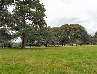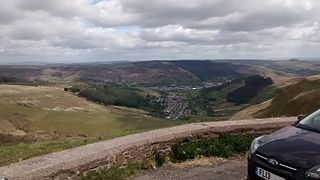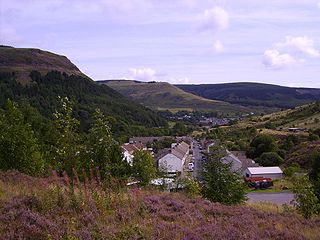
Tonypandy is a town and community located in the county borough of Rhondda Cynon Taf, within the historic county boundaries of Glamorgan, Wales, lying in the Rhondda Fawr Valley. A former industrial coal mining town, today Tonypandy is best known as the site of the 1910 Tonypandy riots.

The Brecon Beacons National Park is one of three national parks in Wales, and is centred on the Brecon Beacons range of hills in southern Wales. It includes the Black Mountain in the west, Fforest Fawr and the Brecon Beacons in the centre and the Black Mountains in the east.

Llwynypia is a village and community in Rhondda Cynon Taf, Wales, near Tonypandy in the Rhondda Fawr Valley. Before 1850 a lightly populated rural farming area, Llwynypia experienced a population boom between 1860 and 1920 with the sinking of several coal mines after the discovery of large coal deposits throughout the Rhondda Valleys.

Sugar Loaf, sometimes called The Sugar Loaf, is a hill situated 2 miles (3.2 km) north-west of Abergavenny in Monmouthshire, Wales and sits within the Brecon Beacons National Park. It is the southernmost of the summit peaks of the Black Mountains, with a height of 1,955 feet (596 metres). Sugar Loaf was gifted to the National Trust by suffragette Lady Rhondda.

The River Llynfi, Welsh: Afon Llynfi, is one of three main tributaries of the River Ogmore.

The River Rhondda is a river in South Wales with two major tributaries, Rhondda Fawr and Rhondda Fach.
Ysgol Gyfun Cwm Rhondda is a Welsh-medium secondary school located in the county borough of Rhondda Cynon Taf, situated near Porth.

Llansannor is a small hamlet in the Vale of Glamorgan, Wales, United Kingdom.

The A4107 road is an A road in Neath Port Talbot County Borough, Wales. It begins in Port Talbot and heads up the Afan Valley in a north easterly direction. It then continues over the moors eastwards until it connects with the A4061 road south west of Treorchy in the Rhondda Valley.
The Sirhowy Valley is an industrialised valley in the eastern part of the Valleys region of Wales. It is named from the Sirhowy River which runs through it. Its upper reaches are occupied by the town of Tredegar within the unitary area of Blaenau Gwent. The valley initially heads south-southeast between the ridges of Cefn Manmoel to the east and Mynydd Bedwellte to the west before turning to a more southerly direction. Its central section is one of the least populated of the Welsh coalfield valleys. The valley enters the unitary area of Caerphilly which contains the towns of Blackwood and Pontllanfraith. It then turns east and joins the valley of the Ebbw River, Ebbw Vale at Crosskeys.

Blaencwm is a village in the county borough of Rhondda Cynon Taf, Wales, lying at the head the Rhondda Fawr valley. Two collieries were opened here during the Industrial Revolution, the Dunraven Colliery in 1865 and the Glenrhondda Colliery in 1911. Both had closed by 1966 and the sites have since been landscaped, leaving little trace of their industrial past. It is in the historic county of Glamorgan.

Gelli is a village in the Rhondda Fawr valley, in the county borough of Rhondda Cynon Taff, Wales, situated on the southern bank of the Rhondda Fawr River. Gelli is a former coal mining village which is a district of the community of Ystrad.

Mynydd-y-glog is a hill just east of the village of Penderyn in the northern corner of the county borough of Rhondda Cynon Taff in south Wales. It lies within the Brecon Beacons National Park and Fforest Fawr Geopark. Its summit plateau rises to a height of 389m / 1277 ft at OS grid ref SN 982088, a spot marked by a trig point. To its north lies the partly dry valley of Pant Sychbant which forms the eastern extension of Cwm Cadlan. Its southern slopes are drained by various streams which feed into the Afon Cynon.

Mynydd Carn-y-cefn is the name given to the broad ridge of high ground between the Ebbw Vale and the valley of the Ebbw Fach in the Valleys region of South Wales. It lies within the unitary area of Blaenau Gwent, formerly Monmouthshire.
Cefn Manmoel is the name given to the broad ridge of high ground between the Sirhowy Valley and Ebbw Vale in the Valleys region of South Wales. It straddles the boundary between the unitary areas of Caerphilly and Blaenau Gwent.

Mynydd Merthyr is a broad ridge of high ground between Taff Vale and the Cwm Cynon in the Valleys region of South Wales. It forms the boundary between the unitary authorities of Rhondda Cynon Taff to the west and Merthyr Tydfil to the east.

Mynydd Cilfach-yr-encil attains a height of 445m at OS grid reference SO 079033 making it the high point of the broad ridge of high ground between Taff Vale and Cwm Bargod in the Valleys region of South Wales. It lies within the unitary area of Merthyr Tydfil.

Mynydd Maendy is a hilltop and moorland, near Gilfach Goch, in the County Borough of Rhondda Cynon Taf in south Wales, to the southwest of Tonyrefail. As with the Maindee district of Newport, the name derives from the Welsh maen dy meaning "stone house".
This page is based on this
Wikipedia article Text is available under the
CC BY-SA 4.0 license; additional terms may apply.
Images, videos and audio are available under their respective licenses.


