Related Research Articles

Abercarn is a town and community in Caerphilly county borough, Wales. It is 10 miles (16 km) northwest of Newport on the A467 between Cwmcarn and Newbridge, within the historic boundaries of Monmouthshire.

Until 1974, Brecknockshire, also formerly known as the County of Brecknock, Breconshire, or the County of Brecon, was an administrative county in the south of Wales, later classed as one of the thirteen historic counties of Wales. Named after its county town of Brecon, the county was mountainous and primarily rural.

Torfaen is a county borough in the south-east of Wales. Torfaen is bordered by the county of Monmouthshire to the east, the city of Newport to the south, and the county boroughs of Caerphilly and Blaenau Gwent to the south-west and north-west. It is within the boundaries of the historic county of Monmouthshire, and between 1974 and 1996 was a district of Gwent, until it was reconstituted as a principal area in 1996.

Blaenau Gwent is a county borough in the south-east of Wales. It borders the unitary authority areas of Monmouthshire and Torfaen to the east, Caerphilly to the west and Powys to the north. Its main towns are Abertillery, Brynmawr, Ebbw Vale and Tredegar. Its highest point is Coity Mountain at 1,896 feet (578 m).

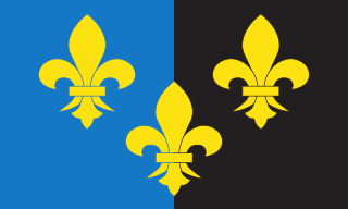
Until 1974, Monmouthshire, also formerly known as the County of Monmouth, was an administrative county in the south-east of Wales, on the border with England, and later classed as one of the thirteen historic counties of Wales. Its area now corresponds approximately to the present principal areas of Monmouthshire, Blaenau Gwent, Newport and Torfaen, and those parts of Caerphilly and Cardiff east of the Rhymney River.

South Glamorgan is a preserved county of Wales.

Mid Glamorgan is a preserved county of Wales. From 1974 until 1996 it was also an administrative county with a county council.

The Borough of Islwyn was one of five local government districts of Gwent from 1974 to 1996.

Monmouth was a county constituency of the House of Commons of the Parliament of the United Kingdom. The seat was created for the 1918 general election. From 2005 until 2024 the Member of Parliament (MP) was David Davies of the Conservative Party.

Blackwood is a town, community and an electoral ward on the Sirhowy River in the South Wales Valleys administered as part of Caerphilly County Borough. It is located within the historic county of Monmouthshire.

Monmouth District was one of five local government districts in the county of Gwent in Wales between 1974 and 1996. In 1988 the district was granted a charter conferring borough status, becoming the Borough of Monmouth.

Rhymney Valley was one of six local government districts in Mid Glamorgan from 1974 to 1996.

Bedwas, Trethomas and Machen is a community and an electoral ward in the county borough of Caerphilly, constituting the villages of Machen, Trethomas, Bedwas, and Upper and Lower Graig-y-Rhacca. It lies in the Caerphilly Basin in the shadow of Mynydd y Grug and Mynydd Machen. All villages in the area grew as a result of the coal mining industry, which carries its legacy on today.

Bedwellty is a small village in Caerphilly County Borough in south Wales. The village stands on a ridge of high ground between the Rhymney and Sirhowy valleys. The village comprises St Sannan's parish church, public house and a few houses. The register of St Sannan's Church dates from 1624, which qualifies Bedwellty as an ancient parish. Historically the parish lay in the county of Monmouthshire, the hundred of Wentloog, Tredegar County Court District, the rural deanery of Bedwellty, the archdeaconry of Monmouth and the diocese of Llandaff. Several towns based on the iron industry expanded within the parish boundary, including from west to east, Rhymney, Tredegar and Ebbw Vale, which gradually gained administrative independence from Bedwellty between the 1870s and 1890s. A Bedwellty Local Government District was established for the rest of the parish in 1891, becoming an urban district in 1894.
Bedwellty was a county constituency in Monmouthshire which returned one Member of Parliament (MP) to the House of Commons of the Parliament of the United Kingdom from 1918 until it was abolished for the 1983 general election.

Islwyn Borough Transport was a Welsh bus operator providing services around Blackwood, Caerphilly, and surrounding towns in the former Borough of Islwyn between 1974 and 2010.

Gwent is a preserved county and former local government county in southeast Wales. A county of Gwent was formed on 1 April 1974, under the Local Government Act 1972; it was named after the ancient Kingdom of Gwent. The authority was a successor to both the administrative county of Monmouthshire and the county borough of Newport.

Gelligaer is a community in the County Borough of Caerphilly, Wales, in the Rhymney River valley. As well as the village of Gelligaer, the community also includes the small towns of Hengoed and Ystrad Mynach. The population of the community at the 2011 census was 18,408.
Western Monmouthshire was a parliamentary constituency in Monmouthshire, Wales. It returned one Member of Parliament (MP) to the House of Commons of the Parliament of the United Kingdom.

Penmaen is a hamlet and community in Caerphilly county borough, south Wales, within the historic boundaries of Monmouthshire. It is situated in the Sirhowy valley, 3 miles (4.8 km) East of Blackwood. It is contiguous with, if not completely encompassed by, the larger village of Oakdale, which forms most of the community urban area.
References
- ↑ Kelly's Directory of Monmouthshire, 1901
- ↑ County Census Report, Monmouthshire, 1901
- ↑ Local Government Act 1972, Schedule 4