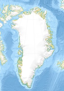
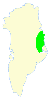
The Mørkefjord expedition of 1938–1939 was sent out by Alf Trolle, Ebbe Munck, and Eigil Knuth in order to continue the work of the Denmark Expedition. [1] It was an exploratory expedition to Northeast Greenland led by Eigil Knuth and had been planned to last from 1938 to 1939. It was affected by the outbreak of World War II.
Count Eigil Knuth was a Danish explorer, archaeologist, sculptor and writer. He is referred to as the Nestor of Danish polar explorers. His archaeological investigations were made in Peary Land and adjacent areas of High Arctic Greenland. Knuth was made a Knight of the Dannebrog.
Greenland is an autonomous constituent country of the Kingdom of Denmark between the Arctic and Atlantic oceans, east of the Canadian Arctic Archipelago. Though physiographically a part of the continent of North America, Greenland has been politically and culturally associated with Europe for more than a millennium. The majority of its residents are Inuit, whose ancestors began migrating from the Canadian mainland in the 13th century, gradually settling across the island.
World War II, also known as the Second World War, was a global war that lasted from 1939 to 1945. The vast majority of the world's countries—including all the great powers—eventually formed two opposing military alliances: the Allies and the Axis. A state of total war emerged, directly involving more than 100 million people from over 30 countries. The major participants threw their entire economic, industrial, and scientific capabilities behind the war effort, blurring the distinction between civilian and military resources. World War II was the deadliest conflict in human history, marked by 50 to 85 million fatalities, most of whom were civilians in the Soviet Union and China. It included massacres, the genocide of the Holocaust, strategic bombing, premeditated death from starvation and disease, and the only use of nuclear weapons in war.
There had been a previous expedition to Northeast Greenland led by Johan Peter Koch in 1913; the Mørkefjord Expedition. – which Alfred Wegener had been a part of. [2] Eigil Knuth arrived in Greenland with his co-leader and friend, Ebbe Munck, on 19 June 1938. The other expedition members were botanist Paul Gelting, Alf Trolle, and five more men. The expedition made use of an aircraft – a Tiger Moth. [3]
Johan Peter Koch was a Danish captain and explorer of the Arctic dependencies of Denmark, born at Vestenskov.
Alfred Lothar Wegener was a German polar researcher, geophysicist and meteorologist.
Paul Emil Elliot Gelting was a Danish ecologist, botanist and lichenologist. He was associate professor at the University of Copenhagen and particularly active in Greenland.
The expedition members began by building a scientific station north of the mouth of the Mørkefjord, west of Hvalrosodden. It was named Mørkefjord Station and was used as a base. The expedition also used a hunting hut in nearby Godfred Hansen Island built by the Nanok East Greenland Fishing Company. [4]
Mørkefjord, meaning in Danish "The dark fjord," is a fjord in King Frederick VIII Land, northeastern Greenland.
Godfred Hansen Island is an uninhabited island of the Greenland Sea, Greenland.
Nanok East Greenland Fishing Company, generally known as 'Nanok' —meaning "polar bear" in Greenlandic, was a Danish company in Greenland.
Mørkefjord Station was manned for a further two years after the end of the expedition, from 1938 to 1941. The additional two years were for two reasons, first because of the Danish Meteorological Institute having requested a continuation of weather reports and second, because Eigil Knuth, faced with the outbreak of World War II, could not return to Greenland as initially planned and decided to continue the activities of the expedition. The Mørkefjord Expedition would map and name a number of geographic features in East Greenland during the years it operated in the area. The Mørkefjord station is now a ruin. [4]
The Danish Meteorological Institute is the official Danish meteorological institute, administrated by the Ministry of Energy, Utilities and Climate. The institute makes weather forecasts and observations for Denmark, Greenland, and the Faroe Islands.
This is a list of recognised pioneering expeditions to Greenland that contributed to the cartography of the territory.
Peary Land is a peninsula in northern Greenland, extending into the Arctic Ocean. It reaches from Victoria Fjord in the west to Independence Fjord in the south and southeast, and to the Arctic Ocean in the north, with Cape Morris Jesup, the northernmost point of Greenland's mainland, and Cape Bridgman in the northeast.
Independence I was a culture of Paleo-Eskimos who lived in northern Greenland and the Canadian Arctic between 2400 and 1000 BC.
Clavering Island is a large island in eastern Greenland off Gael Hamkes Bay, to the south of Wollaston Foreland.
Sabine Island is an island to the northeast of Wollaston Foreland, previously known as Inner Pendulum Island. It is in the Northeast Greenland National Park area.
Germania Land or Germanialand is a peninsula in northeastern Greenland. Despite the high latitude it is largely unglaciated.
Carl Christian Koldewey was a German Arctic explorer. He led both German North Polar Expeditions.
Brønlundhus, on some maps also Brønlundfjord, is a former research station and radio station located on the western shore of Jørgen Brønlund Fjord in southern Peary Land, in northern Greenland. It is named after Greenlandic Arctic researcher Jørgen Brønlund, or after the namesake fjord on which it is located. It is close to the mouth of Jørgen Brønlund Fjord where it opens into Independence Fjord.
Independence Fjord or Independence Sound is a large fjord or sound in the eastern part of northern Greenland. It is about 200 km (120 mi) long and up to 30 km (19 mi) wide. Its mouth, opening to the Wandel Sea of the Arctic Ocean is located at 82°15′N21°54′W.
Godske Christoffersen Lindenov or Lindenow was a Danish naval officer and Arctic explorer. He is most noted for his role in King Christian IV's expeditions to Greenland.
The Three-year Expedition was an exploratory expedition to East Greenland that lasted from 1931 to 1934 financed by the Carlsberg Foundation and the Danish state. The expedition included aerial surveys.
Dove Bay is a bay in King Frederick VIII Land, northeastern Greenland. It is part of the Northeast Greenland National Park area.
Queen Louise Land is a vast mountainous region located west of Dove Bay, King Frederick VIII Land, northeastern Greenland. Administratively it is part of the Northeast Greenland National Park zone.
The Denmark expedition, also known as Denmark Expedition to Greenland's Northeast Coast, and as the Danmark Expedition after the ship, was an expedition to the northeast of Greenland in 1906–1908.
Seal Lake, also known as Sael Lake, Saelso, Saelsöen and Sælsø, is a land-locked freshwater fjord in southern King Frederick VIII Land, in Greenland's northeastern coast. The Danish weather station Danmarkshavn —the only inhabited place in the area— lies about 30 km (19 mi) to the east. The lake and its surroundings are part of the Northeast Greenland National Park zone.
The bark Danmark is best known for her role as expedition ship for the Danmark expedition (1906–08), so named after the ship, but had a long prehistory as a whaler under the name Sir Colin Campell of Peterhead and later as a sealer named Magdalena of Tønsberg/Kristiana.