Eqrem Çabej University is a university in the Albanian town of Gjirokastër, named after Eqrem Çabej. It is one of nine SIFE accredited universities in Albania. It was created as a University with the name of “Eqrem Çabej” with decision of the Albanian Government nr. 414, dated 12 November 1991, on the basis of the Higher Institute of Pedagogy that was already established in 1971. It is the most important teaching and scientific institute of Southern Albania.
Woodland is a neighborhood in Duluth, Minnesota, United States. Woodland Avenue serves as a main route in the community. The neighborhood is located between Fairmont Street and Martin Road. Other routes include Calvary Road.
Zompa is a village of Arapgir. It has population of about 318 (2000).
Fisher is a rural municipality in the province of Manitoba in Western Canada.
The canton of Montrevel-en-Bresse is a former administrative division in eastern France. It was disbanded following the French canton reorganisation which came into effect in March 2015. It consisted of 14 communes, which joined the new canton of Attignat in 2015. It included the following communes:

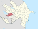
Abbasbəyli is a village in the Qazakh Rayon of Azerbaijan.
Orta Çalğan is a village in the Siazan Rayon of Azerbaijan. The village forms part of the municipality of Məşrif.

Yanshan County is under the administration of the Wenshan Zhuang and Miao Autonomous Prefecture, in the southeast of Yunnan province, China.
Bożenczyzna is a village in the administrative district of Gmina Zwoleń, within Zwoleń County, Masovian Voivodeship, in east-central Poland.
Jeziorno is a settlement in the administrative district of Gmina Sieraków, within Międzychód County, Greater Poland Voivodeship, in west-central Poland.

Dzierżysławice, is a village in the administrative district of Gmina Głogówek, within Prudnik County, Opole Voivodeship, in south-western Poland, close to the Czech border. It lies approximately 3 kilometres (2 mi) west of Głogówek (Oberglogau), 18 km (11 mi) east of Prudnik, and 38 km (24 mi) south of the regional capital Opole.
Deka is a village in the administrative district of Gmina Liniewo, within Kościerzyna County, Pomeranian Voivodeship, in northern Poland. It lies approximately 8 kilometres (5 mi) east of Liniewo, 25 km (16 mi) east of Kościerzyna, and 40 km (25 mi) south-west of the regional capital Gdańsk.
Świerki is a village in the administrative district of Gmina Nowy Staw, within Malbork County, Pomeranian Voivodeship, in northern Poland. It lies approximately 5 kilometres (3 mi) east of Nowy Staw, 11 km (7 mi) north of Malbork, and 40 km (25 mi) south-east of the regional capital Gdańsk.

Rewal is a village in Gryfice County, West Pomeranian Voivodeship, in north-western Poland. It is the seat of the gmina called Gmina Rewal. It lies approximately 23 kilometres (14 mi) north-west of Gryfice and 80 km (50 mi) north of the regional capital Szczecin.
Kłokowo is a settlement in the administrative district of Gmina Połczyn-Zdrój, within Świdwin County, West Pomeranian Voivodeship, in north-western Poland. It lies approximately 7 kilometres (4 mi) south of Połczyn-Zdrój, 23 km (14 mi) east of Świdwin, and 105 km (65 mi) east of the regional capital Szczecin.

Nanle County is a county in the north of Henan province, China, bordering the provinces of Hebei and Shandong to the north and east, respectively. It is the northernmost county-level division of Puyang City.

El Hamma, Khenchela is a town and commune in Khenchela Province, Algeria. According to the 1998 census it has a population of 10,702.

Kutuzero is a village in the municipality of Srebrenica, Bosnia and Herzegovina.
VietinBank Business Center Office Tower is a skyscraper under construction in Hanoi, Vietnam.
Thanet Parkway railway station is a proposed railway station that would serve the Kent International Airport site, Discovery Park Enterprise Zone and development sites around Westwood.