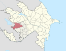
Nagorno-Karabakh is a landlocked region in the South Caucasus, within the mountainous range of Karabakh, lying between Lower Karabakh and Zangezur, and covering the southeastern range of the Lesser Caucasus mountains. The region is mostly mountainous and forested.

Shusha is a city and the centre of the Shusha District of Azerbaijan. Situated at an altitude of 1,400–1,800 metres (4,600–5,900 ft) in the Karabakh mountains, Shusha was a mountain recreation resort in the Soviet era.

Zangilan District is a district in south-west Azerbaijan with the administrative centre being the city of Zangilan.

Khojavend is a district of the Republic of Azerbaijan.

Zəngilan is a town and the administrative centre of the Zangilan District of Azerbaijan.

Karki or Tigranashen is a village that is de jure an exclave of the Nakhchivan Autonomous Republic of Azerbaijan, but is de facto under control of Armenia. The village is near the border with Armenia, located on the bank of the Arpachay River near the Yerevan-Jermuk highway, which is 15 kilometres (9.3 mi) away from the district center. The area of the village itself is 950 hectares. Karki is de jure within the administrative territory of the Sadarak Rayon of Nakhchivan. It was occupied on January 19, 1990, by Armenian forces.
Nagorno-Karabakh is located in the southern part of the Lesser Caucasus range, at the eastern edge of the Armenian Highlands, encompassing the highland part of the wider geographical region known as Karabakh. Under Russian and Soviet rule, the region came to be known as Nagorno-Karabakh, meaning "Mountainous Karabakh" in Russian. The name Karabakh itself was first encountered in Georgian and Persian sources from the 13th and 14th centuries to refer lowlands between Kura and Aras rivers and adjacent mountainous territory.

Karabakh is a geographic region in present-day eastern Armenia and southwestern Azerbaijan, extending from the highlands of the Lesser Caucasus down to the lowlands between the rivers Kura and Aras.

Seviyan is a village in the Barda Rayon of Azerbaijan.

Xanməmməd-Bünaən is a village in the Kalbajar Rayon of Azerbaijan.

Armudly is a village in the Kalbajar District of Azerbaijan.

Kaxat-Xəl is a village in the Kalbajar Rayon of Azerbaijan.

Eger-Yurd is a village in the Kalbajar Rayon of Azerbaijan.

Kürd-Dam is a village in the Kalbajar Rayon of Azerbaijan.

Nizhniy Gyaduk is a village in the Lerik Rayon of Azerbaijan.

Namekyash is a village in the Lerik Rayon of Azerbaijan.

Izzhor is a village in the Quba Rayon of Azerbaijan.

Khodzham Saqly is a village in the Qubadli Rayon of Azerbaijan.

Dashalfy is a village in the Qubadli Rayon of Azerbaijan. Dashalfy is the Azeri village in Qubadli

Mam is a village in the Sabirabad Rayon of Azerbaijan. Mam is found in eastern Azerbaijan.


