Gmina Kuźnia Raciborska is an urban-rural gmina in Racibórz County, Silesian Voivodeship, in southern Poland. Its seat is the town of Kuźnia Raciborska, which lies approximately 16 kilometres (10 mi) north of Racibórz and 50 km (31 mi) west of the regional capital Katowice.
Gmina Nędza is a rural gmina in Racibórz County, Silesian Voivodeship, in southern Poland. Its seat is the village of Nędza, which lies approximately 11 kilometres (7 mi) north-east of Racibórz and 51 km (32 mi) west of the regional capital Katowice.

Gmina Rudnik is a rural gmina in Racibórz County, Silesian Voivodeship, in southern Poland. Its seat is the village of Rudnik, which lies approximately 7 kilometres (4 mi) north-west of Racibórz and 60 km (37 mi) west of the regional capital Katowice.

Gmina Lyski is a rural gmina in Rybnik County, Silesian Voivodeship, in southern Poland. Its seat is the village of Lyski, which lies approximately 13 kilometres (8 mi) west of Rybnik and 46 km (29 mi) west of the regional capital Katowice.
Rudy Landscape Park is a protected area in southern Poland, established in 1993, covering an area of 493.87 square kilometres (190.68 sq mi).

Kobyla is a village in the administrative district of Gmina Kornowac, within Racibórz County, Silesian Voivodeship, in southern Poland. It lies approximately 2 kilometres (1 mi) north-west of Kornowac, 5 km (3 mi) east of Racibórz, and 54 km (34 mi) west of the regional capital Katowice.

Bojanów is a village in the administrative district of Gmina Krzanowice, within Racibórz County, Silesian Voivodeship, in southern Poland, close to the Czech border. It lies approximately 2 kilometres (1 mi) east of Krzanowice, 10 km (6 mi) south-west of Racibórz, and 66 km (41 mi) south-west of the regional capital Katowice.

Borucin is a village in the administrative district of Gmina Krzanowice, within Racibórz County, Silesian Voivodeship, in southern Poland, close to the Czech border. It lies approximately 3 kilometres (2 mi) south-east of Krzanowice, 11 km (7 mi) south-west of Racibórz, and 67 km (42 mi) south-west of the regional capital Katowice.

Wojnowice is a village in the administrative district of Gmina Krzanowice, within Racibórz County, Silesian Voivodeship, in southern Poland, close to the Czech border. It lies approximately 4 kilometres (2 mi) north-east of Krzanowice, 8 km (5 mi) south-west of Racibórz, and 65 km (40 mi) west of the regional capital Katowice.
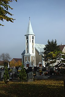
Babice is a village in the administrative district of Gmina Nędza, within Racibórz County, Silesian Voivodeship, in southern Poland. It lies approximately 3 kilometres (2 mi) south of Nędza, 8 km (5 mi) north-east of Racibórz, and 52 km (32 mi) west of the regional capital Katowice.
Ciechowice is a village in the administrative district of Gmina Nędza, within Racibórz County, Silesian Voivodeship, in southern Poland. It lies approximately 4 kilometres (2 mi) west of Nędza, 10 km (6 mi) north of Racibórz, and 54 km (34 mi) west of the regional capital Katowice.

Górki Śląskie is a village in the administrative district of Gmina Nędza, within Racibórz County, Silesian Voivodeship, in southern Poland. It lies approximately 7 kilometres (4 mi) east of Nędza, 13 km (8 mi) north-east of Racibórz, and 46 km (29 mi) west of the regional capital Katowice.
Łęg is a village in the administrative district of Gmina Nędza, within Racibórz County, Silesian Voivodeship, in southern Poland. It lies approximately 7 kilometres (4 mi) south-west of Nędza, 6 km (4 mi) north of Racibórz, and 57 km (35 mi) west of the regional capital Katowice.

Szymocice is a village in the administrative district of Gmina Nędza, within Racibórz County, Silesian Voivodeship, in southern Poland. It lies approximately 5 kilometres (3 mi) east of Nędza, 14 km (9 mi) north-east of Racibórz, and 46 km (29 mi) west of the regional capital Katowice.
Zawada Książęca is a village in the administrative district of Gmina Nędza, within Racibórz County, Silesian Voivodeship, in southern Poland. It lies approximately 4 kilometres (2 mi) west of Nędza, 9 km (6 mi) north of Racibórz, and 54 km (34 mi) west of the regional capital Katowice.
Amandów is a village in the administrative district of Gmina Pietrowice Wielkie, within Racibórz County, Silesian Voivodeship, in southern Poland, close to the Czech border. It lies approximately 8 kilometres (5 mi) north of Pietrowice Wielkie, 15 km (9 mi) north-west of Racibórz, and 68 km (42 mi) west of the regional capital Katowice.
Czerwięcice is a village in the administrative district of Gmina Rudnik, within Racibórz County, Silesian Voivodeship, in southern Poland. It lies approximately 4 kilometres (2 mi) north of Rudnik, 9 km (6 mi) north-west of Racibórz, and 60 km (37 mi) west of the regional capital Katowice.

Lasaki is a village in the administrative district of Gmina Rudnik, within Racibórz County, Silesian Voivodeship, in southern Poland. It lies approximately 9 kilometres (6 mi) north-east of Rudnik, 12 km (7 mi) north of Racibórz, and 54 km (34 mi) west of the regional capital Katowice. Hamlet had a German name Lassoky [1], in the years 1936 - 1945 Weidenmoor [1].
Strzybnik is a village in the administrative district of Gmina Rudnik, within Racibórz County, Silesian Voivodeship, in southern Poland. It lies approximately 2 kilometres (1 mi) north-west of Rudnik, 8 km (5 mi) north-west of Racibórz, and 61 km (38 mi) west of the regional capital Katowice.

Szonowice is a village in the administrative district of Gmina Rudnik, within Racibórz County, Silesian Voivodeship, in southern Poland. It lies approximately 5 kilometres (3 mi) north-west of Rudnik, 11 km (7 mi) north-west of Racibórz, and 62 km (39 mi) west of the regional capital Katowice.


