Senegal is a coastal West African nation located 14 degrees north of the equator and 14 degrees west of the Prime Meridian. The country's total area is 196,190 km2 of which 192,000 km2 is land and 4,190 km2 is water.

This article describes the system of transport in Senegal, both public and private.This system comprises roads, rail transport, water transport, and air transportation.

The Government of Senegal is the union government created by the constitution of Senegal, consisting of the executive, parliament, and judiciary. The Seat of the Government is located in Dakar. The government is led by the president.

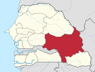
Tambacounda, formerly known as Sénégal Oriental, is a region of Senegal. It used to be part of the Mali Empire before the borders were created to separate Mali from Senegal. Tambacounda is physically the largest of Senegal's 14 regions, but is sparsely populated and its economy lags behind the rest of the country. The department of Kédougou was separated from Tambacounda in 2008, and became a separate region.

Tambacounda is the largest city in eastern Senegal, 400 kilometres (250 mi) southeast of Dakar, and is the regional capital of the province of the same name. Its population in 2023 was 149,071.
N4, N-4, or N.4 may refer to:

The Dakar–Niger Railway connects Dakar, Senegal to Koulikoro, Mali. The name refers to the Niger River, not the Republic of Niger. It serves many cities in Senegal, including Thiès, and in Mali, including Kayes, Kita, Kati, Bamako. The line covers a course of 1,287 km of which 641 km lies in Mali.

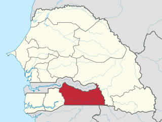
Kolda is a region of Senegal. It is also referred to historically and popularly as Haute Casamance.

Kolda is a city and urban commune located in southern Senegal. It is the capital city of Kolda Region and Kolda Department, a region known historically and popularly as Haute Casamance.

Bignona is a town with commune status located in the Ziguinchor Region of Senegal (Casamance). It briefly appears in the movie Binta and the Great Idea.
The Trans-Gambia Highway is a major highway in The Gambia, running across the centre of the nation in a north–south direction.

Mpack is a village in Niaguis Arrondissement, Ziguinchor Department, Ziguinchor Region in southern Senegal. Government statistics classified it as a rural community and recorded its population as 518 people in 72 households. It is located about seven kilometres from the regional capital of Ziguinchor. It is one of the endpoints of the 90-km long Oussouye-Kabrousse-Cap Skirring-Ziguinchor-Mpack road, which is being rebuilt with 17 billion CFA francs of funding from the European Union. The village used to be on the front lines of the Casamance Conflict between the Senegalese government and the Movement of Democratic Forces of Casamance.

The Trans-Sahelian Highway or TAH 5 is a transnational highway project to pave, improve and ease border formalities on a highway route through the southern fringes of the Sahel region in West Africa between Dakar, Senegal in the west and Ndjamena, Chad, in the east. Alternative names for the highway are the Dakar-Ndjamena Highway or Ndjamena-Dakar Highway and it is Trans-African Highway 5 in the Trans-African Highway network.

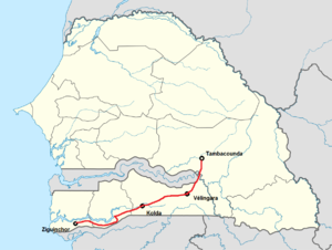
The N4 road is one of the 7 national roads in Senegal. It connects central-Senegal with Basse Casamance by a route which crosses The Gambia.
Kabiline is a large village in the Bignona Department of the Ziguinchor Region of southwestern Senegal. In 2002 the village had a population of 3258 people. Surrounded by rivers, it is connected by a road which leads to the N5 road, which connects it directly to the district seat of Diouloulou in the northwest.

The N1 road is one of the national roads of Senegal. It connects the west and the east of the country by a direct route across the middle from the capital Dakar via Mbour, Fatick, Kaolack, Kaffrine, Koungheul, Tambacounda, Goudiry to Nayé and Kidira on the border with Mali. It connects with the N4 at Kaolack and the N2 at Kidira.

The N3 road is one of the national roads of Senegal. It connects the west and the east of the country by a direct route across the middle from Thiès in the west via Bambey, Diourbel, Mbacké, Touba, Dahra, Linguère and Ranérou to Ouro Sogui and Malem on the eastern border with Mauritania. The N3 connects with the N2 road at both ends.

The N5 road is one of the 7 national roads of Senegal. It connects the centre of Senegal to Basse Casamance in the south by a route which traverses the Gambia at the mouth of the River Gambia.

The N7 road is one of the 7 national roads of Senegal. It connects Ouro Sogui in the north-east of Senegal to Kédougou in the south-east by a route which crosses the Niokolo-Koba National Park.


