
This article provides a breakdown of the transportation options available in Cameroon. These options are available to citizens and tourists such as railways, roadways, waterways, pipelines, and airlines. These avenues of transport are used by citizens for personal transportation, of goods, and by tourists for both accessing the country and traveling.

Modes of transport in Mozambique include rail, road, water, and air. There are rail links serving principal cities and connecting the country with Malawi, Zimbabwe and South Africa. There are over 30,000 km of roads, but much of the network is unpaved.

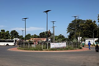
This article describes the system of transport in Senegal, both public and private.This system comprises roads, rail transport, water transport, and air transportation.

The N3 is a national route in South Africa that connects Johannesburg and Durban, respectively South Africa's largest and third-largest cities. Johannesburg is the financial and commercial heartland of South Africa, while Durban is South Africa's key port and one of the busiest ports in the Southern Hemisphere and is also a holiday destination. Durban is the port through which Johannesburg imports and exports most of its goods. As a result, the N3 is a very busy highway and has a high volume of traffic.

National routes in South Africa are a class of trunk roads and freeways which connect major cities. They form the highest category in the South African route numbering scheme, and are designated with route numbers beginning with "N", from N1 to N18. Most segments of the national route network are officially proclaimed National Roads that are maintained by the South African National Roads Agency (SANRAL), but some segments are maintained by provincial or local road authorities.

The N1 is a national route in South Africa that runs from Cape Town through Bloemfontein, Johannesburg, Pretoria and Polokwane to Beit Bridge on the border with Zimbabwe. It forms the first section of the famed Cape to Cairo Road.

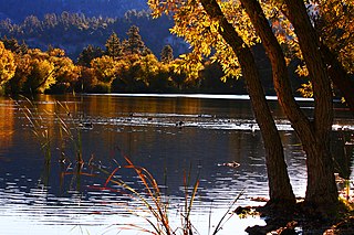
The Casamance River flows westward for the most part into the Atlantic Ocean along a path about 200 miles (320 km) in length. However, only 80 miles (130 km) are navigable. The Casamance is the principal river of the Kolda, Sédhiou, and Ziguinchor Regions in the southern portion of Senegal. It is located between the Gambia River to the north and the Cacheu and Geba rivers to the south.
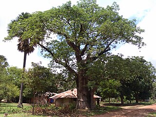
Bignona is a town with commune status located in the Ziguinchor Region of Senegal (Casamance). It briefly appears in the movie Binta and the Great Idea.
The Trans-Gambia Highway is a major highway in The Gambia, running across the centre of the nation in a north–south direction.

Baïla is a village in the rural community of Suelle, Sindian, Bignona, Ziguinchor, Casamance, Senegal.
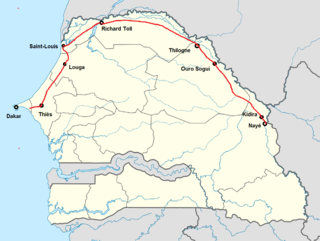
The N2 road is one of the national roads of Senegal. It connects the west and the east of the country in a large arc following the northern frontier from the outskirts of the capital Dakar via Thiès, Louga, Saint-Louis, Richard Toll, Thilogne, Ouro Sogui, Kidira and Nayé on the border with Mali.
There are 9 routes assigned to the "N" zone of the California Route Marker Program, which designates county routes in California. The "N" zone includes county highways lying in Los Angeles and Orange counties.
Bagaya is a settlement in Senegal in the department Bignona, in the region Ziguinchor Region, in the Casamance area. Bagaya belongs to the rural community of Balinghore in the arrondissement of Tendouck. It is located on the road from Bignona to Elana between Mandégane and Diatock.
Kabiline is a large village in the Bignona Department of the Ziguinchor Region of southwestern Senegal. In 2002 the village had a population of 3258 people. Surrounded by rivers, it is connected by a road which leads to the N5 road, which connects it directly to the district seat of Diouloulou in the northwest.

The N1 road is one of the national roads of Senegal. It connects the west and the east of the country by a direct route across the middle from the capital Dakar via Mbour, Fatick, Kaolack, Kaffrine, Koungheul, Tambacounda, Goudiry to Nayé and Kidira on the border with Mali. It connects with the N4 at Kaolack and the N2 at Kidira.

The N3 road is one of the national roads of Senegal. It connects the west and the east of the country by a direct route across the middle from Thiès in the west via Bambey, Diourbel, Mbacké, Touba, Dahra, Linguère and Ranérou to Ouro Sogui and Malem on the eastern border with Mauritania. The N3 connects with the N2 road at both ends.

The N5 road is one of the 7 national roads of Senegal. It connects the centre of Senegal to Basse Casamance in the south by a route which traverses the Gambia at the mouth of the River Gambia.

The N6 road is one of the 7 national roads of Senegal. It connects Tambacounda in the centre of Senegal to Ziguinchor in Basse Casamance in the south by a route which avoids traversing the Gambia. It is also known as the Route du Sud.

The N7 road is one of the 7 national roads of Senegal. It connects Ouro Sogui in the north-east of Senegal to Kédougou in the south-east by a route which crosses the Niokolo-Koba National Park.

The Senegambia bridge, also known as the Trans-Gambia Bridge, is a bridge in The Gambia that carries the Trans-Gambia Highway connecting northern and southern Gambia. It also provides access to the isolated Casamance province from the rest of Senegal. A bridge had been proposed for this location in 1956 but political considerations delayed construction which finally began in 2015. Construction was funded largely by a loan of US$ 65 million from the African Development Bank, with remaining funding coming from the Gambian government. Construction works were carried out by a joint venture of Spanish company Isolux Corsán and the Senegalese Arezki Group.


