
Sitamarhi is an Indian city and the district headquarters of the Sitamarhi district in the Mithila region of Bihar and is a part of the Tirhut Division. It dates back to the time of Ramayana and is considered as the place where Janaka found Sita. The Bihar government declared Sitamarhi a municipal council.

Darbhanga is the fifth-largest city and municipal corporation in the Indian state of Bihar. It is one of the most important districts and big cities of North Bihar.

Madhubani is a City Municipal Corporation and headquarter of Madhubani district. Madhubani is situated in the Indian state of Bihar. It comes under Darbhanga Division. It is situated at 26 km northeast of Darbhanga City.The Madhuban Raj in Madhubani was created as a consequence. The word "Madhuban" means "forest of honey" from which Madhubani is derived, but sometimes it is also known as "madhu"+"vaani" meaning "sweet" "voice/language".

Muzaffarpur is a city located in Muzaffarpur district in the Tirhut region of the Indian state of Bihar. It serves as the headquarters of the Tirhut division, the Muzaffarpur district and the Muzaffarpur Railway District. It is the fourth most populpus city in Bihar.

Purnia (also romanized as Purnea) is the fourth largest city of Bihar and emerging as the biggest economic hub in North Bihar. It serves as the administrative headquarters of both Purnia district and Purnia division in the Indian state of Bihar. It is well known for its favourable climate like Darjeeling and have abundance amount of resources for human settlements and economic activities.

Saharsa is a city and Municipal corporation in the Saharsa District in the eastern part of the state of Bihar, India. It is situated near the eastern banks of the Kosi River. It serves as the administrative headquarters for Saharsa District and is also the Divisional Headquarter of the Kosi Division.

Bettiah is a city and administrative headquarters of West Champaran district - (Tirhut), near Indo-Nepal border, 225 kilometres (140 mi) north-west of Patna, in Bihar state of India.

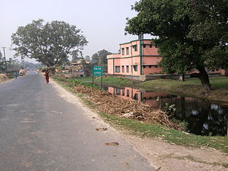
Sitamarhi is one of the districts in the Mithila region of the Indian state of Bihar, India. Dumra is the administrative headquarters of this district. The district is a part of the Tirhut Division and is located along the border of Nepal.
Benipatti is a town and headquarter of sub-division Benipatti (अनुमंडल), in Madhubani district, in the Mithila region of Bihar, India. The native language of Benipatti is Maithili, while the official languages are Hindi and Urdu.
Laukaha is a very old Border Town in the district of Madhubani in the Indian state of Bihar. It is close to the border with Nepal and the Nepalese town of Thadi. The population of Laukaha is between 11, 000 and 15, 000.
Malmal Village is a village in India, situated about 560mi east of New Delhi, the country's capital. It is situated 3km from Kaluahi and approximately 17km from Madhubani in the Indian state of Bihar.
Dullipatti is a village, situated in Madhubani district of Bihar, near the Nepal international border. National Highway 105 passes through this village and is 6 kilometers away from Jainagar, sub-division.
Chandih is a village in Bahadurpur Block, Darbhanga District, Bihar, India.
Bagha Kusmar is a small town in the Madhubani district in northern Bihar state, India. It is under Phulparas subdivision. The distance between Bagha Kusmar and its district headquarters is 52 km (32 mi). The distance between Bagha Kusmar and town Khutauna is 7 km (4.3 mi).
Durgawati is a community development block in Kaimur district in Indian state of Bihar. It is geographically located between 25° 12' 41" north latitude and 83° 31' 51" east longitude. It is located at an altitude of 76 m (249 ft) above mean sea level. Its headquarters is 30.6 km by road north of the district headquarters, Bhabua, on National Highway 19.

Chhatwan is a village in Keotiranway Tehsil, Darbhanga District, Bihar, India.

2017 Bihar floods affected 19 districts of North Bihar causing death of 514 people. 2,371 panchayats under 187 blocks of 19 districts of Northern Bihar have been affected in the flood. Around 1.71 crore people were hit by the floods. Over 8.5 lakhs of people have lost their homes, with Araria district alone accounting for 2.2 lakh homeless people. 2017 Flood has broken 9-Year record of deaths In Bihar. Bihar is India's most flood-prone State, with 76% of the population in the North Bihar living under the recurring threat of flood devastation. Devastating flood was caused due to excess heavy rainfall in monsoon season.
Jharbaria is a village in the Indian state of Bihar located near Baheri town in Darbhanga District. It is 36 kilometres (22 mi) southeast of Darbhanga. As of 2011, Jharbaria had a population of 2000. People of the village are mostly dependent on agricultural income along with government jobs.

Sitamarhi Institute of Technology is a government engineering college under Department of Science and Technology, Bihar. It is situated in Sitamarhi district of Bihar. Institute is affiliated with Aryabhatta Knowledge University. It was established in the year 2016.
