Nadir | |
|---|---|
Settlement | |
 | |
 Nadir | |
| Coordinates: 18°19′20″N64°52′42″W / 18.32222°N 64.87833°W |
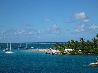
Nadir is a settlement on the island of St. Thomas in the United States Virgin Islands. [1]
A "Bridge to Nowhere" is located in Nadir. [2]
Nadir | |
|---|---|
Settlement | |
| | |
| Nadir | |
| Coordinates: 18°19′20″N64°52′42″W / 18.32222°N 64.87833°W |
Nadir is a settlement on the island of St. Thomas in the United States Virgin Islands. [1]
A "Bridge to Nowhere" is located in Nadir. [2]

The British Virgin Islands (BVI), officially the Virgin Islands, are a British Overseas Territory in the Caribbean, to the east of Puerto Rico and the US Virgin Islands and north-west of Anguilla. The islands are geographically part of the Virgin Islands archipelago and are located in the Leeward Islands of the Lesser Antilles and part of the West Indies.

The United States Virgin Islands, officially the Virgin Islands of the United States, are a group of Caribbean islands and an unincorporated and organized territory of the United States. The islands are geographically part of the Virgin Islands archipelago and are located in the Leeward Islands of the Lesser Antilles.

The Virgin Islands are an archipelago in the Caribbean Sea. They are geologically and biogeographically the easternmost part of the Greater Antilles, While the British Virgin Islands are officially designated as “The Virgin Islands”, the name is most often used to refer to the entire international grouping of the British and United States Virgin Islands together with the Spanish Virgin Islands, which, contrary to their name are in fact officially part of the Commonwealth of Puerto Rico, itself an unincorporated territory of the United States. Geographically, the northern islands lie along the Puerto Rico Trench. St. Croix is a displaced part of that same geologic structure. Politically, the British Virgin Islands have been governed as the western island group of the Leeward Islands, which are the northern part of the Lesser Antilles, and form the border between the Caribbean Sea and the Atlantic Ocean. The archipelago is separated from the true Lesser Antilles by the Anegada Passage and from the main island of Puerto Rico by the Virgin Passage.

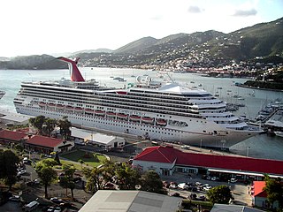
Charlotte Amalie, located on St. Thomas, is the capital and the largest city of the United States Virgin Islands. It was founded in 1666 as Taphus. In 1691, the town was renamed to Charlotte Amalie after the Danish queen Charlotte Amalie of Hesse-Kassel (1650–1714). It has a deep-water harbor that was once a haven for pirates and is now one of the busiest ports of call for cruise ships in the Caribbean, with about 1.5 million-plus cruise ship passengers landing there annually. Protected by Hassel Island, the harbor has docking and fueling facilities, machine shops, and shipyards and was a U.S. submarine base until 1966. The Town has been inhabited for centuries. When Christopher Columbus arrived in 1493, the area was inhabited by Caribs, Arawaks, Ciboney and Taíno native peoples. It is on the southern shore at the head of Saint Thomas Harbor. In 2010 the city had a population of 18,481, which makes it the largest city in the Virgin Islands Archipelago. Hundreds of ferries and yachts pass by the Town each week.
Saint Croix is an island in the Caribbean Sea, and a county and constituent district of the United States Virgin Islands (USVI), an unincorporated territory of the United States.

The Antilles is an archipelago bordered by the Caribbean Sea to the south and west, the Gulf of Mexico to the northwest, and the Atlantic Ocean to the north and east.

The Leeward Islands are a group of islands situated where the northeastern Caribbean Sea meets the western Atlantic Ocean. Starting with the Virgin Islands east of Puerto Rico, they extend southeast to Guadeloupe and its dependencies. In English, the term Leeward Islands refers to the northern islands of the Lesser Antilles chain. The more southerly part of this chain, starting with Dominica, is called the Windward Islands. Dominica was originally considered a part of the Leeward Islands, but was transferred from the British Leeward Islands to the British Windward Islands in 1940.

Saint Thomas is one of the Virgin Islands in the Caribbean Sea, and a constituent district of the United States Virgin Islands (USVI), an unincorporated territory of the United States. Along with surrounding minor islands, it is one of three county-equivalents in the USVI. Together with Saint John, it forms one of the districts of the USVI. The territorial capital and port of Charlotte Amalie is located on the island.

The United States Virgin Islands, often abbreviated USVI, are a group of islands and cays located in the Lesser Antilles of the Eastern Caribbean, consisting of three main islands and fifty smaller islets and cays. Like many of their Caribbean neighbors, the history of the islands is characterized by native Amerindian settlement, European colonization, and the Atlantic slave trade.

Buck Island National Wildlife Refuge is located about 2 miles (4 km) south of the island of St. Thomas in the Virgin Islands of the United States. Adjacent to the refuge is Capella Island, about half the size of Buck, owned by the territorial government. There is a second Buck Island just north of St. Croix that is the centerpiece of Buck Island Reef National Monument.

Havensight on Saint Thomas in the U.S. Virgin Islands is a community and the busiest cruise port in the world.

Little Saint James is a small private island in the United States Virgin Islands, southeast of Saint Thomas. It was owned by American financier and sex offender Jeffrey Epstein from 1998 until his death in 2019. During Epstein's ownership the island acquired the nickname Epstein Island.
Calabash is a neighborhood on the island of St. John in the United States Virgin Islands. It is located in the east of the island on the coast of Coral Bay, to the south of the town of Coral Bay.
Palestina is a settlement on the island of St. John in the United States Virgin Islands. It is located in the east of the island on the coast of Coral Bay, to the east of the town of Coral Bay.
The following outline is provided as an overview of and topical guide to the United States Virgin Islands:

Crown Mountain is located on the island of Saint Thomas, U.S. Virgin Islands and is the highest point of the United States Virgin Islands. It is 1,555 feet (474 m) in height.

Tutu, also known as Estate Tutu is one of the seven administrative subdistricts on Saint Thomas island in the United States Virgin Islands. It is located in eastern St. Thomas and is mostly made up of the second-largest town in the U.S.V.I., Anna's Retreat in the Tutu Valley, sometimes nicknamed Tutu. The word tutu, in Danish, means a trumpet-like conch shell which was used to call the slaves to work. According to the U.S. Census Bureau in 2010 the population was 6,867, which is down from 8,197 in 2000 and further down from 9,100 in the U.S. Census of 1990. Tutu is known as a densely populated residential area and is second only to the territorial capital of Charlotte Amalie in terms of highest population density on the island of Saint Thomas. It is home to approximately 20 percent of the island population and has a total area of 1.5 square miles. There have been numerous excavations in an area known as the Tutu Archaeological Village Site, which has discovered numerous artifacts from the native Arawak people who inhabited the area in the pre-Columbian era.
Protestant Cay is a four-acre triangular islet in the Christiansted Harbor, 200 yards north of Christiansted. The island is home to a resort, the Hotel on the Cay, which is home to a protected sand beach, small shop and beach bar. It also has the closest beach to Downtown Christiansted. With one of the ferries, which run from 7 a.m. to 12 a.m., every ten minutes, it will only take about two minutes to get there. The ride is free of charge after 4 p.m., and for guests of the Hotel on the Cay. To get on the ferry, passengers have to stand near the boardwalk in front of the King Christian Hotel and wave to the boat captain on duty.

East End is an administrative subdistrict of the island of St. Thomas in the United States Virgin Islands. The largest community is Red Hook, while smaller communities include Benner, Nazareth, Nadir, Frydendal, and Smith Bay. The subdistrict includes the offshore islands of Great Saint James, Little Saint James, Bovoni Cay, Patricia Cay, Cas Cay, Rotto Cay, Thatch Cay, Shark Island, and Dog Island.
Southside is a census subdistrict (CSD) on Saint Thomas in the United States Virgin Islands. The CSD is bordering Charlotte Amalie from Havensight in the west, Nordside- and the Tutu subdistricts to the north, and the East End subdistrict to the east. The 2010 U.S. Census showed a population of 5,411 people, which is a decrease of 56 people as compared to the 2000 U.S. Census of 5,467. Some of the communities here includes Havensight, Bellevue, Raphune, Hoffman, Bolongo and Bovoni.
| | This Saint Thomas, United States Virgin Islands location article is a stub. You can help Wikipedia by expanding it. |