Related Research Articles

Mandasa is a village in Srikakulam district of the Indian state of Andhra Pradesh. Mandasa is also known by the name Manjusha in Odia. It was ruled by erstwhile odia zamindar Rajamani royal family during British Raj. Srinivasa Rajamani was the famous Ruling chief Rajah of this estate.

Vizianagaram district is one of the six districts in the Uttarandhra region of the Indian state of Andhra Pradesh with its headquarters located at Vizianagaram. The district was once the part of ancient Kalinga.Saripilli Dibbilingeswara temple, Jayathi Mallikarjuna Temple are the finest examples of ancient Eastern Ganga Dynasty built monuments in the district. The district is bounded on the east by the district of Srikakulam, north by Parvathipuram Manyam south by Visakhapatnam, Anakapalli, southeast by the Bay of Bengal, and west by Alluri Sitharama Raju district. It was formed on 1 June 1979, with some parts carved from the neighbouring districts of Srikakulam and Visakhapatnam. The district is named after the princely state of Vizianagaram. In 2011, it was the least populous district in Andhra Pradesh.

Srikakulam district is one of the twenty-six districts of the Indian state of Andhra Pradesh, located in the Uttarandhra region of the state, with its headquarters located at Srikakulam. It is one of the six districts, located in the extreme northeastern direction of the state. It was formerly known as Chicacole, and was under Ganjam district till 1936 April 1, then merged under Vizagapatam district. Srikakulam district forms the core area of Kalinga where most of its historical capitals like Kalinganagari, pithunda, Dantapuram are located.
Acharya N. G. Ranga Agricultural University (ANGRAU) is a public agricultural university with its headquarters at the village Lam, Guntur, Andhra Pradesh, India.

Parvathipuram is a municipality located at Parvathipuram Manyam district of Indian state of Andhra Pradesh. It is the administrative headquarters of Parvathipuram Manyam district and headquarters of Parvathipuram revenue division and Parvathipuram mandal. This revenue division shares a border with various districts in Odisha.

Ganjam is a town and a notified area council in Ganjam district in the state of Odisha, India. Brahmapur, one of the major city of Odisha is situated in this district.

The River Nagavali also known as Langulya is one of the main rivers of Southern Odisha and Andhra States in India, between Rushikulya and Godavari basins.
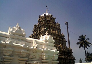
Sri Kurmam also known as Srikurmu or Srikurmais a village near Srikakulam, Andhra Pradesh, India. Srikurmam village is situated at a distance of 14.5 km to the South-east of Srikakulam town. It is in the Gara mandal of Srikakulam district. The village was named after the Srikurmam temple dedicated to Kurma avatar of the Hindu god Vishnu, which was re-established by Eastern Ganga Dynasty King Anantavarman Chodaganga Deva.

Gara is a village in Srikakulam district of the Indian state of Andhra Pradesh. It is also the mandal head quarters of Gara Mandal, Srikakulam District, AP.
Kaviti is a village in Srikakulam district of the Indian state of Andhra Pradesh. Kaviti mandal is bordered by Ichchapuram mandal to the north, Kanchili and Sompeta mandals to the south, Odisha state to the west and the Bay of Bengal to the east.

Pathapatnam is a town in Srikakulam district of the Indian state of Andhra Pradesh. It is located in Pathapatnam mandal of Palakonda revenue division. Pathapatnam is located on the border of Srikakulam district of Andhra Pradesh and Gajapati district of Odisha. Parlakhemundi, the headquarters of Gajapati District, can be considered as twin town of Pathapatnam because of its close proximity. It is located around 65 km from srikakulam. It was the old capital of Paralakhemundi Gajapati Maharajah of his erstwhile kingdom.
Veeraghattam is an Indian town in Parvathipuram Manyam district of Andhra Pradesh. It is located in Veeraghattam mandal of Palakonda revenue division.

Kalingapatnam is a village in Srikakulam district of the Indian state of Andhra Pradesh. It is located in Gara mandal of Srikakulam revenue division. It has one of the major beach sand deposits of the state. In medieval era it was famous for the ancient port city of Kalinga. Kalingapatnam is located at a distance of 26 km from the district headquarters and 17 km from Singupuram.
Urlam village is located in Narasannapeta mandal in Srikakulam district, Andhra Pradesh, India.
Telineelapuram and Telukunchi Bird Sanctuaries are located in Srikakulam district of Andhra Pradesh, India. Telineelapuram is a village located 65 kilometers from Srikakulam in Tekkali mandal, while Telukunchi is at a distance of 115 kilometers from Srikakulam in Ichchapuram mandal. Every year, over 3,000 pelicans and painted storks visit from Siberia to these villages during September and stay on till March.

Andhra Pradesh is a state in India. Andhra Pradesh Tourism Development Corporation (APTDC) is a state government agency which promotes tourism in Andhra Pradesh, describing the state as the Koh-i-Noor of India. Andhra Pradesh has a variety of tourist attractions including beaches, hills, caves, wildlife, forests and temples.
Fareed Peta is a village in the Etcherla Mandalam in Srikakulam District in the state of Andhra Pradesh in India.
Srikakulam mandal is one of the 38 mandals in Srikakulam district of the Indian state of Andhra Pradesh. It is under the administration of Srikakulam revenue division and the headquarters are located at Srikakulam. The mandal is bounded Amudalavalasa, Etcherla and Gara mandals. A portion of it lies on the banks of Vamsadhara River and Bay of Bengal.
Singupuram is a census town in the Indian state of Andhra Pradesh.
The naira is the currency of Nigeria.
References
- ↑ "Agricultural College of Naira". Archived from the original on 30 September 2007. Retrieved 12 April 2020.