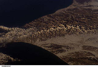
In modern mapping, a topographic map is a type of map characterized by large-scale detail and quantitative representation of relief, usually using contour lines, but historically using a variety of methods. Traditional definitions require a topographic map to show both natural and man-made features. A topographic survey is typically published as a map series, made up of two or more map sheets that combine to form the whole map. A contour line is a line connecting places of equal elevation.

Nakano is a special ward in Tokyo, Japan. The English translation of its Japanese self-designation is Nakano City.
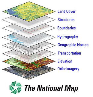
The National Map is a collaborative effort of the United States Geological Survey (USGS) and other federal, state, and local agencies to improve and deliver topographic information for the United States. The purpose of the effort is to provide "...a seamless, continuously maintained set of public domain geographic base information that will serve as a foundation for integrating, sharing, and using other data easily and consistently".
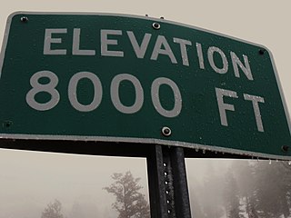
The elevation of a geographic location is its height above or below a fixed reference point, most commonly a reference geoid, a mathematical model of the Earth's sea level as an equipotential gravitational surface . The term elevation is mainly used when referring to points on the Earth's surface, while altitude or geopotential height is used for points above the surface, such as an aircraft in flight or a spacecraft in orbit, and depth is used for points below the surface.

The National Institute of Statistics and Geography is an autonomous agency of the Mexican Government dedicated to coordinate the National System of Statistical and Geographical Information of the country. It was created on January 25, 1983 by presidential decree of Miguel de la Madrid.

The Institut national de l’information géographique et forestière , previously Institut géographique national or IGN is a French public state administrative establishment founded in 1940 to produce and maintain geographical information for France and its overseas departments and territories.

Arrans is a commune in the Côte-d'Or department in the Bourgogne-Franche-Comté region of eastern France.

Antheuil is a commune in the Côte-d'Or department in the Bourgogne-Franche-Comté region of eastern France.
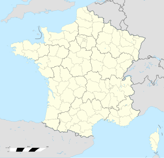
Bagnoles is a commune in the Aude department in the Occitanie region of southern France.

Debenham Glacier is a glacier flowing into the northern part of Wilson Piedmont Glacier on the coast of Victoria Land. It was first mapped by the British National Antarctic Expedition, 1901–04, and was named by the British Antarctic Expedition, 1910–13, for Frank Debenham, a geologist with the expedition and Director of the Scott Polar Research Institute, 1925–48.

East Ongul Island is an island in the Flatvaer Islands off of Antarctica. It is 2 kilometres (1 nmi) long, lying immediately east of the northern part of Ongul Island at the east side of the entrance of Lutzow-Holm Bay.
Mount Nakano is a mountain in the Hokkaidō prefecture of Japan. It is located in the Hidaka Mountains range, and its peak is 1,519 meters above sea level.
Newall Glacier is a glacier in the east part of the Asgard Range of Victoria Land, flowing east between Mount Newall and Mount Weyant into the Wilson Piedmont Glacier. In its uppermost névé area sits Kaminuma Crag, a craggy, island-like nunatak, 0.75 nautical miles (1.4 km) long, rising to 1,750 metres (5,740 ft) high.

Otake is a stratovolcano in the Tokara Islands of Japan. It is the largest mountain on Nakanoshima, which is part of the village of Toshima in Kagoshima District of Kagoshima Prefecture. Being the largest mountain on a small island, it is also referred to as Nakanoshima. It is also called "Tokara Fuji" from its shape.
Jutulstraumen Glacier is a large glacier in Queen Maud Land, Antarctica, about 120 nautical miles (220 km) long, draining northward to the Fimbul Ice Shelf between the Kirwan Escarpment, Borg Massif and Ahlmann Ridge on the west and the Sverdrup Mountains on the east. It was mapped by Norwegian cartographers from surveys and air photos by the Norwegian–British–Swedish Antarctic Expedition (1949–52) and air photos by the Norwegian expedition (1958–59) and named Jutulstraumen. More specifically jutulen are troll-like figures from Norwegian folk tales. The ice stream reaches speeds of around 4 metres per day near the coast where it is heavily crevassed.

The Flatvaer Islands, also known as the Ongul Islands, are a group of small islands lying at the east side of the entrance of Lützow-Holm Bay, 4 km from the coastline of Antarctica. They were mapped by Norwegian cartographers from air photos taken by the Lars Christensen Expedition (LCE), 1936–37. Many of the islands and their features were subsequently named by members of the Japanese Antarctic Research Expedition (JARE); unless otherwise noted, features noted in this article were named by JARE.
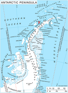
Jenner Glacier is a glacier 3 nautical miles (6 km) long flowing southwest from the Solvay Mountains between Paprat Peak and Kondolov Peak into the eastern arm of Duperré Bay, in the southern part of Brabant Island in the Palmer Archipelago, Antarctica.

Donnellan Glacier is a steep valley glacier fed by highland ice adjacent to Opalchenie Peak and Fukushima Peak on Vinson Plateau, the summit plateau of Vinson Massif, in the Sentinel Range of the Ellsworth Mountains, Antarctica. The glacier flows west-southwestward from Opalchenie Peak along the northwest side of Mount Slaughter into Nimitz Glacier.

Wheatland is an unincorporated community within Manchester Township in Ocean County, New Jersey, United States.
