The Mekong is a trans-boundary river in Southeast Asia. It is the world's twelfth longest river and the seventh longest in Asia. Its estimated length is 4,350 km (2,703 mi), and it drains an area of 795,000 km2 (307,000 sq mi), discharging 475 km3 (114 cu mi) of water annually. From the Tibetan Plateau the river runs through China, Myanmar, Laos, Thailand, Cambodia, and Vietnam. The extreme seasonal variations in flow and the presence of rapids and waterfalls in the Mekong make navigation difficult. Even so, the river is a major trade route between western China and Southeast Asia.

The Chao Phraya is the major river in Thailand, with its low alluvial plain forming the centre of the country. It flows through Bangkok and then into the Gulf of Thailand.

The Red River, also known as the Hồng Hà and Sông Cái (lit. "Mother River") in Vietnamese and the Yuan River in Chinese, is a river that flows from Yunnan in Southwest China through northern Vietnam to the Gulf of Tonkin. According to C. Michael Hogan, the associated Red River Fault was instrumental in forming the entire South China Sea at least as early as 37 million years before present.

The Salween, known in China as the Nu River, is a river about 2,815 kilometres (1,749 mi) long that flows from the Tibetan Plateau into the Andaman Sea in Southeast Asia.

The Mun River, sometimes spelled Moon River, is a tributary of the Mekong River. It carries approximately 26 cubic kilometres (6.2 cu mi) of water per year.

The Ing River is a tributary of the Mekong River in the northern part of Thailand. It has its source in Doi Luang, Phi Pan Nam Range, in Mae Chai District, Phayao Province. The Ing flows through the plain area of Thoeng District.

The Nam Song River is a small river in Laos that flows through the town of Vang Vieng. It is a popular tourist destination as many people enjoy seeing the Laotian countryside while going down the river in the inner tube of a tractor tyre or in a kayak. The river is surrounded by striking karst rock formations. Upstream from Vang Vieng, numerous bars have been built on the river's banks to attract the tourists floating by.
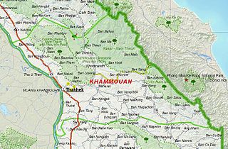
The Nam Ngum Dam is a hydroelectric dam on the Nam Ngum River, a major tributary of the Mekong River in Laos. It was the first hydropower dam built in the Lao PDR.

Nam Ngum is a 354 km long river in Laos. It is a major tributary of the Mekong River.

The Wang River is a river in northern Thailand.

Theinni or Hsenwi is a town in northern Shan State of Burma, situated near the north bank of the Nam Tu River and now the centre of Hsenwi Township in Lashio District. It is 28 miles north of Lashio. It is 2,100 feet above sea level.

The Yom River is a river in Thailand. It is the main tributary of the Nan River. The Yom River has its source in the Phi Pan Nam Range in Pong District, Phayao Province. Leaving Phayao, it flows through Phrae and Sukhothai as the main water resource of both provinces before it joins the Nan River at Chum Saeng District, Nakhon Sawan Province.

The Kok River flows in Southeast Asia.

The Kraburi River, also Kra or Pak Chan River is the boundary river between Thailand and Myanmar at the Kra Isthmus of the Malay Peninsula. The river has its source in the Tenasserim Hills and flows into the Andaman Sea near the Thai town of Ranong and Kawthaung, Myanmar.

Dhansiri is the main river of Golaghat District of Assam and the Dimapur District of Nagaland. It originates from Laisang peak of Nagaland. It flows through a distance of 352 kilometres (219 mi) from south to north before joining the Brahmaputra on its south bank. Its total catchment area is 1,220 square kilometres (470 sq mi).

Thailand has 25 river basins with 254 sub-basins. Rainwater is one of the most important sources of water. Thailand's water resoukle per capita is less than that of other countries in the region.

The Xe Bang Fai River or Nam Xebangfai is a river of Laos.
Neyinzaya River is a river in Chin State and Sagaing Region of Burma (Myanmar). It is a tributary of the Myittha River, enterring it from the left (west) just south of Kalemyo.

Mae Charim National Park, also known as Mae Jarim, is a protected area in the Luang Prabang Range, Nan Province, Northern Thailand. The Wa River, a popular river for white water rafting between July and December, flows through the park area. The park was established in 1961. Mae Charim National Park is part of the Luang Prabang montane rain forests ecoregion.