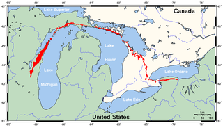
The Niagara Escarpment is a long escarpment, or cuesta, in Canada and the United States that runs predominantly east–west from New York through Ontario, Michigan, Wisconsin, and into Illinois. The escarpment is the cliff over which the Niagara River plunges at Niagara Falls, for which it is named.
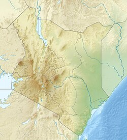
Kakamega is a town in western Kenya lying about 30 km north of the Equator. It is the headquarters of Kakamega County that has a population of 1,867,579.

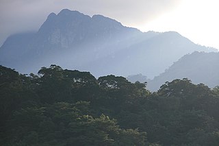
Kakamega Forest is a tropical rainforest situated in the Kakamega and Nandi County of Kenya, northwest of the capital Nairobi, and near to the border with Uganda. It is Kenya's only tropical rainforest and is said to be Kenya's last remnant of the ancient Guineo-Congolian rainforest that once spanned the continent.
The Nguru Mountains are a mountain range in Morogoro Region, Tanzania, Africa. The Nguru Mountains are part of the Eastern Arc Mountains. The mountains are predominantly covered with rainforest, home to 83 species of birds and African violets. There are a number of forest reserves in the mountains.
The Kipengere Range, also known as the Livingstone Mountains, lies entirely in Njombe Region in southwest Tanzania at the northern end of Lake Nyasa. Near Lake Nyasa they are known as the Kinga Mountains. It is a plateau-like ridge of mountains running southeastwards from the basin of the Great Ruaha River in the north to that of the Ruhuhu River in the south, and forms part of the eastern escarpment of the East African Rift. The range is mostly clad in montane grasslands, renowned for their botanical diversity and displays of flowers, with montane evergreen forests mostly in stream valleys.

Kakamega County is a county in the former Western Province of Kenya and borders Vihiga County to the South, Siaya County to the West, Bungoma and Trans Nzoia counties to the North and Nandi and Uasin Gishu counties to the East. Its capital and largest town is Kakamega. It has a population of 1,867,579 and an area of 3,033.8 km2.

The Udzungwa Mountains are a mountain range in south-central Tanzania. The mountains are mostly within Iringa Region, south of Tanzania's capital Dodoma. The Udzungwa Mountains are part of the Eastern Arc Mountains, and are home to a biodiverse community of flora and fauna with large numbers of endemic species.

Nandi County is a county in Kenya in the North Rift, occupying an area of 2,884.4 square kilometres. Its capital, Kapsabet, is the largest town in the county while other towns include Mosoriot, Tinderet, Kobujoi, Kaiboi, Kabiyet and Nandi Hills. According to a 2019 census, the county had a population of 885,711, made up of a number of Kenyan communities, the majority of whom belong to the native tribe called Nandi.

Shelley's greenbul or Shelley's bulbul, is a species of the bulbul family of passerine birds. It is found in east-central Africa. Its natural habitats are subtropical or tropical dry forests and subtropical or tropical moist montane forests.

The grey-chested babbler, also known as the grey-chested kakamega or grey-chested illadopsis, is a species of bird in the family Modulatricidae. It is the only species in its genus.

Monteiro's bushshrike is a species of bird in the bush-shrike family (Malaconotidae).

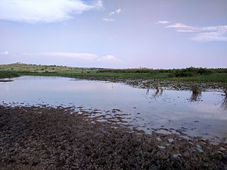
The Yala Swamp is a wetland region of about 175 square kilometres (68 sq mi) in Western Kenya.

Kerio Valley lies between the Tugen Hills and the Elgeyo Escarpment in Kenya. It sits at an elevation of 1,000 meters in the Great Rift Valley.

Tiriki is one of sixteen clans and dialects of the Abaluyia people of Western Kenya. The word Tiriki is also used to refer to their Geographical Location in Hamisi Division, Vihiga County, in the Western province of Kenya. Hamisi Constituency now Hamisi Sub County is one of the longest in Kenya stretching from kiboswa(Ny'angori) to Shiru which borders Kapsabet and Musunji which borders Kakamega Forest. Some also moved to nandi county and occupied aldai and other parts of nandi county.
The Ukaguru Mountains are a mountain range in central Tanzania. The mountains are in Morogoro region, east of Tanzania's capital Dodoma. The mountains are named for the Kaguru people. The Ukaguru Mountains are part of the Eastern Arc Mountains, and are home to a biodiverse community of flora and fauna with large numbers of endemic species.

The Southwestern Arabian foothills savanna, also known as the Southwestern Arabian Escarpment shrublands and woodlands, is a desert and xeric shrubland ecoregion of the southern Arabian Peninsula, covering portions of Saudi Arabia, Yemen, and Oman.

The Victoria Basin forest–grassland mosaic is an ecoregion that lies mostly in Uganda and extends into neighboring countries. The ecoregion is centered north and west of Lake Victoria, with an outlier on the border of Ethiopia and South Sudan.

The Yala River is a river of western Kenya, a tributary of Lake Victoria. It generally flows fast over a rocky bed through a wide valley before joining the Nzoia River to form the Yala Swamp on the border of Lake Victoria. The land along its course is mostly cultivated or used for grazing, with relatively few remnants of the original forest. Soil erosion is visible throughout the river basin, particularly in the lower parts. Projects are underway to exploit the river for hydroelectricity.

Lake Kanyaboli is a lake in the Yala Swamp in western Kenya. It is important as a refuge for fish species that have almost disappeared from Lake Victoria.
Lake Sare is a lake in western Kenya that lies between the Yala Swamp and Lake Victoria. It has potential as a site for restocking fish species that have become endangered in Lake Victoria, but due to lack of management the lake ecology is steadily degrading.


