Yala River

Last updated
Yala River
YalaRiver.JPG
Yala river within Kakamega rainforest, western Kenya
Kenya relief location map.jpg
Red pog.svg
Mouth location
Location
Country Kenya
Physical characteristics
Mouth Lake Victoria
  coordinates
0°03′40″S34°02′33″E / 0.060998°S 34.042633°E / -0.060998; 34.042633
Length219 kilometres (136 mi)
Basin size3,351 square kilometres (1,294 sq mi)

The Yala River is a river in western Kenya, a tributary of Lake Victoria. It generally flows fast over a rocky bed through a wide valley before joining the Nzoia River to form the Yala Swamp on the border of Lake Victoria. The land along its course is mostly cultivated or used for grazing, with relatively few remnants of the original forest. Soil erosion is visible throughout the river basin, particularly in the lower parts. Projects are underway to exploit the river for hydroelectricity.

Contents

Course

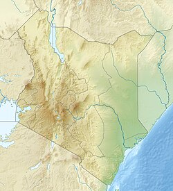
The Yala River rises in the Nandi Escarpment in the Rift Valley Province, Kenya. It flows west for 219 kilometres (136 mi) to its mouth on Lake Victoria in Siaya County, Kenya. [1] It is one of the largest Kenyan rivers feeding Lake Victoria, with an average discharge of 27.4 cubic metres per second (970 cu ft/s). [2] The river contributes about 5% of the annual inflow to Lake Victoria. [3]

The Yala River flows through a wide, mature valley that appears to have been rejuvenated during the tilting associated with the rifting movements of the mid-Pleistocene. It runs swiftly over a rocky bed, with a notable absence of alluvial flats and terraces. [4] The main channel is about 30 metres (98 ft) wide, apart from the Yala Swamp. [3] The river runs through the southeast of the Kakamega Forest, where it has a dramatic 20 metres (66 ft) waterfall. [5]

The Yala Swamp at the mouth of the river covers about 175 square kilometres (68 sq mi) along the northern shore of Lake Victoria. [1] The swamp contains 1,500 hectares (3,700 acres) Lake Kanyaboli, a freshwater deltaic wetland with an average depth of 3 metres (9.8 ft), which is fed by the floodwaters of the Nzoia and Yala rivers and by the backflow of water from Lake Victoria. The lake provides a refuge for several species of fish that are no longer present in Lake Victoria. [6]

In the past the Yala River flowed through the eastern 20% of the Yala Swamp into Lake Kanyaboli, then into the main swamp, and then through a small gulf into Lake Victoria. Today the eastern part of the swamp has been drained, and the river flows directly into the 8,000 hectares (20,000 acres) main swamp. It is cut off from Lake Kanyaboli by a silt-clay dyke. Lake Kanyaboli now receives its water from the surrounding catchment area and from back-seepage from the swamp. The river's gulf has been cut off from the lake by a culvert, which created the 500 hectares (1,200 acres) Lake Sare through back-flooding. [7] Lake Sare, with its direct link to Lake Victoria, is important in preserving the cichlid fish fauna of Lake Victoria. [8] The river water enters Lake Victoria from Lake Sare through a channel crossed by a bridge that carries the C27 coastal highway along the Goye causeway. [9] [10]

Basin

Handmade raft on the river Crossing The Yala.jpg
Handmade raft on the river

The Yala River drainage basin covers 3,351 square kilometres (1,294 sq mi). [1] An ecosystem management study of the Yala and Nzoia river basins issued a baseline report in 2008. It studied three representative 10 by 10 square kilometres (3.9 by 3.9 sq mi) blocks of land in the Yala basin. [11] In all three blocks much of the land was cultivated. Subsistence crops included maize, beans, sorghum, banana, cassava and sweet potato, while cash crops included tea, wheat and mango. [12]

The Upper Yala Block in the Uasin Gishu District includes Lake Lessos, one of the Yala River's main sources. The block has level terrain with medium gradient hills with shallow depressions. There are wetlands and small permanent streams. The farms are large and there is little subsistence agriculture. The cultivated land is interspersed with grasslands. [13] Dairy production is important. [14] 22% of the plots showed soil erosion in 2008. [15]

The Middle Yala Block in Vihiga District and Kakamega District contains mountainous highlands with many small streams, and held clusters of wetlands. There are preserved remnants of forest throughout the block used for cultural purposes, and logging in the Kaimosi forest in the southeast of the block. Most of the farms are overcropped, without traditional rotation and fallow periods. The farms are managed better in the north of the block, with more trees and hedges, while in the southern part steep slopes are cultivated with no conservation measures. [16] About half the block shows evidence of soil erosion. [17]

The Lower Yala block in Kisumu District and Siaya District has low to medium gradient terrain with a few large hills. Most of the population are Luo, but in some areas the people are mainly Luhya. [18] About 43% of the land is used for crops, and 55% for grazing livestock. [19] Livestock includes cows, bulls, chickens, goats and sheep. [20] There are few trees, and widespread soil erosion. [21]

Hydroelectric projects

As of 2016 a feasibility study had been completed for development of the Nandi Forest dam to support irrigation, water supply and power generation. The power plant would have two 25 MW Pelton turbines and would supply 185 GWh annually. [22] In April 2020 it was announced that Tembo Power of Mauritius, along with Metier and WK Construction of South Africa had signed an agreement for development of a run-of-the-river hydroelectricity plant on the Yala River. [23] The Kaptis Hydroelectric Power Station was to have a 15MW capacity and would be operational by 2022. The project would cost $30 million. The electricity would be fed to the grid operated by the state-owned Kenya Power and Lighting Company (KPLC). [24] The power plant was to be located near the town of Kakamega. [25]

Ecological changes

Lake Kanyaboli Kenyaboli1.JPG
Lake Kanyaboli

A study of discharge data from 1950 to 2000 showed a general increase in discharge. This may be due to destruction of land cover, including indigenous forests. [26] Yearly discharge of nutrients into the lake is about 1,000 tonnes of nitrogen and 102 tonnes of phosphorus. [2] Threats to the river ecology include garbage from panning for minerals, oil spills in and near the river, deforestation and resulting river bank erosion, and sand extraction. [1] Development potential includes irrigation and drainage projects in the lower and middle parts of the basin, hydroelectricity, wetlands products, eco-tourism and water sports tourism, and perhaps carbon sequestration. [3]

Conversion of the wetlands for crop production must be carefully managed to ensure environmental sustainability. Sufficient wetlands must be maintained to control erosion and improve water quality, which in turn affects fisheries in the river and the adjacent lake. The watershed must also be rehabilitated to maintain farm productivity and to reduce erosion and sedimentation of the wetlands and river. [3] A 2005 report noted changes in Lake Sare that threatened the lake ecosystem through eutrophication and pollution. It recommended an inclusive management plan for the Yala swamp complex to prevent further degradation of the ecosystem. [27] As of 2019 BirdLife International scored the threat to the swamp complex as high, and was pessimistic about action being taken. [7]

Notes

    1. 1 2 3 4 Okuna 2019.
    2. 1 2 Boye, Verchot & Zomer 2008, p. 4.
    3. 1 2 3 4 Identification of a multipurpose water resources ...
    4. Ominde 1971, p. 30.
    5. Mwangi & Chege 2019, p. 4.
    6. Lake Kanyaboli – Kenya GNF.
    7. 1 2 Yala Swamp Complex ... BirdLife.
    8. Gichuki, Maithya & Masai 2005, p. 340.
    9. Relation: Yala (8873639).
    10. Gichuki, Maithya & Masai 2005, p. 341.
    11. Boye, Verchot & Zomer 2008, p. 5.
    12. Boye, Verchot & Zomer 2008, p. 9, 27, 43.
    13. Boye, Verchot & Zomer 2008, p. 41.
    14. Boye, Verchot & Zomer 2008, p. 43.
    15. Boye, Verchot & Zomer 2008, p. 46.
    16. Boye, Verchot & Zomer 2008, p. 25.
    17. Boye, Verchot & Zomer 2008, p. 29.
    18. Boye, Verchot & Zomer 2008, p. 9.
    19. Boye, Verchot & Zomer 2008, p. 13.
    20. Boye, Verchot & Zomer 2008, p. 18.
    21. Boye, Verchot & Zomer 2008, p. 14.
    22. Lahmeyer International GmbH 2016, p. 59.
    23. Kenya: Tembo Power ...
    24. Takouleu 2020.
    25. Creamer 2020.
    26. Sangale, Okungu & Opango 2011, p. 6.
    27. Gichuki, Maithya & Masai 2005, p. 347.

    Sources

    Related Research Articles

    <span class="mw-page-title-main">Geography of Kenya</span> Geographical features of Kenya

    The Geography of Kenya is diverse, varying amongst its 47 counties. Kenya has a coastline on the Indian Ocean, which contains swamps of East African mangroves. Inland are broad plains and numerous hills. Kenya borders South Sudan to the northwest, Uganda to the west, Somalia to the east, Tanzania to the south, and Ethiopia to the north. Kenya currently faces border disputes with South Sudan over the Ilemi Triangle and with Somalia over Jubbaland where, if the Somalian Government gives it up, it could be a new part of Kenya, which would bring the total land area of Kenya to approximately 692,939 km2.

    <span class="mw-page-title-main">Lake Baringo</span> Freshwater lake in Kenya

    Lake Baringo is, after Lake Turkana, the most northern of the Kenyan Rift Valley lakes, with a surface area of 130 square kilometres (50 sq mi) and an elevation of 970 metres (3,180 ft). The lake is fed by several rivers: the Molo, Perkerra and Ol Arabel. It has no obvious outlet; the waters are assumed to seep through lake sediments into the faulted volcanic bedrock. It is one of the two freshwater lakes in the Rift Valley in Kenya, the other being Lake Naivasha.

    <span class="mw-page-title-main">Lake Victoria</span> Lake in East-central Africa

    Lake Victoria is one of the African Great Lakes. With a surface area of approximately 59,947 km2 (23,146 sq mi), Lake Victoria is Africa's largest lake by area, the world's largest tropical lake, and the world's second-largest fresh water lake by surface area after Lake Superior in North America. In terms of volume, Lake Victoria is the world's ninth-largest continental lake, containing about 2,424 km3 (1.965×10⁹ acre⋅ft) of water. Lake Victoria occupies a shallow depression in Africa. The lake has an average depth of 40 m (130 ft) and a maximum depth of 80–81 m (262–266 ft). Its catchment area covers 169,858 km2 (65,583 sq mi). The lake has a shoreline of 7,142 km (4,438 mi) when digitized at the 1:25,000 level, with islands constituting 3.7% of this length.

    <span class="mw-page-title-main">Swamp</span> A forested wetland

    A swamp is a forested wetland. Swamps are considered to be transition zones because both land and water play a role in creating this environment. Swamps vary in size and are located all around the world. The water of a swamp may be fresh water, brackish water, or seawater. Freshwater swamps form along large rivers or lakes where they are critically dependent upon rainwater and seasonal flooding to maintain natural water level fluctuations. Saltwater swamps are found along tropical and subtropical coastlines. Some swamps have hammocks, or dry-land protrusions, covered by aquatic vegetation, or vegetation that tolerates periodic inundation or soil saturation. The two main types of swamp are "true" or swamp forests and "transitional" or shrub swamps. In the boreal regions of Canada, the word swamp is colloquially used for what is more formally termed a bog, fen, or muskeg. Some of the world's largest swamps are found along major rivers such as the Amazon, the Mississippi, and the Congo.

    <span class="mw-page-title-main">Mara River</span> River in Mara Region, Tanzania and Narok County, Kenya

    The Mara River is a river in that begins in Narok County (Kenya) and in ends in Mara Region (Tanzania), and lies across the migration path of ungulates in the Maasai Mara/Serengeti ecosystem.

    <span class="mw-page-title-main">Western Province (Kenya)</span> Province of Kenya

    Western Province was one of Kenya's seven administrative provinces outside Nairobi. It is inhabited mainly by the Luhya people. Quakerism is widely practised here. Kenya's second highest mountain, Mount Elgon is located in Bungoma District. The Kakamega Forest rainforest is part of the area. The province capital was Kakamega. After the 2013 general election, and the coming into effect of the new constitution, provinces became defunct and the country is currently divided into 47 counties. Each county has its own government and therefore there is no central regional capital. Western Province became the Western region, comprising four counties: Kakamega, Bungoma, Vihiga, and Busia.

    <span class="mw-page-title-main">Kakamega Forest</span> Rainforest in Kakamega & Nandi Counties, Kenya

    Kakamega Forest is a tropical rainforest situated in the Kakamega and Nandi County of Kenya, northwest of the capital Nairobi, and near the border with Uganda. It is Kenya's only tropical rainforest and is said to be Kenya's last remnant of the ancient Guineo-Congolian rainforest that once spanned the continent.

    <span class="mw-page-title-main">Nzoia River</span>

    The Nzoia River is a 257-kilometre-long (160 mi) Kenyan river, rising from Cherangany hills. It passes through Kapsara, Springer, and Moi's Bridge then crosses to Kakamega County. It flows south and then west, eventually flowing into Lake Victoria near the town of Port Victoria.

    <span class="mw-page-title-main">Busia County</span> County in Kenya

    Busia is a county in the former Western Province of Kenya. It borders Kakamega County to the east, Bungoma County to the north, Lake Victoria and Siaya County to the south and Uganda's Busia District to the west. The county population was 893,861, as of 2019. It spans about 1,700 square kilometers, making it one of the smallest counties in Kenya. Busia is inhabited by the Luhya tribe and the Teso of Kenya, and small groups of the Luo. The Luhya communities include the Abakhayo, Marachi, Samia and Abanyala communities.

    <span class="mw-page-title-main">Atchafalaya Basin</span> Largest wetland and swamp in the United States

    The Atchafalaya Basin, or Atchafalaya Swamp, is the largest wetland and swamp in the United States. Located in south central Louisiana, it is a combination of wetlands and river delta area where the Atchafalaya River and the Gulf of Mexico converge. The river stretches from near Simmesport in the north through parts of eight parishes to the Morgan City southern area.

    <span class="mw-page-title-main">Nairobi River</span> River in Kenya

    The Nairobi River is a river that flows across Nairobi, the capital city of Kenya. It is the main river of the Nairobi River Basin, with several parallel streams flowing eastward. All of the Nairobi basin rivers join east of Nairobi and meet the Athi River, which eventually flows into the Indian Ocean. The rivers are mostly narrow and highly polluted, though recent efforts to clean the rivers have improved water quality.

    <span class="mw-page-title-main">Yala Swamp</span> Physical feature in Kenya

    The Yala Swamp is a wetland region of about 175 square kilometres (68 sq mi) in Western Kenya.

    Budalangi Constituency is an electoral constituency in Kenya. It is one of seven constituencies in Busia County. The constituency was established for the 1997 elections. The physical setting of Budalangi at the floodplain of River Nzoia and increased runoff from degraded catchments has been contributory factors to flooding disasters experienced in the region every year, destroying thousands of crop fields and leaving thousands of families homeless. In most cases, River Nzoia breaks its banks due to the backflow of Lake Victoria, flooding the entire filed within days. The most recent catastrophic disaster was caused by Lake Kanyaboli which broke all of its dykes and drained more than 50% of its volume to the region, sweeping away everything on its way.

    <span class="mw-page-title-main">Southern Ewaso Ng'iro</span> River in Kenya

    The Southern Ewaso Ng'iro is a river in the Great Rift Valley in Kenya. It plays an important role in the ecology of Lake Natron, the main regular breeding site for near-threatened lesser flamingos. Changes to land use in the river's headwaters or in the marshes before the river enters the lake could have a serious impact on this species.

    <span class="mw-page-title-main">Victoria Basin forest–savanna mosaic</span>

    The Victoria Basin forest–grassland mosaic is an ecoregion that lies mostly in Uganda and extends into neighboring countries. The ecoregion is centered north and west of Lake Victoria, with an outlier on the border of Ethiopia and South Sudan.

    <span class="mw-page-title-main">Lake Kanyaboli</span>

    Lake Kanyaboli is the largest oxbow lake in Kenya and the second largest in Africa,formed after River Yala disconnected from its course at the meander stage, leaving behind a U-shaped lake. The lake is found in Siaya County in western Kenya and is home to a variety of fish species that have almost disappeared from Lake Victoria, the country's largest freshwater lake.

    Lake Sare is a lake in western Kenya that lies between the Yala Swamp and Lake Victoria. It has potential as a site for restocking fish species that have become endangered in Lake Victoria, but due to lack of management the lake ecology is steadily degrading.

    <span class="mw-page-title-main">Kesses Dam</span>

    Kesses Dam is a small man-made lake in Kenya. It is one of the sources of the Yala River. It is used as a source of water for irrigation and domestic use, and also for boating and other water activities.

    The Nandi Escarpment is an escarpment in Nandi County, Kenya. It marks the boundary between Kisumu and Nandi counties. It consists of numerous massive geological rocks ,one being Nandi rock. Monkeys and baboons are among common wildlife sightings.