Related Research Articles

Kisumu is the third-largest city in Kenya located in the Lake Victoria area in the former Nyanza Province. It is the second-largest city after Kampala in the Lake Victoria Basin. The city has a population of slightly over 600,000. The metro region, including Maseno and Ahero, has a population of 1,155,574 people according to the 2019 Kenya Population and Housing Census which was conducted by the Kenya National Bureau of Statistics.

Kisumu County is one of 47 counties in the Republic of Kenya. Its borders follow those of the original Kisumu District, one of the former administrative districts of the former Nyanza Province in western Kenya. Its headquarters is Kisumu City which is the third largest city in Kenya after the capital Nairobi and the coastal city of Mombasa. It has a population of 1,155,574. The land area of Kisumu County totals 2085.9 km2.

Siaya County is one of the counties in the former Nyanza Province in western Kenya. It is bordered by Busia County to the north, Kakamega County, and Vihiga County to the northeast and Kisumu County to the southeast. It shares a water border with Homa Bay County which is located south of Siaya County. The total area of the county is approximately 2,496.1 km2. The county lies between latitude 0° 26' to 0° 18' north and longitude 33° 58' east and 34° 33' west. Siaya has been split up into six new districts (sub-counties). Under the 2010 Constitution, the role of the districts is still unclear as much of the administrative authority was transferred to the county. The capital is Siaya, town, although the largest town is Bondo.

Siaya is a municipality and the capital of Siaya County, Kenya. It is located 74 km (46 mi) northwest of Kisumu. The urban center had a population of 33,153 in 2019.
Bondo District was an administrative district in the former Nyanza Province of Kenya. Its capital town was Bondo. The Bondo District had a population of 238,780. The district was relatively new; it was created in 1998 from southern parts of the Siaya District. Bondo district has since been further split off from Rarieda District to its east.
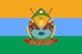
Homa Bay County is a county in the former Nyanza Province of Kenya. Its capital and largest town is Homa Bay. The county has a population of 1,131,950 and an area of 3,154.7 km2. Lake Victoria is a major source of livelihood for Homa Bay County. It has 40 wards, each represented by an MCA in the Homa Bay county assembly located in Homa Bay town, which is the county headquarters.

Migori County is a county in the former Nyanza Province of southwestern Kenya. It borders Homa Bay County to the north, Kisii County to the northeast, Narok County to the southeast, Tanzania to the west and south, and Lake Victoria to the west. The county also borders Uganda via Migingo Island in Lake Victoria. The county's headquarter is Migori, which is also its largest town. In the 2019 National Census, Migori County had a population of 1,116,436, almost 200,000 more than the 917,170 recorded in 2009.

Bondo is a Municipality in Siaya County of Kenya. It has traditionally been a fishing town and its entire economy rotates around the fish from Lake Victoria. It the largest and most populous town of the county. Located 64 kilometers west of Kisumu, Bondo was established in the early 1920s as a market centre. In the 1990s, it became the headquarters of Bondo district which was carved out of the larger Siaya District.
Oyugis is the second-largest town in Homa Bay County in Nyanza Kenya. The town lies along the Kisumu-Kisii highway. It is the commercial and financial centre of Rachuonyo Sub-County in Homa Bay County of the former Nyanza Province.

Kendu Bay is a bay and town in Kenya. The area is the part of Rachuonyo North District in Homa Bay County.

Nyang'oma Kogelo, also known as Kogelo, is a village in Siaya County, Kenya. It is located near the equator, 60 kilometres (37 mi) west-northwest of Kisumu, the provincial capital of the former Nyanza province. The population of Nyangoma-Kogelo is 3,648.
Luanda is a market town in the Vihiga County of Kenya, located along the Kisumu-Busia highway. It was one of the administrative divisions in Emuhaya district between 2007 and 2009. Luanda has grown over the past ten years with several banks, and supermarkets establishing within the locality. Luanda serves as the main town for Emuhaya and Luanda subcounties. The predominant tribe in Luanda are the Banyore people.
The Kenya People's Union (KPU) was a socialist political party in Kenya led by Oginga Odinga. The party was banned in 1969.
Madiany is a settlement in Kenya's Nyanza Province.

Sub-counties, formerly known as Districts, are the decentralised units through which government of Kenya provides functions and services. At national level, sub-counties take a more administrative function like security, statistical purposes, provision of government services, etc. Even though the sub-counties are divisions of counties, powers to create new national sub-counties lies with the national government. As of 2023, there are 314 sub-counties, compared to 290 constituencies. A deputy county commissioner is appointed by the state to lead each sub-county. The sub-counties are further divided into divisions, locations and sub-locations.
Migori District was an administrative district in the Nyanza Province of Kenya. It is located in southwestern Kenya. Its capital town was Migori. The district has a population of 514,897 and an area of 2,005 km2.
Kisumu District was an administrative district of Nyanza Province in western Kenya. Its headquarters was Kisumu. It had a population of 504,359 and a land area of 919 km². The main industries were subsistence agriculture and fishery on Lake Victoria. Kisumu Town was the main commercial centre in western Kenya. The district was created after Central Nyanza District, renamed from Central Kavirondo District, was in 1968, split into Kisumu and Siaya districts. Kisumu district was split up further. In 2013, Kisumu County was officially effected; all districts that were carved out of Kisumu District after 1992 were reconsolidated into the county.
Homa Bay District was an administrative district in the Nyanza Province of Kenya. Its capital town is Homa Bay. The district had a population of 288,540 and an area of 1,160 km². The district itself was carved out of the South Nyanza District formerly known as South Kavirondo District. In 2013, the district's boundaries before 1992 were used in the creation of the devolved Homa Bay County.
Busia District was an administrative district in the Western Province of Kenya. It bordered Kakamega District to the east, Bungoma District and Teso district to the north, Busia District, Uganda to the west, and Lake Victoria to the south.
Central Nyanza was an administrative district of Nyanza Province in western Kenya. It was headquartered in Kisumu. Created as Kisumu District in 1902, after the eastern region of Uganda was transferred to the East Africa Protectorate. At the time the district was under Kisumu Province, later renamed Nyanza Province in 1909. There were boundary alterations between 1920 and 1921, leading to the district being renamed Central Kavirondo. In 1948, Central Kavirondo was renamed Central Nyanza.
References
- ↑ "Kenya Gazette dated 2nd April, 1963" (PDF). Gazettes.Africa. Retrieved 4 October 2023.
- ↑ "Kenya Districts". www.statoids.com. Retrieved 2023-10-04.
- ↑ "The 2009 Kenya Population and Housing Census" (PDF). Amazonaws. pp. 152, 153, 154. Retrieved 4 October 2023.
0°05′S34°15′E / 0.083°S 34.250°E
| | This Nyanza Province location article is a stub. You can help Wikipedia by expanding it. |