Related Research Articles

The Luhya are a Bantu people and the second largest ethnic group in Kenya. The Luhya belong to the larger linguistic stock known as the Bantu. The Luhya are located in western Kenya and Uganda. They are divided into 20 culturally and linguistically united clans. Once known as the Kavirondo, multiple small tribes in North Nyanza came together under the new name Baluhya between 1950 and 1960. The Bukusu are the largest Luhya subtribe and account for almost 50% of the entire Luhya population, dominating other Luhya subtribes. They live in both Bungoma and Trans-Nzoia counties.

Western Province was one of Kenya's seven administrative provinces outside Nairobi. It is inhabited mainly by the Luhya people. Quakerism is widely practised here. Kenya's second highest mountain, Mount Elgon is located in Bungoma District. The Kakamega Forest rainforest is part of the area. The province capital was Kakamega. After the 2013 general election, and the coming into effect of the new constitution, provinces became defunct and the country is currently divided into 47 counties. Each county has its own government and therefore there is no central regional capital. Western Province became the Western region, comprising four counties: Kakamega, Bungoma, Vihiga, and Busia.
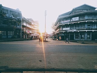
Bungoma is the capital of Bungoma County in Kenya. It was established as a trading centre in the early 20th century. It is located in Kenya's fertile Western region and at the foot of Mount Elgon, Kenya's second-tallest mountain. The town and the surrounding areas boast one of Kenya's highest average rainfalls, making Bungoma one of the nation's most important food baskets.

Busia is a county in the former Western Province of Kenya. It borders Kakamega County to the east, Bungoma County to the north, Lake Victoria and Siaya County to the south and Uganda's Busia District to the west. The county population was 893,861, as of 2019. It spans about 1,700 square kilometers, making it one of the smallest counties in Kenya. Busia is inhabited by the Luhya tribe and the Teso of Kenya, and small groups of the Luo. The Luhya communities include the Abakhayo, Marachi, Samia and Abanyala communities.

Bungoma County is a county in the former Western Province of Kenya with its capital in Bungoma town. It has a population of 1,670,570 of which 812,146 are males and 858,389 are females as per the 2019 census and an area of 2,069 km2. It has nine constituencies, namely: Bumula, Kabuchai, Kanduyi, Kimilili, Mt. Elgon, Sirisia, Tongaren, Webuye East, and Webuye West.
Malaba, Kenya is a town in Teso North Sub-County, Busia County, on Kenya's western border with Uganda. It sits across the Malaba River, which forms the international border from Malaba, Uganda.

Siaya County is one of the counties in the former Nyanza Province in western Kenya. It is bordered by Busia County to the north, Kakamega County, and Vihiga County to the northeast and Kisumu County to the southeast. It shares a water border with Homa Bay County which is located south of Siaya County. The total area of the county is approximately 2,496.1 km2. The county lies between latitude 0° 26' to 0° 18' north and longitude 33° 58' east and 34° 33' west. Siaya has been split up into six new districts. Under the 2010 Constitution, the role of the districts is still unclear as much of the administrative authority was transferred to the county. The capital is Siaya, although the largest town is Bondo.

Migori County is a county in the former Nyanza Province of southwestern Kenya. It borders Homa Bay County to the north, Kisii County to the northeast, Narok County to the southeast, Tanzania to the west and south, and Lake Victoria to the west. The county also borders Uganda via Migingo Island in Lake Victoria. The county is headquartered by Migori, which is also its largest town. At the 2019 census, Migori County had a population of 1,116,436, almost 200,000 more than the 917,170 recorded in 2009.
Tiriki or Hamisi is home to the Tiriki subtribe of the Abaluyia. Hamisi Constituency is an electoral constituency in Kenya. It is one of five constituencies in Vihiga County. Hamisi Constituency includes seven electoral wards: Shiru Ward, Gisambai Ward, Shamakhokho Ward, Banja Ward, Muhudu Ward, Tambua ward, and Jepkoyai Ward. It has a population of 159,241 people.
Amagoro Constituency was an electoral constituency in Kenya's former Western Province. It was the only constituency in the now-defunct Teso District. Sospeter Ojaamong represented the constituency for the Orange Democratic Movement in the National Assembly, and did so since 2002. In the 2007 general election, he was challenged by Gabriel Obasie of the recently created Party of National Unity.
Bunyore is a locality in the Vihiga County in the western province of Kenya. It is largely inhabited by Luhya, who speak the OLunyole dialect of the Luhya language. In the local language, the place is known as Ebunyore and its people as the Abanyore. It is divided into eight locations namely Central Bunyore, West Bunyore, South Bunyore, South-West Bunyore, East Bunyore, North Bunyore, North East Bunyore, and Wekhomo. Prior to 1990, Bunyore was under Kakamega District, divided into East and West Bunyore locations. As population increased, the former West Bunyore was split into Central, West, South and South West locations while the former East Bunyore was split into North, North East, Wekhomo and East Bunyore locations in order to better serve the people.

Sub-counties, also known as Districts, are the decentralised units through which government of Kenya provides functions and services. At national level, sub-counties take a more administrative function like security, statistical purposes, provision of government services, etc. Even though the sub-counties are divisions of counties, powers to create new national sub-counties lies with the national government. As of 2023, there are 314 sub-counties, compared to 290 constituencies. A deputy county commissioner is appointed by the state to lead each sub-county. The sub-counties are further divided into divisions, locations and sub-locations.
Trans-Nzoia District was an administrative district of Rift Valley Province, Kenya, located between the Nzoia River and Mount Elgon with its centre at the town of Kitale.
Siaya District was a district of Nyanza Province in the southwest part of Kenya. It was bordered by Busia District to the North, Vihiga and Butere/Mumias Districts to the North-East, Bondo District to the South, and Kisumu District to the southeast. The total area of the district is approximately 1520 km2.
Nandi District was an administrative district in the Rift Valley Province of Kenya. Its capital town was Kapsabet.
Migori District was an administrative district in the Nyanza Province of Kenya. It is located in southwestern Kenya. Its capital town was Migori. The district has a population of 514,897 and an area of 2,005 km2.
Kisumu District was an administrative district of Nyanza Province in western Kenya. Its headquarters is Kisumu. It had a population of 504,359 and a land area of 919 km². The main industries are subsistence agriculture and fishery on Lake Victoria. Kisumu Town was the main commercial centre in western Kenya. The district was created after Central Nyanza District, itself created from North Kavirondo District, was in 1968, split into Kisumu and Siaya districts. Kisumu district was split up further. In 2013, Kisumu County was officially effected; all districts that were carved out of Kisumu District after 1992 were reconsolidated into the county.
Homa Bay District was an administrative district in the Nyanza Province of Kenya. Its capital town is Homa Bay. The district had a population of 288,540 and an area of 1,160 km². The district itself was carved out of the South Nyanza District formerly known as South Kavirondo District. In 2013, the district's boundaries before 1992 were used used in the creation of the devolved Homa Bay County.
Bungoma District was a district in the Western Province of Kenya. Its capital town was Bungoma. It had an area of 2,069 km2.
Jonathan Wasilwa Barasa was a Kenyan chief born in Sirisia, in Bungoma County to Wasilwa and Lumbasi. He went to Bitonge School at the age of seven and later Government African School, present-day Kakamega High School. After primary school he was called to Alliance High School. His lack of school fees drove him to Maseno and to train as a teacher under Carey Francis. He married Ruth Nanjala Murumba in the Quaker Church in Bitonge, and they had ten children. He supported hundreds of children by mentoring them, paying their school fees and taking care of them. Barasa was a staunch Quaker who also respected and promoted the Bukusu culture. He was a member of the East African Yearly Meeting of Friends (Quakers).
References
- ↑ "description of the districts and provinces". Syracuse University. p. 6. Retrieved 1 October 2023.
- ↑ "Kenya Gazette dated 2nd April, 1963" (PDF). Gazettes.Africa. Retrieved 1 October 2023.
- ↑ Ogutu, M.A. (1985). "The Changing Role of Women in the Commercial History of Busia District in Kenya, 1900 – 1983". Journal of Eastern African Research & Development. 15: 74–90. ISSN 0251-0405.
- ↑ "Kenya Districts". www.statoids.com. Retrieved 2023-09-22.
- ↑ "The 2009 Kenya Population and Housing Census" (PDF). Amazonaws. p. 203. Retrieved 1 October 2023.
0°26′N34°9′E / 0.433°N 34.150°E
| | This Western Province (Kenya) location article is a stub. You can help Wikipedia by expanding it. |