Malaba, Kenya is a town in Teso North Sub-County, Busia County, on Kenya's western border with Uganda. It sits across the Malaba River, which forms the international border from Malaba, Uganda.

Mombasa Road, also known as the Nairobi–Mombasa Road, or Mombasa–Nairobi Road or A109 Road (Kenya) is the main road between Nairobi, Kenya's capital and largest city and Mombasa, the country's largest port city. The road is a component of the Northern Corridor. It is part of the Lagos–Mombasa Highway.

Busia is a town in the Eastern Region of Uganda. It is the main municipal, administrative, and commercial center of the Busia District, with the district headquarters located there.
Malaba, Uganda is a town in Tororo District in the Eastern Region of Uganda, on its eastern border with Kenya. It sits adjacent from Malaba, Kenya, across the Malaba River that marks the border between Uganda and Kenya.
Tororo Cement Limited (TCL), a Ugandan company, is one of the largest manufacturers of construction materials in East Africa.
Lwakhakha is a town in the Eastern Region of Uganda. It is one of the municipal centers in Manafwa District. The town lies across the international border from Lwakhakha, Kenya.
Busia Airport is an airport in Kenya.
The Musita–Mayuge–Lumino–Majanji–Busia Road is a road in the Eastern Region of Uganda, connecting the town of Musita in Mayuge District to Busia in Busia District at the international border with Kenya.
Suam, Uganda is a border crossing between Uganda and Kenya. The settlement sits directly across the Suam River from Suam, Kenya.
Suam, Kenya is a settlement in the Trans-Nzoia County of Kenya. It sits across the Suam River from Suam, Uganda, at the international border between the two countries.
The Suam–Endebess–Kitale–Eldoret Road, is a rural road in Kenya. The road links Suam, in Trans-Nzoia County, to the towns of Endebess, Kitale, and Eldoret in Uasin Gishu County.
The Jinja–Iganga–Bugiri–Tororo Road is a road in the Eastern Region of Uganda, connecting the towns of Jinja and Tororo. Sometimes referred to as Tororo–Jinja Road, it is a busy transport corridor, connecting traffic from neighboring Kenya, and northeastern Uganda to Jinja, a major commercial and industrial center, and ultimately to Kampala, the country's capital, and beyond.
Hoima Sugar Limited (HSL), also Hoima Sugar is a sugar manufacturer in Uganda, the third-largest economy in the East African Community.
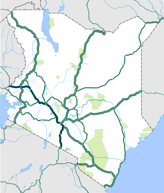
The Nairobi–Malaba Road, also Nairobi–Uganda Road or A104 Road (Kenya) is a major highway in Kenya, the largest economy in the East African Community. The road connects Nairobi, the capital and largest city in Kenya, with the border town of Malaba at the international border with Uganda.

The Uganda Standard Gauge Railway is a planned railway system linking the country to the neighboring countries of Kenya, Rwanda, Democratic Republic of the Congo and South Sudan, as part of the East African Railway Master Plan. The new standard-gauge railway (SGR) is intended to replace the old, inefficient metre-gauge railway system. The entire 1,724 kilometres (1,071 mi) SGR in Uganda will cost an estimated $12.8 billion.
Simba Cement Uganda Limited (SCUL), also National Cement Company Uganda, is a cement manufacturer in Uganda. It is a subsidiary of National Cement Company Limited, the construction materials manufacturer based in Kenya. National Cement is itself a subsidiary of the Devki Group of Companies.
The Kenya Standard Gauge Railway (SGR) is a partially finished railway system connecting Kenya's cities. Once completed, it will link the country to the neighboring country of Uganda, and through Uganda, to South Sudan, the Democratic Republic of the Congo, Rwanda, and Burundi. There are also plans to link to Addis Ababa, in neighboring Ethiopia to the north. The first segment, between Mombasa and Nairobi, opened passenger rail service in June 2017, and freight rail service in January 2018. Other segments are under construction or planned. The new standard gauge railway is intended to replace the old, inefficient metre-gauge railway system.
The Nairobi Southern Bypass Highway is a road in Kenya, forming a semi-circle through the south-western neighbourhoods of the capital city of Nairobi. The road allows traffic from Mombasa, destined for western Kenya and Uganda to bypass downtown Nairobi, thereby reducing traffic congestion in the city's central business district.
The Kakira–Kisumu Expressway, also Kenya–Uganda Highway, is a road in Uganda and Kenya, connecting the cities of Kakira and Iganga in Uganda to Busia, Malaba and Kisumu in Kenya.

