Nanyuki

Last updated

Nanyuki
Town
Nanyuki main street.jpg
Nanyuki main street
Kenya adm location map.svg
Red pog.svg
Nanyuki
Location in Kenya
Coordinates: 0°01′N37°04′E / 0.017°N 37.067°E / 0.017; 37.067
CountryFlag of Kenya.svg  Kenya
County Laikipia County
Government
  GovernorJoshua Irungu
Population
 (2019)
  Total72,813

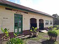
Nanyuki is a market town in Laikipia County of Kenya lying northwest of Mount Kenya along the A2 road and at the terminus of the branch railway from Nairobi. The name is derived from Enyaanyukie Maasai word for resemblance.

Contents

It is situated just north of the Equator (0° 01' North). In 1907, British immigrants settled in Nanyuki, some of whose descendants still live in and around the town. Nanyuki is currently the main airfield (airbase) of the Kenya Air Force. The British Army Training Unit Kenya (BATUK), has a base at Nyati Barracks. It conducts infantry exercises in Laikipia and on Kenyan Ministry of Defense land at Archer's Post.

History

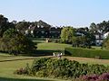
Maasai herders found red ochre in Nanyuki, the ground resembled roan coated cattle. The town saw British immigrants settle there during the early days of colonial Kenya in 1907. Some of their descendants still live in or around the town. Major Digby Tatham-Warter, a British Army officer famed for carrying an umbrella into battle, moved to Nanyuki after the war and lived on his farm until his death in 1993. During the Mau Mau Uprising, Digby raised a volunteer mounted police force at his own expense and led them against the Mau Mau. [1] [2] The town is noted for small- and large-scale farms, ranches and pastoral lands, and wildlife conservancies. It is also the base for people seeking to climb Mount Kenya. Nanyuki sits almost directly on the Equator, and Equator Markers erected by the governments of Kenya and Nanyuki alongside A2 are famous.

Climate

Nanyuki is relatively cool year-round, experiences weakly trimodal rainfall, with a distinct dry season in January and February.

Climate data for Nanyuki
MonthJanFebMarAprMayJunJulAugSepOctNovDecYear
Mean daily maximum °C (°F)25
(77)
26
(79)
25
(77)
23
(74)
23
(73)
23
(74)
22
(72)
23
(73)
24
(76)
24
(75)
23
(73)
23
(74)
24
(75)
Mean daily minimum °C (°F)7
(45)
8
(47)
9
(49)
11
(51)
10
(50)
9
(48)
8
(47)
8
(47)
8
(46)
8
(47)
9
(49)
8
(47)
9
(48)
Average precipitation mm (inches)13
(0.5)
23
(0.9)
46
(1.8)
120
(4.7)
81
(3.2)
51
(2)
69
(2.7)
66
(2.6)
48
(1.9)
64
(2.5)
86
(3.4)
38
(1.5)
700
(27.5)
Source: Weatherbase [3]

Economy and overview

Majengo quarter Majengo Nanyuki.jpg
Majengo quarter

Nanyuki municipality had an urban population of 72,813 in 2019. [4] Most members of the population earn their money through trade. Shops in the town supply many farms, ranches and game parks in a wide circle, as well as the town's residents. Originally, most shops were owned by Indians, who still form a sizable part of the population. Climbers and backpackers visit Nanyuki on their way to or from Mount Kenya along the Sirimon and Naro Moru routes and many other tourists pass through the town. Nanyuki has many hotels, of which Mount Kenya Safari Club and Sportsman's Arms Hotel are the most prominent with others including Sport's Club, Le Rustique, Kongoni Camp, Mount Kenya Paradise Hotel and Joskaki Hotel. South of Nanyuki, the Bantu lodge offers outdoor activities, including forest walks. The nearby “Trout Tree Restaurant” offers trout prepared in various ways from its own trout farm. Another notable restaurant is "Barneys" located at Nanyuki Civil Airfield, once the location of the No. 1340 Flight RAF, which flew Harvards during the Mau Mau Uprising.

There is little large-scale industry in Nanyuki. The Mount Kenya Textile (Mountex) Mills went bankrupt in 1978, was reopened briefly under new management, but eventually closed. [5] There have been a number of sawmills in Nanyuki. However, with the almost total ban on tree felling on Mount Kenya (sometimes indifferently enforced), these either closed down or are now eking out a difficult existence. [6] Recently, large horticultural operations have come to the Nanyuki area, including Likii flower farm, Traco farm, Kongoni farm and several others along Nanyuki- Timau road. The revived railway transport between Nanyuki and Nairobi has increased trade in the town. Main retail centers are Cieni, Cedar Mall and Quick Mart.

A city park lies in the centre of the town and two rivers, the Nanyuki and LikiI Rivers, pass through it. The Equator passes through the southern part of Nanyuki. One crosses it when approaching Nanyuki on the A2 from the south. This spot is popular with tourists who have themselves photographed there. Some people are usually at hand to show them the supposed effect of the Coriolis force, which they say makes draining water swirl clockwise or anticlockwise depending on whether one is on the northern or southern hemisphere, though as noted in the article about the Coriolis force, the effect is detectable only in the laboratory and the "demonstrations" at the Equator are merely engaging diversions.

Tourism

The airport lies 6.5 km (4.0 mi) south of the town along the highway to Nairobi and is serves light aircraft. There are regular flights operated by Air Kenya, Safarilink and Fly SAX, which is convenient for businessmen and tourists. The town is also served by a paved road from Nairobi, and northward to northern Kenya. Tourists can visit a number of parks and reserves in the vicinity of Nanyuki, the most obvious one being Mount Kenya National Park. The Mount Kenya Wildlife Conservancy and the Fairmont Mount Kenya Safari Club host large numbers of tourists seeking a luxury safari experience. The hotel has 120 luxury rooms with views of Mount Kenya alongside the Mount Kenya Wildlife Conservancy which together with William Holden Wildlife Foundation aims to breed and reintroduce the endangered bongo back into Mount Kenya. [7] Others are Ol Pejeta Conservancy, [8] and further afield Lewa Wildlife Conservancy, Aberdare National Park, Samburu National Reserve and Shaba National Reserve.[ citation needed ]

Nanyuki has some of the cleanest water in Kenya because the source originates from Mt. Kenya. The entire water system is gravity fed, from the supply to the sewer system.

Education

Academic institutions in Nanyuki include Nanyuki High School, Moi Equator Girls' High School, St Christopher's School (formerly the Beehive School), Braeburn International School Nanyuki, Nanyuki Primary School, Mary Immaculate Primary School, Baraka School, Brickwoods School, St. Jude Nturukuma secondary, Loise Girls high school, and others.

Images

See also

Related Research Articles

<span class="mw-page-title-main">Maasai Mara</span> National Reserve in Narok County, Kenya

Maasai Mara, also sometimes spelled Masai Mara and locally known simply as The Mara, is a large national game reserve in Narok, Kenya, contiguous with the Serengeti National Park in Tanzania. It is named in honour of the Maasai people, the ancestral inhabitants of the area, who migrated to the area from the Nile Basin. Their description of the area when looked at from afar: "Mara" means "spotted" in the local Maasai language, because of the short bushy trees which dot the landscape.

Meru is a town in eastern Kenya. It is the headquarters of the Meru County, and the seventh largest urban centre in the country. Meru urban center has a population of 80,191 residents (2019).

<span class="mw-page-title-main">Nyeri</span> City in Nyeri County, Kenya

Nyeri is a town situated in the Central Highlands of Kenya. It is the county headquarters of Nyeri County. The town was the central administrative headquarters of the country's former Central Province. Following the dissolution of the former provinces by Kenya's new constitution on 26 August 2010, the city is situated about 150 km north of Kenya's capital Nairobi, in the country's densely populated and fertile Central Highlands, lying between the eastern base of the Aberdare (Nyandarua) Range, which forms part of the eastern end of the Great Rift Valley, and the western slopes of Mount Kenya.

<span class="mw-page-title-main">Nairobi National Park</span> First national park in Kenya, Africa

Nairobi National Park is a national park in Kenya that was established in 1946 about 7 km (4.3 mi) south of Nairobi. It is fenced on three sides, whereas the open southern boundary allows migrating wildlife to move between the park and the adjacent Kitengela plains. Herbivores gather in the park during the dry season. Nairobi National Park is negatively affected by increasing human and livestock populations, changing land use and poaching of wildlife. Despite its proximity to the city and its relative small size, it boasts a large and varied wildlife population, and is one of Kenya's most successful rhinoceros sanctuaries.

<span class="mw-page-title-main">Treetops Hotel</span> Building in Kenya

Treetops Hotel was a hotel in Aberdare National Park in Kenya near the township of Nyeri, 1,966 m (6,450 ft) above sea level on the Aberdare Range and in sight of Mount Kenya. First opened in 1932 by Eric Sherbrooke Walker, it was built into the tops of the trees of Aberdare National Park as a treehouse, offering the guests a close view of the local wildlife. The idea was to provide a machan experience in relative safety and comfort. From the original modest two-room tree house, it has grown into a 35-room hotel. The original structure was burned down by The Kenya Land and Freedom Army (KLFA) during the 1954 Mau Mau Uprising, but the hotel was rebuilt near the same waterhole and has become fashionable for many of the rich and famous. It includes observation lounges and ground-level photographic hides from which guests can observe the local wildlife which comes to the nearby waterholes. The hotel closed in October 2021.

<span class="mw-page-title-main">Nyahururu</span> Town in Laikipia County, Kenya

Nyahururu is a town in Kenya, lying north east of Nakuru. The town derives its name from the Maasai word e-naiwurruwurr, meaning waterfall and/or windy or place of storms. It is allegedly located in Laikipia County. Despite this, Nyahururu formerly functioned as the administrative capital of Nyandarua District, before it became a county, until the headquarters was shifted to Ol Kalou. There have been calls for a reversal. The town has an urban population of 36,450. The town still continues to be a central economic power of the immediate former district of Nyandarua. For that reason, the town has strong economic ties to the two counties.

<span class="mw-page-title-main">Aberdare Range</span> Mountain range in Kenya

The Aberdare Range is a 160 km (99 mi) long mountain range of upland, north of Kenya's capital Nairobi with an average elevation of 3,500 metres (11,480 ft). It straddles the counties of Nyandarua, Nyeri, Muranga, Kiambu and Laikipia. The mountain range is located in west central Kenya, northeast of Naivasha and Gilgil and lies just south of the Equator. The mountain range is called Nyandarua among the Agikuyu people in whose territory this forest and mountain range is located. The name Nyandarua comes from the Kikuyu word rwandarua meaning a drying hide, due to the distinctive fold of its silhouette.

<span class="mw-page-title-main">Naivasha</span> Town in Nakuru County, Kenya

Naivasha is a town in Nakuru County, Kenya, 92.8 km (57.7 mi) north west of Nairobi. From 1969, the population expanded by a factor of 17 times to over 198,000 at the 2019 census. It is situated on the shores of Lake Naivasha, from which it takes its name. The name Naivasha derives from the local Maasai word ɛnaɨpɔ́sha, meaning "that which heaves", a common Maasai word for bodies of water larger enough to have wave action when it is windy or stormy. Naivasha arose as the British attempt to pronounce the Maasai name. Literally, Lake Naivasha means "Lake Lake" and Naivasha Town means "Lake Town".

<span class="mw-page-title-main">Hell's Gate National Park</span> National park in Kenya

Hell's Gate National Park lies south of Lake Naivasha in Kenya, north west of Nairobi. Hell's Gate National Park is named after a narrow break in the cliffs, once a tributary of a prehistoric lake that fed early humans in the Rift Valley. It was established in 1984. A small national park, it is known for its wide variety of wildlife and for its scenery. This includes the Fischer's Tower and Central Tower columns and Hell's Gate Gorge. The national park is also home to five geothermal power stations at Olkaria. The park is equipped with three basic campsites and includes a Maasai Cultural Center, providing education about the Maasai tribe's culture and traditions.

Nanyuki Airfield is an airport in Nanyuki, Kenya.

<span class="mw-page-title-main">Wildlife of Kenya</span> Kenyan Heritage

The wildlife of Kenya refers to its fauna. The diversity of Kenya's wildlife has garnered international fame, especially for its populations of large mammals. Mammal species include lion, cheetah hippopotamus, African buffalo, wildebeest (Connochaetes), African bush elephant, zebra (Equus), giraffe (Giraffa), and rhinoceros. Kenya has a very diverse population of birds, including flamingo and common ostrich.

The earliest account of Nairobi's history dates back to 1899 when a railway depot was built in a brackish African swamp occupied by a pastoralist people, the Maasai, the sedentary Akamba people, as well as the agriculturalist Kikuyu people who were all displaced by the colonialists. The railway complex and the building around it rapidly expanded and urbanized until it became the largest city of Kenya and the country's capital. The name Nairobi comes from the Maasai phrase Enkare Nyirobi, which translates to 'the place of cool waters'. However, Nairobi is popularly known as the "Green City in the Sun".

<span class="mw-page-title-main">Tourism in Kenya</span> Overview of tourism in Kenya

Tourism in Kenya is Kenya's third largest source of foreign exchange revenue, following diaspora remittances and agriculture. The Kenya Tourism Board is responsible for maintaining information about tourism in Kenya.

<span class="mw-page-title-main">Mau-Mau Cave</span>

Located near Nanyuki, about 199.2 km North East of Nairobi in Kenya's Central Province, the Mau Mau Cave was used as a hide-out by Kenyan Freedom Fighters during the Mau Mau Uprising of 1952 to 1960. It is located approximately 18 km south of the equator inside the thick Mount Kenya National Park.

The Lewa Safari Marathon is an annual fund raising event held at Lewa Downs, about 140 miles (230 km) north of Nairobi, Kenya. The 42.195-kilometre (26.219 mi) endurance race is sponsored by Safaricom in partnership with the Lewa Wildlife Conservancy and Tusk in order to raise funds for numerous community development and wildlife conservation efforts. Most well known for its unique setting, Runner's World Magazine named the Lewa Marathon as being, 'One of the top ten races to run in your life'.

Solio Ranch or Solio Game Reserve is a privately owned wildlife conservancy located in Kenya's Central Province.

<span class="mw-page-title-main">Ol Pejeta Conservancy</span> Not-for-profit wildlife conservancy in Central Kenyas Laikipia County

The Ol Pejeta Conservancy is a 360 km2 (140 sq mi) not-for-profit wildlife conservancy in Central Kenya's Laikipia County. It is situated on the equator west of Nanyuki, between the foothills of the Aberdares and Mount Kenya. The Ol Pejeta Conservancy works to conserve wildlife, provide a sanctuary for great apes, and generate income through wildlife tourism and complementary enterprises for re-investment in conservation and community development.

<span class="mw-page-title-main">Digby Tatham-Warter</span> British Army officer

Major Allison Digby Tatham-Warter DSO, also known as Digby Tatham-Warter or just Digby, was a British Army officer who fought in the Second World War and was famed for wearing a bowler hat and carrying an umbrella into battle.

Francis Xavier Ole Kaparo, EGH, is a Kenyan politician. He is the Commission Chairman, the NCIC since August 2014 to October 2019.

<span class="mw-page-title-main">British Army Training Unit Kenya</span> British Army training support unit in Kenya

The British Army Training Unit Kenya (BATUK) is a training support unit of the British Army located in Kenya.

References

  1. "The Tatham Family of County Durham".
  2. "Major Digby Tatham-Warter".
  3. "Weatherbase: Historical Weather for Nanyuki, Kenya". Weatherbase. 2011. Retrieved on November 24, 2011.
  4. "NANYUKI".
  5. "Nanyuki Town Kenya - A Guide to Nanyuki Kenya". Softkenya.com. 2010-01-11. Retrieved 2017-06-29.
  6. Emerton, Lucy. "Mount Kenya: The Economics of Community Conservation" (PDF). International Institute for Environment and Development.
  7. "Mount Kenya Wildlife Conservancy - Magical Kenya". Magical Kenya. Retrieved 2017-06-29.
  8. "Closer look: Ol Pejeta Conservancy". Fauna and Flora International. Retrieved 16 February 2016.