Aberdare National Park

Last updated
Aberdare National Park
Aberdare Park entrance.jpg
Aberdare Park entrance
Kenya relief location map.jpg
Red pog.svg
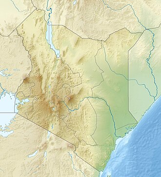
Location of Aberdare National Park
Location Kenya, Nyandarua County & Nyeri County
Nearest city Nyeri
Coordinates 0°25′48″S36°43′57″E / 0.43000°S 36.73250°E / -0.43000; 36.73250
Area767 km2 (296 sq mi)
Established1950
Governing body Kenya Wildlife Service

The Aberdare National Park is a protected area in the Aberdare Mountain Range in central Kenya located east of the East African Rift Valley. [1] It covers the higher areas and the Aberdare Salient to the east.

Contents

Overview

Lake in Aberdare National Park Lake in Aberdare National Park.jpg
Lake in Aberdare National Park

The park is located about 100 km north of Nairobi and stretches over a wide variety of terrain at elevations from 2,000 metres (6,600 ft) to 4,000 metres (13,000 ft). Established in May 1950, the Aberdare National Park covers an area of 766 square kilometers and forms part of the Aberdare Mountain Range. The park contains a wide range of landscapes - from mountain peaks that rise to 4,000 metres (13,000 ft) above sea level, to their deep, v-shaped valleys intersected by streams, rivers, and waterfalls. Moorland, bamboo forests and rainforests are found at lower elevations.

History

Aberdare National Park was established in 1950 with an aim to conserve and protect the Aberdare Mountains. Since then it has grown to a size of an area of 767 km2

Aberdare National Park is best known as the site where in 1952, Princess Elizabeth became Queen after the death of her father King George VI, whilst staying at the Treetops Hotel.

Wildlife

Wildlife present in the protected area include lion, leopard, elephant, East African wild dog, giant forest hog, bushbuck, mountain reedbuck, waterbuck, Cape buffalo, suni, side-striped jackal, eland, duiker, olive baboon, black and white colobus monkey, and sykes monkey. Rarer sightings include those of the African golden cat and the bongo. Species such as the common eland, serval live in the higher moorlands. The Aberdare National Park also hosts a large eastern black rhinoceros population and over 250 bird species including the endangered Aberdare cisticola, Jackson's spurfowl, sparrowhawk, African goshawk, African fish eagle, sunbirds and plovers.

Facilities

Visitors to the park can find different types of accommodation, from the Treetops lodge, to the Ark - built in the shape of Noah's Ark - and three self-help banda sites, eight special campsites and a public campsite in the moorland. There are also five picnic sites. Both Treetops and The Ark provide excellent nighttime wildlife viewing. Animals seen include Elephants, Cape buffalo, and rhino, which come to the waterholes. The park also includes two airstrips at Mweiga and Nyeri. [2] [3]

Park entry and charges

The park is open daily from 6:00 am to 7:00 pm. Entry on foot is prohibited and visitors are turned away after 6:15 pm.
Entry to the park is by smart card only, obtained and loaded at the main gate.

Charges (2020-2021)
Visitor categoryFee
East African Citizens (adults) KSh.300/=
East African students and childrenKSh.215/=
East African Residents (adults)KSh.300/=
East African students and childrenKSh.215/=
Nonresident adults US$52 [4]
Nonresident students and childrenUS$26 [5]

Related Research Articles

<span class="mw-page-title-main">Bongo (antelope)</span> Species of mammal

The bongo is a large, mostly nocturnal, forest-dwelling antelope, native to sub-Saharan Africa. Bongos are characterised by a striking reddish-brown coat, black and white markings, white-yellow stripes, and long slightly spiralled horns. It is the only tragelaphid in which both sexes have horns. Bongos have a complex social interaction and are found in African dense forest mosaics. They are the third-largest antelope in the world.

<span class="mw-page-title-main">Serengeti National Park</span> National park in Mara and Simiyu Regions, Tanzania

The Serengeti National Park is a large national park in northern Tanzania that stretches over 14,763 km2 (5,700 sq mi). It is located in eastern Mara Region and northeastern Simiyu Region and contains over 1,500,000 hectares of virgin savanna. The park was established in 1940.

<span class="mw-page-title-main">Nyeri</span> City in Nyeri County, Kenya

Nyeri is a town situated in the Central Highlands of Kenya. It is the county headquarters of Nyeri County. The town was the central administrative headquarters of the country's former Central Province. Following the dissolution of the former provinces by Kenya's new constitution on 26 August 2010, the city is situated about 150 km north of Kenya's capital Nairobi, in the country's densely populated and fertile Central Highlands, lying between the eastern base of the Aberdare (Nyandarua) Range, which forms part of the eastern end of the Great Rift Valley, and the western slopes of Mount Kenya.

<span class="mw-page-title-main">Treetops Hotel</span> Building in Kenya

Treetops Hotel was a hotel in Aberdare National Park in Kenya near the township of Nyeri, 1,966 m (6,450 ft) above sea level on the Aberdare Range and in sight of Mount Kenya. First opened in 1932 by Eric Sherbrooke Walker, it was built into the tops of the trees of Aberdare National Park as a treehouse, offering the guests a close view of the local wildlife. The idea was to provide a machan experience in relative safety and comfort. From the original modest two-room tree house, it has grown into a 35-room hotel. The original structure was burned down by The Kenya Land and Freedom Army (KLFA) during the 1954 Mau Mau Uprising, but the hotel was rebuilt near the same waterhole and has become fashionable for many of the rich and famous. It includes observation lounges and ground-level photographic hides from which guests can observe the local wildlife which comes to the nearby waterholes. The hotel closed in October 2021.

<span class="mw-page-title-main">Mount Kenya National Park</span> National park in Kenya

Mount Kenya National Park was established in 1949 to protect Mount Kenya, the wildlife, and the surrounding environment, which forms a habitat for wild animals, as well as acting as an area for the catchment of water, to supply Kenya's water.

<span class="mw-page-title-main">Aberdare Range</span> Mountain range in Kenya

The Aberdare Range is a 160 km (99 mi) long mountain range of upland, north of Kenya's capital Nairobi with an average elevation of 3,500 metres (11,480 ft). It straddles across the counties of Nyandarua, Nyeri, Muranga, Kiambu and Laikipia. The mountain range is located in west central Kenya, northeast of Naivasha and Gilgil and lies just south of the Equator. The mountain range is called Nyandarua among the Agikuyu people in whose territory this forest and mountain range is located. The name Nyandarua comes from the Kikuyu word rwandarua meaning a drying hide, due to the distinctive fold of its silhouette.

<span class="mw-page-title-main">Mount Elgon National Park</span> National park in Uganda and Kenya

Mount Elgon National Park is a national park 140 kilometres (87 mi) northeast of Lake Victoria. The park covers an area of 1,279 square kilometres (494 sq mi) and is bisected by the border of Kenya and Uganda. The Ugandan part of the park covers 1,110 km2 (430 sq mi) while the Kenyan part covers 169 km2 (65 sq mi). The Kenyan part of the park was gazetted in 1968, the Ugandan part in 1992.

<span class="mw-page-title-main">Wildlife of Zimbabwe</span> Native fauna and flora of Zimbabwe

The wildlife of Zimbabwe occurs foremost in remote or rugged terrain, in national parks and private wildlife ranches, in miombo woodlands and thorny acacia or kopje. The prominent wild fauna includes African buffalo, African bush elephant, black rhinoceros, southern giraffe, African leopard, lion, plains zebra, and several antelope species.

<span class="mw-page-title-main">Kenya Wildlife Service</span>

Kenya Wildlife Service (KWS) is a state corporation under the Ministry of Tourism and Wildlife established by an act of Parliament; Wildlife Conservation and Management Act CAP 376, of 1989, now repealed and replaced by the Wildlife Conservation and Management Act, 2013. At independence, the Government of Kenya committed itself to conserving wildlife for posterity with all the means at its disposal, including the places animals lived, forests and water catchment areas.

<span class="mw-page-title-main">Wildlife of Uganda</span> Endemic flora and fauna

The wildlife of Uganda is composed of its flora and fauna. Uganda has a wide variety of different habitats, including mountains, hills, tropical rainforest, woodland, freshwater lakes, swamps and savanna with scattered clumps of trees. The country has a biodiverse flora and fauna reflecting this range of habitats and is known for its primates, including gorillas and chimpanzees. There are ten national parks and thirteen wildlife reserves; some 345 species of mammal and 1020 species of bird have been recorded in the country.

<span class="mw-page-title-main">Wildlife of Kenya</span> Kenyan Heritage

The wildlife of Kenya refers to its fauna. The diversity of Kenya's wildlife has garnered international fame, especially for its populations of large mammals. Mammal species include lion, cheetah hippopotamus, African buffalo, wildebeest (Connochaetes), African bush elephant, zebra (Equus), giraffe (Giraffa), and rhinoceros. Kenya has a very diverse population of birds, including flamingo and common ostrich.

<span class="mw-page-title-main">Ol Doinyo Orok</span> Mountain in southern Kenya, East Africa

The Ol Donyo Orok mountain, also called Namanga Hills, is situated in southern Kenya next to the Tanzanian border in the Namanga Division. The mountain has a stretched triangular shape, almost like an arrow pointing north. The short side faces the Tanzanian border. The highest peak is 2,548 metres (8,360 ft).

<span class="mw-page-title-main">Mountaineering on Mount Kenya</span>

Most of the peaks on Mount Kenya have been summited. The majority of these involve rock climbing as the easiest route, although some only require a scramble or a walk. The highest peak that can be ascended without climbing is Point Lenana, 4,985 metres (16,355 ft). The majority of the 15,000 visitors to the national park each year climb this peak. In contrast, approximately 200 people summit Nelion and 50 summit Batian, the two highest peaks.

<span class="mw-page-title-main">Chyulu Hills</span> Mountain range in Kenya

The Chyulu Hills is a mountain range in Makueni County in southeastern Kenya. It forms a 100-kilometre-long volcanic field in an elongated northeast–southwest direction. Its highest peak is 2,188 metres high.

Solio Ranch or Solio Game Reserve is a privately owned wildlife conservancy located in Kenya's Central Province.

<span class="mw-page-title-main">Wildlife of Tanzania</span>

Tanzania contains some 20 percent of the species of Africa's large mammal population, found across its reserves, conservation areas, marine parks, and 17 national parks, spread over an area of more than 42,000 square kilometres (16,000 sq mi) and forming approximately 38 percent of the country's territory. Wildlife resources of Tanzania are described as "without parallel in Africa" and "the prime game viewing country". Serengeti National Park, the country's second largest national park area at 14,763 square kilometres (5,700 sq mi), is located in northern Tanzania and is famous for its extensive migratory herds of wildebeests and zebra while also having the reputation as one of the great natural wonders of the world. The Ngorongoro Conservation Area, established in 1959, is a UNESCO World Heritage Site and inhabited by the Maasai people. Its Ngorongoro Crater is the largest intact caldera in the world.

<span class="mw-page-title-main">East African montane forests</span>

The East African montane forests is a montane tropical moist forest ecoregion of eastern Africa. The ecoregion comprises several separate areas above 2000 meters in the mountains of South Sudan, Uganda, Kenya, and Tanzania.

<span class="mw-page-title-main">East African montane moorlands</span>

The East African montane moorlands is a montane grasslands and shrublands ecoregion which occupies several high mountain peaks in Kenya, South Sudan, Tanzania, and Uganda.

Mount Kipipiri is an isolated volcano in the Wanjohi Valley, on the Kinangop Plateau near to the Aberdare Range. It is about 20 miles (32 km) northeast of Lake Naivasha, which is visible from the summit. Wildlife includes Colobus and Sykes monkeys, elephants and buffalo and abundant birdlife. The name of the mountain means "butterfly" in the Gikuyu language, a reference to its profile from a distance.

The Kinangop Plateau is a region in Kenya that lies between the Kenyan Rift Valley to the west and the Aberdare Range to the east. It takes its name from Kinangop Mountain, which rises in the Aberdares to the east.

References

  1. Mwangi, P.N., Milewski, A. and Wahungu, G.M. (2004). Chemical composition of mineral licks used by elephants in Aberdares National Park, Kenya. Pachyderm 37: 59−67.
  2. "Aberdare National Park". Kenya Wildlife Service. 2014-06-29. Retrieved 2017-04-05.
  3. "The Ark". thearkkenya.com. Retrieved 2017-04-05.
  4. KENYA WILDLIFE SERVICE WEBSITE
  5. KENYA WILDLIFE SERVICE WEBSITE