| UNESCO World Heritage Site | |
|---|---|
 | |
 Interactive map of Central Island | |
| Location | Kenya |
| Part of | Lake Turkana National Parks |
| Criteria | Natural: (viii)(x) |
| Reference | 801bis-002 |
| Inscription | 1997 (21st Session) |
| Extensions | 2001 |
| Area | 500 ha (1,200 acres) |
| Coordinates | 3°29′46″N36°02′11″E / 3.496°N 36.0365°E |
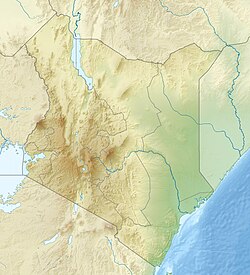 Central Island Location of Central Island in Kenya | |
Central Island, also known as Crocodile Island, is a volcanic island located in the middle of Lake Turkana in Kenya. It is also the location of Central Island National Park, which is governed by the Kenya Wildlife Service. [1]