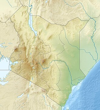
Lake Bogoria National Reserve

Last updated
Lake Bogoria National Reserve

Flickr - Rainbirder - Born of Fire.jpg

Flamingos and geyser at Lake Bogoria
Kenya relief location map.jpg
Red pog.svg
Location of Lake Bogoria National Reserve
Location Rift Valley Province, Kenya
Coordinates 0°15′N36°06′E / 0.25°N 36.1°E / 0.25; 36.1 Coordinates: 0°15′N36°06′E / 0.25°N 36.1°E / 0.25; 36.1
Area 107 square kilometres (41 sq mi)
Established November 1970
Governing body Kenya Wildlife Service

Lake Bogoria National Reserve is in the Great Rift Valley, Kenya, covering Lake Bogoria and the land immediately surrounding the lake. It is administered by the Kenya Wildlife Service. [1]

Great Rift Valley, Kenya

The Great Rift Valley is part of an intra-continental ridge system that runs through Kenya from north to south. It is part of the Gregory Rift, the eastern branch of the East African Rift, which starts in Tanzania to the south and continues northward into Ethiopia. It was formed on the "Kenyan Dome" a geographical upwelling created by the interactions of three major tectonics: the Arabian, Nubian, and Somalian plates. In the past, it was seen as part of a "Great Rift Valley" that ran from Madagascar to Syria. Most of the valley falls within the former Rift Valley Province.

Lake Bogoria meromictic lake

Lake Bogoria is a saline, alkaline lake that lies in a volcanic region in a half-graben basin south of Lake Baringo, Kenya, a little north of the equator. Lake Bogoria, like Lake Nakuru, Lake Elmenteita, and Lake Magadi further south in the Rift Valley, and Lake Logipi to the north, is home at times to one of the world's largest populations of lesser flamingos. The lake is a Ramsar site and Lake Bogoria National Reserve has been a protected National Reserve since November 29, 1973. Lake Bogoria is shallow, and is about 34 km long by 3.5 km wide, with a drainage basin of 700 km2.

The Kenya Wildlife Service (KWS) is a Kenyan state corporation that was established in 1989 to conserve and manage Kenya’s wildlife. It is established under an Act of Parliament Cap 376 with the mandate to conserve and manage wildlife in Kenya, and to enforce related laws and regulations. It manages the biodiversity of the country, protecting and conserving the flora and fauna.

Contents

Location

The lake lies in a trough below the Ngendelel Escarpment, a sheer wall 600 metres (2,000 ft) high. The lake covers 32 square kilometres (12 sq mi). [2] It is geothermically active on the western shore, with geysers and hot springs. [3] The geologist J.W. Gregory described the lake in 1892 as "the most beautiful view in Africa". [4]

The reserve is in a semi-arid area. The only major river feeding the lake is the Waseges River, which rises on the northern slopes of the Aberdare Range. The Waseges runs through productive agricultural land higher up, through bush and scrub used for grazing, and then through very dry bush before entering the lake at its northern end. [5] The lake is surrounded by grasslands dotted with bushes. There is acacia-ficus woodland to the south, and the north merges into a papyrus swamp. [1]

Waseges River river in Kenya

The Waseges River is a river that rises on the slopes of the Nyandarua Plateau below the Aberdare Range in Kenya. The river flows north, then west and south to enter Lake Bogoria in the Great Rift Valley from the north after passing through a swamp. In 2002 rubies were found in the region of the Waseges River.

Aberdare Range mountain range

The Aberdare Range is a 160 km long mountain range of upland, north of Kenya's capital Nairobi with an average elevation of 3,500 metres (11,480 ft). It is located in Nyandarua County, west central Kenya, northeast of Naivasha and Gilgil and just south of the Equator. The mountain range is called Nyandarua among the Agikuyu people in whose territory this forest and mountain range is located. The name Nyandarua means a drying hide due to the distinctive fold of its silhouette.

The park was opened in November 1970. Facilities for tourists include the park lodge, three public campsites and one privately operated campsite. Visitors may also bathe in the hot springs, which form a natural spa. [6] The reserve was submitted as a candidate World Heritage Site in 1999. [5]

World Heritage Site place listed by the UNESCO as of special cultural or natural significance

A World Heritage Site is a landmark or area which is selected by the United Nations Educational, Scientific and Cultural Organization (UNESCO) as having cultural, historical, scientific or other form of significance, and is legally protected by international treaties. The sites are judged important to the collective interests of humanity.

Ecology

The lake is alkaline, feeding blue-green algae which in turn feed flamingoes. At times the number of flamingoes feeding in the lake may be as high as two million. [5] Raptors such as tawny eagles prey on the flamingoes. [2] In total, 135 species of bird have been recorded. They include little grebe, pratincole, swift, little bee-eater, cape wigeon, yellow-billed stork, African spoonbill, augur buzzard, gabar goshawk, water dikkop, great tit, starling, hornbill and crombec. [1]

The reserve has a herd of the relatively uncommon Greater Kudu. Other large mammals include buffalo, zebra, cheetah, baboon, warthog, caracal, spotted hyena, impala and dik dik. [1]

The Waseges flows through regions of intensive coffee cultivation where heavy use is made of chemical fertilizers and pesticides, which may be polluting the lake. Many visitors are attracted to the hot springs on the western lakeshore, and these cause pollution from solid wastes. Siltation is another threat to biodiversity. [5]

Related Research Articles

Serengeti National Park national park in Africa

The Serengeti National Park is a Tanzanian national park in the Serengeti ecosystem in the Mara and Simiyu regions. It is famous for its annual migration of over 1.5 million white-bearded wildebeest and 250,000 zebra and for its numerous Nile crocodile and honey badger.

Lesser flamingo species of bird

The lesser flamingo is a species of flamingo occurring in sub-Saharan Africa, with another population in India. Birds are occasionally reported from further north, but these are generally considered vagrants. It was moved from the genus Phoeniconaias to Phoenicoparrus in 2014.

Lake Natron salt lake

Lake Natron is a salt or soda lake in Arusha Region in Tanzania. It is in the Gregory Rift, which is the eastern branch of the East African Rift. The lake is within the Lake Natron Basin, a Ramsar Site wetland of international significance.

Tsavo East National Park national park

Tsavo East National Park is one of the oldest and largest parks in Kenya at 13,747 square kilometres. Situated in a semi-arid area previously known as the Taru Desert it opened in April 1948, and is located near the town of Voi in the Taita-Taveta County of the former Coast Province. The park is divided into east and west sections by the A109 road and a railway. Named for the Tsavo River, which flows west to east through the national park, it borders the Chyulu Hills National Park, and the Mkomazi Game Reserve in Tanzania.

Lake Manyara salinity

Lake Manyara is a shallow lake in the Natron-Manyara-Balangida branch of the East African Rift in Manyara Region in Tanzania. Said by Ernest Hemingway to be the "loveliest [lake] ... in Africa," it is also the home of a diverse set of landscapes and wildlife.

Lake Nakuru soda lake

Lake Nakuru is one of the Rift Valley soda lakes at an elevation of 1,754 m (5,755 ft) above sea level. It lies to the south of Nakuru, in the rift valley of Kenya and is protected by Lake Nakuru National Park.

Selous Game Reserve

The Selous Game Reserve is a protected area in southern Tanzania. It covers a total area of 50,000 km2 (19,000 sq mi) and has additional buffer zones. It was designated a UNESCO World Heritage Site in 1982 due to its wildlife diversity and undisturbed nature. Some of the typical wildlife of the miombo inhabits the reserve, such as African bush elephant, black rhino, hippopotamus, lion, East African wild dog, Cape buffaloes, Masai giraffe, Plains zebra, and Nile crocodile. Permanent human habitation is not permitted within the reserve. All human entry and exit is controlled by the Wildlife Division of the Tanzanian Ministry of Natural Resources and Tourism.

Hells Gate National Park national park

Hell's Gate National Park lies south of Lake Naivasha in Kenya, north west of Nairobi. Hell's Gate National Park is named after a narrow break in the cliffs, once a tributary of a prehistoric lake that fed early humans in the Rift Valley. It was established in 1984. A small national park, it is known for its wide variety of wildlife and for its scenery. This includes the Fischer's Tower and Central Tower columns and Hell's Gate Gorge. The national park is also home to three geothermal power stations at Olkaria. The park is equipped with three basic campsites and includes a Maasai Cultural Center, providing education about the Maasai tribe's culture and traditions.

Mount Elgon National Park National park in Uganda and Kenya

Mount Elgon National Park is a national park 140 kilometres (87 mi) northeast of Lake Victoria. The park covers an area of 1,279 square kilometres (494 sq mi) and is bisected by the border of Kenya and Uganda. The Ugandan part of the park covers 1,110 km2 (430 sq mi) while the Kenyan part covers 169 km2 (65 sq mi). The Kenyan part of the park was gazetted in 1968, the Ugandan part in 1992.

Baringo County County in Kenya

Baringo County is one of the 47 Counties of Kenya. It is located in the former Rift Valley Province. Its headquarters and largest town is Kabarnet. The county is home to Lake Baringo.

Lake Elmenteita lake

Lake Elmenteita, also spelled Elementaita, is a soda lake, in the Great Rift Valley, about 120 km northwest of Nairobi, Kenya.

Wildlife of Kenya

The wildlife of Kenya refers to its fauna. The diversity of Kenya's wildlife has garnered international fame, especially for its populations of large mammals. Mammal species include lion, cheetah hippopotamus, African buffalo, wildebeest (Connochaetes), African elephant (Loxodonta), zebra, giraffe (Giraffa), and rhinoceros. Kenya has a very diverse population of birds, including flamingo and ostrich

Tourism in Kenya

Tourism in Kenya is the second-largest source of foreign exchange revenue following agriculture. The Kenya Tourism Board is responsible for maintaining information pertaining to tourism in Kenya.

<i>The Great Rift: Africas Wild Heart</i> British nature documentary series

The Great Rift: Africa's Wild Heart is a British nature documentary series, which began airing on BBC Two on 24 January 2010. A BBC/Animal Planet co-production, the three-part series focuses on the landscape and wildlife of the Great Rift Valley in East Africa. At the end of each fifty-minute episode, a ten-minute featurette, Inside The Great Rift, takes a behind-the-scenes look at the challenges of filming the series.

Shaba National Reserve national park

Shaba National Reserve is a protected area in northern Kenya to the east of the Samburu and Buffalo Springs national reserves. Together, the three reserves form a large protected area.

Kerio Valley National Reserve

The Kerio Valley National Reserve is a protected area in the Kerio Valley, Kenya, a branch of the Great Rift Valley. The 66 square kilometres (25 sq mi) reserve was created in 1983 and is managed by the Kenya Wildlife Service.

References

  1. 1 2 3 4 Lake Bogoria - Kenya Wildlife.
  2. 1 2 Williams 2005, p. 61.
  3. Williams 2005, p. 64.
  4. Lake Bogoria - AfricaPoint.
  5. 1 2 3 4 Lake Bogoria UNESCO.
  6. Lake Bororia - ThinkQuest.

Sources