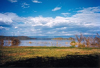
Lake Baringo is, after Lake Turkana, the most northern of the Kenyan Rift Valley lakes, with a surface area of 130 square kilometres (50 sq mi) and an elevation of 970 metres (3,180 ft). The lake is fed by several rivers: the Molo, Perkerra and Ol Arabel. It has no obvious outlet; the waters are assumed to seep through lake sediments into the faulted volcanic bedrock. It is one of the two freshwater lakes in the Rift Valley in Kenya, the other being Lake Naivasha.

Rift Valley Province of Kenya, bordering Uganda, was one of Kenya's eight provinces, before the Kenyan general election, 2013. Rift Valley Province was the largest and one of the most economically important provinces in Kenya. It was dominated by the Kenya Rift Valley which passes through it and gives the province its name. According to the 2009 Census, the former province covered an area of 182,505.1 square kilometres and would have had a population of 10,006,805, making it the largest and most populous province in the country. The bulk of the provincial population inhabited a strip between former Nairobi and Nyanza Province. The capital was the town of Nakuru.

These lists cover volcanoes by type and by location.

Covasna is a town in Covasna County, Transylvania, Romania, at an altitude of 550–600 m (1,800–1,970 ft). It is known for its natural mineral waters and mofettas.

Mountain Elgon is an extinct shield volcano on the border of Uganda and Kenya, north of Kisumu and west of Kitale. The mountain's highest point, named "Wagagai", is located entirely within Uganda. Although there is no verifiable evidence of its earliest volcanic activity, geologists estimate that Mount Elgon is at least 24 million years old, making it the oldest extinct volcano in East Africa. The mountain's name originates from its Maasai name, Elgonyi.
Korossy is a Hungarian surname. Some variations of the spelling of this surname are as follows: Kőrösi, Kőrösy, Kőrössi, Kőrössy, Körösi, Körösy, Körössi, Körössy, Korosi, Korosy, Korossi, and Korossy.

Rusinga Island, with an elongated shape approximately 10 miles (16 km) from end to end and 3 miles (5 km) at its widest point, lies in the eastern part of Lake Victoria at the mouth of the Winam Gulf. Part of Kenya, it is linked to Mbita Point on the mainland by a causeway.

MenengaiCrater is a massive shield volcano with one of the biggest calderas in the world, in the Great Rift Valley, Kenya. It is the largest volcano caldera in Kenya and the second largest volcano caldera in Africa. Volcanic formed rich loam soils enrich the adjacent farmland arounds its flanks. The crater is on the floor of the Rift Valley. The volcano formed about 200,000 years ago and the prominent 12 x 8 km caldera formed about 8000 years ago. The caldera floor is covered with numerous post caldera lava flows. The Menengai volcano is considered one of the best-preserved Krakatau-style calderas in the world. Menengai has very little sediment in the caldera which is a thick mass of lava boulders and inaccessible ridges. Volcanic activity continues and a current project under the GDC is at an advanced stage towards geothermal power generation.
Paka is a shield volcano located in the Great Rift Valley, Kenya. Geothermal activity is widespread at Paka. Paka means "ochre" in Pokot.

Namarunu is a shield volcano located in the Great Rift Valley, Kenya.
Emuruangogolak is an active shield volcano straddling the Gregory Rift in Kenya, in Eastern Africa. It has a 3.5-by-5.0-kilometre caldera on its summit. The last known eruption was a trachyte flow which occurred in 1910. Steam vents and fumarolic activity continues from fissures within the caldera and along the flanks of the volcano. Several maar lakes exist in the rift valley adjacent to the volcano. The volcano's summit is at 1,285 metres (4,216 ft) elevation, and its formation is calculated to have been 38,000 years ago.
The Barrier is an active shield volcano located in the north of Kenya. It is last known to have erupted in 1921.

The Great Rift Valley is part of an intra-continental ridge system that runs through Kenya from north to south. It is part of the Gregory Rift, the eastern branch of the East African Rift, which starts in Tanzania to the south and continues northward into Ethiopia. It was formed on the "Kenyan Dome" a geographical upwelling created by the interactions of three major tectonics: the Arabian, Nubian, and Somalian plates. In the past, it was seen as part of a "Great Rift Valley" that ran from Madagascar to Syria. Most of the valley falls within the former Rift Valley Province.
Mount Silali is a dormant volcano in the Gregory Rift Valley, near Kapedo, Kenya. Silali is south of the Suguta Valley, which reaches northward to Lake Turkana, and is about 70 kilometres (43 mi) north of Lake Baringo.

The Gregory Rift is the eastern branch of the East African Rift fracture system. The rift is being caused by the separation of the Somali plate from the Nubian plate, driven by a thermal plume. Although the term is sometimes used in the narrow sense of the Kenyan Rift, the larger definition of the Gregory Rift is the set of faults and grabens extending southward from the Gulf of Aden through Ethiopia and Kenya into Northern Tanzania, passing over the local uplifts of the Ethiopian and Kenyan domes. Ancient fossils of early hominins, the ancestors of humans, have been found in the southern part of the Gregory Rift.

Csaba Kőrösi is a Hungarian diplomat who served as President of the 77th United Nations General Assembly. He was previously Director of Environmental Sustainability in the Office of the President of Hungary.

The Seventy-seventh session of the United Nations General Assembly was the session of the United Nations General Assembly which opened on 13 September 2022, and closed on 5 September 2023. The President of the UN General Assembly was from Eastern European Group.

South Island, or Hohnel Island, is a fissure-formed volcanic island and the largest one out of 3 other major islands in Lake Turkana, Kenya. This volcano was discovered in 1888 while it was erupting by Count Teleki, a Hungarian explorer who led the first expedition into the region. It is a part of the Lake Turkana National Parks, which is a UNESCO World Heritage Site.
