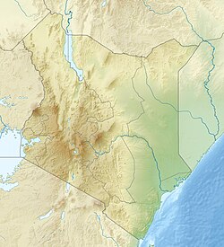
Waseges River

Last updated
Waseges River
Kenya relief location map.jpg
Red pog.svg
Mouth location in Kenya
Physical characteristics
Source 
  coordinates 0°00′57″S36°13′20″E / 0.015836°S 36.222267°E / -0.015836; 36.222267
Mouth  
  coordinates
0°20′34″N36°04′41″E / 0.342698°N 36.078147°E / 0.342698; 36.078147

The Waseges River, or Sandai River, is a river in Kenya. Its source is on the slopes of the Nyandarua Plateau below the Aberdare Range; it ends its course in lake Bogoria.

Contents

In 2002 rubies were found in the region of the Waseges River. [1]

Course

The river flows north, then west and south to enter Lake Bogoria in the Great Rift Valley from the north after passing through the Kesubo swamp. [2] [3]

In its upper reaches, the Waseges flows through regions of intensive coffee cultivation where heavy use is made of chemical fertilizers and pesticides. Lower down it flows through bush and scrub used for grazing, and then through very dry bush before entering the lake at its northern end. [4] The river is seasonal, and is the main affluent of the lake. [5] [3] The inertial flow of the river may generate counter-clockwise currents in the lake. [6]

Chemistry

Its water pH is 8, [7] a mild alcaline level that strongly contrasts with the highly alcaline waters of lake Bogoria, a soda lake which reaches pH 10,5 and 35% salinity. [8]

Irrigation scheme

The Waseges is an important source of irrigation water. With rising populations, by 1985 the Tugen people of Sandai were sometimes refusing to allow their neighbors, the Camus people, to use water from the river. [9] The Sandai farmers had been in the habit of cultivating two or three out of six cultivated areas each year. A given area would be farmed for three or four years, then left fallow for up to four years. All the areas are fed by canals from the Waseges, but half the canals will be blocked at any time. Use of the irrigated farm areas involved agreements between the Tugen and Camus people. [10]

An irrigation scheme carried out by the Baringo District Provincial Irrigation Unit (PIU), funded and given technical support by Dutch Aid, aimed to improve the usage of the river waters. The planned irrigation scheme was based on a single large concrete-lined canal feeding just one area. Scheduled for launch in 1983, there were delays due to protests from the local people, and the project was not completed until the 1987/1988 season. The project introduced a less flexible system, created tensions between the Tugen and Camus people, and tensions among the Tugen. [10]

Before 2003 the river was illegally diverted for irrigation upstream in the Subukia area, causing it to dry up downstream during a period of drought. In 2003 the Ministry of Water Management and Development proposed to establish river basin catchment committees and water user associations to manage the use of the river. [11]

Related Research Articles

<span class="mw-page-title-main">Lake Baringo</span> Freshwater lake in Kenya

Lake Baringo is, after Lake Turkana, the most northern of the Kenyan Rift Valley lakes, with a surface area of 130 square kilometres (50 sq mi) and an elevation of 970 metres (3,180 ft). The lake is fed by several rivers: the Molo, Perkerra and Ol Arabel. It has no obvious outlet; the waters are assumed to seep through lake sediments into the faulted volcanic bedrock. It is one of the two freshwater lakes in the Rift Valley in Kenya, the other being Lake Naivasha.

<span class="mw-page-title-main">Kerio River</span> River

The Kerio River is a river in Turkana County, Kenya. It flows northward into Lake Turkana. It is one of the longest rivers in Kenya, originating near the equator.

<span class="mw-page-title-main">Rift Valley Province</span> Province of Kenya

Rift Valley Province of Kenya, bordering Uganda, was one of Kenya's eight provinces, before the 2013 Kenyan general election. Rift Valley Province was the largest and one of the most economically important provinces in Kenya. It was dominated by the Kenya Rift Valley which passes through it and gives the province its name. According to the 2009 Census, the former province covered an area of 182,505.1 square kilometres and would have had a population of 10,006,805, making it the largest and most populous province in the country. The bulk of the provincial population inhabited a strip between former Nairobi and Nyanza Province. The capital was the town of Nakuru.

<span class="mw-page-title-main">Rift Valley lakes</span> Group of lakes in the East African Rift

The Rift Valley lakes are a series of lakes in the East African Rift valley that runs through eastern Africa from Ethiopia in the north to Malawi in the south, and includes the African Great Lakes in the south. These include some of the world's oldest lakes, deepest lakes, largest lakes by area, and largest lakes by volume. Many are freshwater ecoregions of great biodiversity, while others are alkaline "soda lakes" supporting highly specialised organisms.

<span class="mw-page-title-main">Lake Bogoria</span> Meromictic lake in Kenya

Lake Bogoria is a saline, alkaline lake that lies in a volcanic region in a half-graben basin south of Lake Baringo, Kenya, a little north of the equator. Lake Bogoria, like Lake Nakuru, Lake Elementeita, and Lake Magadi further south in the Rift Valley, and Lake Logipi to the north, is periodically home to one of the world's largest populations of lesser flamingos. The lake is a Ramsar site and Lake Bogoria National Reserve has been a protected National Reserve since November 29, 1973.

<span class="mw-page-title-main">Lake Magadi</span> Lake Kajiado County, Kenya

Lake Magadi is the southernmost lake in the Kenyan Rift Valley, lying in a catchment of faulted volcanic rocks, north of Tanzania's Lake Natron. During the dry season, it is 80% covered by soda and is well known for its wading birds, including flamingos.

<span class="mw-page-title-main">Tugen people</span> Tribe of Kenya

The Tugen are a sub tribe of the Kenyan Kalenjin people. They fall under the highland nilotes category. They occupy Baringo County and some parts of Nakuru County and Elgeyo Marakwet County in the former Rift Valley Province. Daniel Arap Moi, the second president of Kenya (1978–2002), came from this sub-tribe. The Tugen people speak the Tugen language. The Tugen population was 197,556 as of 2019.

<span class="mw-page-title-main">Ilchamus people</span> Ethnic group in Kenya

The Ilchamus, are a Maa-speaking people living south and southeast of Lake Baringo, Kenya. They numbered approximately 32,949 people in 2019 and are closely related to the Samburu living more to the north-east in the Rift Valley Province. They are one of the smallest ethnic groups in Kenya.

<span class="mw-page-title-main">Lake Nakuru</span> Alkaline lake in Rift valley

Lake Nakuru is one of the Rift Valley lakes, located at an elevation of 1,754 m (5,755 ft) above sea level. It lies to the south of Nakuru, in the rift valley of Kenya and is protected by Lake Nakuru National Park.

<span class="mw-page-title-main">Lake Abbe</span> Lake on the border of Djibouti and Ethiopia

Lake Abbe, also known as Lake Abhe Bad, is a salt lake, lying on the Ethiopia-Djibouti border. It is one of a chain of six connected lakes, which also includes lakes Gargori, Laitali, Gummare, Bario and Afambo. The lake is the ultimate destination of the Awash River, which is at the center of the Afar Triangle. Lake Abbe is considered one of the most inaccessible areas of the earth. The water itself is known for its flamingos.

<span class="mw-page-title-main">Kapthurin Formation</span> Pleistocene geological formation in East Africa

The Kapthurin Formation is a series of Middle Pleistocene sediments associated with the East African Rift Valley. Part of the East African Rift System, it is also an important archaeological site in the study of early humans who occupied the area and left stone tools and animal bones behind. It outcrops in Kenya west of Lake Bogoria and northwest of Lake Baringo in the Kenya Rift Valley, exposed on the surface in a 150 km2 (58 sq mi) area. It also outcrops in portions of the Tugen Hills farther east. The ~125 metres (410 ft) of sediment that comprises the Kapthurin formation represents more than 600,000 years of depositional history. Clastic sediments, tuffs, and carbonate beds, in the Kapthurin give information on past river and lake environments. Additionally, intercalated tuffs and extrusive igneous rocks associated with Rift Valley volcanic activity have allowed for multiple argon–argon dating studies. The high resolution dating enables archaeological studies regarding changing hominin behavior. The Kapthurin Formation has been used to study the Acheulian-Middle Stone Age transition.

Kabarnet is a town in Baringo County, Kenya. As of the 2019 census,the town had a population of 22,474 with 10,943 (48.8%) of them being males and 11,531(51.1%) of them being females.

<span class="mw-page-title-main">Baringo County</span> County in Kenya

Baringo County is one of the 47 counties in Kenya. It is located in the former Rift Valley Province. Its headquarters and largest town is Kabarnet. The county is home to Lake Baringo, Lake Bogoria and Lake Kamnarok.

<span class="mw-page-title-main">Lake Elmenteita</span> Lake in Kenya

Lake Elmenteita is a soda lake, in the Great Rift Valley, about 120 km northwest of Nairobi, Kenya.

<span class="mw-page-title-main">Great Rift Valley, Kenya</span> Part of an intra-continental ridge system that runs through Kenya

The Great Rift Valley is part of an intra-continental ridge system that runs through Kenya from north to south. It is part of the Gregory Rift, the eastern branch of the East African Rift, which starts in Tanzania to the south and continues northward into Ethiopia. It was formed on the "Kenyan Dome" a geographical upwelling created by the interactions of three major tectonics: the Arabian, Nubian, and Somalian plates. In the past, it was seen as part of a "Great Rift Valley" that ran from Madagascar to Syria. Most of the valley falls within the former Rift Valley Province.

Mount Silali is a dormant volcano in the Gregory Rift Valley, near Kapedo, Kenya. Silali is south of the Suguta Valley, which reaches northward to Lake Turkana, and is about 70 kilometres (43 mi) north of Lake Baringo.

<span class="mw-page-title-main">Perkerra River</span> River in Kenya

The Perkerra River is a river in the Great Rift Valley in Kenya that feeds the freshwater Lake Baringo. It is the only perennial river in the arid and semi-arid lands of the Baringo County. The Perkerra river supplies water to the Perkerra Irrigation Scheme in the Jemps flats near Marigat Township, just south of the lake.

Ol Arabel is a river in the Great Rift Valley of Kenya that feeds Lake Baringo. It gives its name to a forest covering its headwaters and to a region.

Maji Mazuri is a small town in Kenya's Baringo County along the Makutano-Ravine-Kampi Ya Moto (C55) highway. This is the most southerly tip of the greater Baringo area. It neighbors Kericho's Londiani and Nakuru's Kamara areas. The settlement was formed by migrants who used to work in the Koibatek Forest, but were either retrenched or retired at one time. As such, Maji Mazuri is home to people from different ethnic groups of Kenya. The Agikuyu and Tugen people are the majority population in the larger Maji Mazuri location of Eldama Ravine division.

<span class="mw-page-title-main">Lake Suguta</span>

Lake Suguta is a former lake in Africa. It formed in the Suguta Valley, which is part of the East African Rift, south of Lake Turkana during the Holocene African humid period.

References

  1. Ruby.
  2. Hughes & Hughes 1992, p. 189.
  3. 1 2 Owen et al. 2004, p. 65.
  4. Lake Bogoria UNESCO.
  5. Renaut & Owen 1991, p. 177.
  6. Renaut & Owen 1991, p. 183.
  7. Owen et al. 2004, p. 66.
  8. Dhundale, Vishal; Hemke, Vijayshree; Desai, Dhananjay; Joshi, Samruddhi; Shete, Pranali; Kaur, Gurjinder (2021). "Polyphasic Approach to Understand Bacterial Community Landscape in Soda Lake Environment" (PDF). Applied Ecology and Environmental Sciences. 9 (8): 724-734 (see p. 727). Retrieved 2024-07-05.
  9. Little 1992, p. 137.
  10. 1 2 Little 1992, p. 167-168.
  11. Karua 2003, p. 1335.

Sources