Mount Longonot

Last updated
Mount Longonot
2013-01-23 07-24-03 Kenya Rift Valley - Kijabe.jpg
Highest point
Elevation 2,776 m (9,108 ft) [1]
Listing Volcanoes in Kenya
Coordinates 0°54′55″S36°27′25″E / 0.91528°S 36.45694°E / -0.91528; 36.45694
Naming
Native nameOloonong'ot (Masai)
Geography
Kenya relief location map.jpg
Red triangle with thick white border.svg
Mount Longonot
Geology
Mountain type Stratovolcano
Last eruption 1863 ± 5 years [1]
Climbing
Easiest route Scramble

Mount Longonot is a stratovolcano located southeast of Lake Naivasha in the Great Rift Valley of Kenya, Africa. It is thought to have last erupted in the 1860s. [1] Its name is derived from the Maasai word Oloonong'ot, meaning "mountains of many spurs" or "steep ridges".

Contents

Mount Longonot is protected by the Kenya Wildlife Service as part of Mount Longonot National Park. A 3.1 km trail runs from the park entrance up to the crater rim, and continues in a 7.2 km loop encircling the crater. The whole tour (gate-around the rim-gate) of 13.5 km takes about 4–5 hours allowing for necessary rest breaks - parts of the trail are heavily eroded and very steep. The gate elevation is around 2150 m and the peak at 2776 m but following the jagged rim involves substantially more than the 630 m vertical difference.

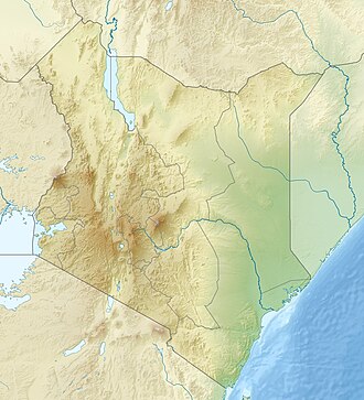
Mount Longonot is 60 kilometres northwest of Nairobi and may be reached from there by a tarmac road. A nearby town is also named Longonot. The Longonot satellite earth station is located south of the mountain.

Geology

Longonot is a stratovolcano which contains a large 8 x 12 km caldera formed by vast eruptions of trachytic lava some 21,000 years ago. The current summit cone was developed within the earlier caldera. This cone itself is capped by a 1.8 km crater. The mountain has several parasitic cones and effusive lava eruptions occur on the flanks and within the caldera floor. [1] Periodic geodetic activity recorded at Longonot in 2004–2006 demonstrated the presence of active magmatic systems beneath this volcano. [2]

As of 2018, geothermal projects struggle to explore the potential. [3]

Flora and fauna

A forest of small trees covers the crater floor, and small steam vents are found spaced around the walls of the crater. The mountain is home to various species of wildlife, notably plains zebra, giraffe, Thomson's gazelle, buffaloes and hartebeest.

The crater is popular for hiking, bird and game watching that is enhanced by the flora and fauna on the slopes of the mountain. [4]

Notable events

On March 21, 2009 bush fires burned up the side of the mountain and descended into the crater, trapping wildlife and feeding on drought-ravaged brush. [5]

Longonot Earth Station 2010 Longonot Earth Station 2010.jpg
Longonot Earth Station 2010
Mt.-Longonot-Crater---Feb-2010.jpg
Panoramic view of Mount Longonot crater in 2010

See also

Related Research Articles

<span class="mw-page-title-main">Stratovolcano</span> Type of conical volcano composed of layers of lava and tephra

A stratovolcano, also known as a composite volcano, is a typically conical volcano built up by many alternating layers (strata) of hardened lava and tephra. Unlike shield volcanoes, stratovolcanoes are characterized by a steep profile with a summit crater and explosive eruptions. Some have collapsed summit craters called calderas. The lava flowing from stratovolcanoes typically cools and solidifies before spreading far, due to high viscosity. The magma forming this lava is often felsic, having high to intermediate levels of silica, with lesser amounts of less viscous mafic magma. Extensive felsic lava flows are uncommon, but can travel as far as 8 km (5 mi).

<span class="mw-page-title-main">Crater Lake National Park</span> National park in Oregon

Crater Lake National Park is a national park of the United States located in southern Oregon. Established in 1902, Crater Lake is the fifth-oldest national park in the United States and the only national park in Oregon. The park encompasses the caldera of Crater Lake, a remnant of Mount Mazama, a destroyed volcano, and the surrounding hills and forests.

<span class="mw-page-title-main">Lassen Volcanic National Park</span> National park in California, United States

Lassen Volcanic National Park is a national park of the United States in northeastern California. The dominant feature of the park is Lassen Peak, the largest plug dome volcano in the world and the southernmost volcano in the Cascade Range. Lassen Volcanic National Park is one of the few areas in the world where all four types of volcanoes can be found: plug dome, shield, cinder cone, and stratovolcano.

<span class="mw-page-title-main">Geology of the Lassen volcanic area</span> Geology of a U.S. national park in California

The Lassen volcanic area presents a geological record of sedimentation and volcanic activity in and around Lassen Volcanic National Park in Northern California, U.S. The park is located in the southernmost part of the Cascade Mountain Range in the Pacific Northwest region of the United States. Pacific Oceanic tectonic plates have plunged below the North American Plate in this part of North America for hundreds of millions of years. Heat and molten rock from these subducting plates has fed scores of volcanoes in California, Oregon, Washington and British Columbia over at least the past 30 million years, including these in the Lassen volcanic areas.

<span class="mw-page-title-main">Lassen Peak</span> Active volcano in California, United States

Lassen Peak, commonly referred to as Mount Lassen, is a 10,457 ft (3,187 m) lava dome volcano in Lassen Volcanic National Park in Northern California. Located in the Shasta Cascade region above the northern Sacramento Valley, it is the southernmost active volcano in the Cascade Range of the Western United States, and part of the Cascade Volcanic Arc stretching from southwestern British Columbia to northern California. It supports many flora and fauna among its diverse habitats, which reach high elevations and are subject to frequent snowfall.

<span class="mw-page-title-main">Kīlauea</span> Active volcano in Hawaii

Kīlauea is an active shield volcano in the Hawaiian Islands. It is located along the southeastern shore of Hawaii Island. The volcano is between 210,000 and 280,000 years old and grew above sea level about 100,000 years ago. Since the islands were settled, it has been the most active of the five volcanoes that together form the island and among the most active volcanoes on Earth. The most recent eruption began in December 2024.

<span class="mw-page-title-main">Newberry Volcano</span> Shield volcano in Oregon, United States

Newberry Volcano is a large, active, shield-shaped stratovolcano located about 20 miles (32 km) south of Bend, Oregon, United States, 35 miles (56 km) east of the major crest of the Cascade Range, within the Newberry National Volcanic Monument. Its highest point is Paulina Peak. Newberry is the largest volcano in the Cascade Volcanic Arc, with an area of 1,200 square miles (3,100 km2) when its lava flows are taken into account. From north to south, the volcano has a length of 75 miles (121 km), with a width of 27 miles (43 km) and a total volume of approximately 120 cubic miles (500 km3). It was named for the geologist and surgeon John Strong Newberry, who explored central Oregon for the Pacific Railroad Surveys in 1855.

<span class="mw-page-title-main">Lake Mashū</span> Crater lake in Akan Mashu National Park, Hokkaido island, Japan

Lake Mashū is an endorheic crater lake formed in the caldera of a potentially active volcano. It is located in Akan Mashu National Park on the island of Hokkaido, Japan. It has been called the clearest lake in the world.

<span class="mw-page-title-main">Mount Mazama</span> Complex volcano in the Cascade Range

Mount Mazama is a complex volcano in the western U.S. state of Oregon, in a segment of the Cascade Volcanic Arc and Cascade Range. The volcano is in Klamath County, in the southern Cascades, 60 miles (97 km) north of the Oregon–California border. Its collapse, due to the eruption of magma emptying the underlying magma chamber, formed a caldera that holds Crater Lake. Mount Mazama originally had an elevation of 12,000 feet (3,700 m), but following its climactic eruption this was reduced to 8,157 feet (2,486 m). Crater Lake is 1,943 feet (592 m) deep, the deepest freshwater body in the U.S. and the second deepest in North America after Great Slave Lake in Canada.

<span class="mw-page-title-main">Mount Katmai</span> Stratovolcano in Katmai National Park, Alaska, USA

Mount Katmai is a large active stratovolcano on the Alaska Peninsula in southern Alaska, located within Katmai National Park and Preserve. It is about 6.3 miles (10 km) in diameter with a central lake-filled caldera about two by three miles in size, formed during the Novarupta eruption of 1912. The caldera rim reaches a maximum elevation of 6,716 feet (2,047 m). In 1975 the surface of the crater lake was at an elevation of about 4,220 feet (1,286 m), and the estimated elevation of the caldera floor is about 3,400 ft (1,040 m). The mountain is located in Kodiak Island Borough, very close to its border with Lake and Peninsula Borough. The volcano has caused ten known fatalities due to gas exposure.

<span class="mw-page-title-main">Active volcano</span> Geological feature

An active volcano is a volcano that has erupted during the Holocene, is currently erupting, or has the potential to erupt in the future. A volcano that is not currently erupting but could erupt in the future is known as a dormant volcano. Volcanoes that will not erupt again are known as extinct volcanoes.

<span class="mw-page-title-main">Mount Wrangell</span> Active volcanic mountain in Alaska, United States

Mount Wrangell, is a massive shield volcano located in Wrangell-St. Elias National Park and Preserve in southeastern Alaska, United States. The shield rises over 12,000 feet (3,700 m) above the Copper River to its southwest. Its volume is over 220 cubic miles (920 km3), making it more than twice as massive as Mount Shasta in California, the largest stratovolcano by volume in the Cascades. It is part of the Wrangell Mountains as well as the Wrangell Volcanic Field, which extends for more than 250 kilometers (160 mi) across Southcentral Alaska into the Yukon Territory in Canada, and has an eruptive history spanning the time from Pleistocene to Holocene.

<span class="mw-page-title-main">Hell's Gate National Park</span> National park in Kenya

Hell's Gate National Park is a national park situated near Lake Naivasha in Kenya. The park is named after a narrow break in the cliffs, once a tributary of a prehistoric lake that fed early humans in the Rift Valley. It was established in 1984. The park is notable for its wide variety of wildlife and for its scenery. This includes the Fischer's Tower and Central Tower columns and Hell's Gate Gorge. The national park is also home to five geothermal power stations at Olkaria. The park features three basic campsites and includes a Maasai Cultural Center, providing education about Maasai culture and traditions.

<span class="mw-page-title-main">Nemrut (volcano)</span> Volcano in Turkey

Nemrut is a dormant volcano in Tatvan district, Bitlis province, Eastern Turkey, close to Lake Van. The volcano is named after King Nimrod who is said to have ruled this area in about 2100 BC.

<span class="mw-page-title-main">Akan Volcanic Complex</span> Volcanic complex that grew out of the Akan caldera

Akan Volcanic Complex is a volcanic group of volcanoes that grew out of the Akan caldera. It is located within Akan National Park, about 50 km Northwest of Kushiro in eastern Hokkaidō, Japan.

<span class="mw-page-title-main">Mount Iwate</span> Stratovolcano complex on the island of Honshu, Japan

Mount Iwate is a stratovolcano complex in the Ōu Mountains of western Iwate Prefecture, in the Tōhoku region of northern Honshū, Japan. With an elevation of 2,038 metres (6,686 ft), it is the highest in Iwate Prefecture. It is included as one of the 100 famous mountains in Japan, a book composed in 1964 by mountaineer and author Kyūya Fukada. The mountain is on the borders of the municipalities of Hachimantai, Takizawa, and Shizukuishi, west of the prefectural capital of Morioka. Much of the mountain is within the borders of the Towada-Hachimantai National Park. The mountain is also referred to as the "Nanbu Fuji" for its resemblance to Mount Fuji.

<span class="mw-page-title-main">Great Rift Valley, Kenya</span> Part of an intra-continental ridge system that runs through Kenya

The Great Rift Valley is part of an intra-continental ridge system that runs through Kenya from north to south. It is part of the Gregory Rift, the eastern branch of the East African Rift, which starts in Tanzania to the south and continues northward into Ethiopia. It was formed on the "Kenyan Dome", a geographical upwelling created by the interactions of three major tectonics: the Arabian, Nubian, and Somalian plates. In the past, it was seen as part of a "Great Rift Valley" that runs from Madagascar to Syria. Most of the valley falls within the former Rift Valley Province.

<span class="mw-page-title-main">Ol Doinyo Eburru</span> Active complex of volcanoes in Kenya, East Africa

Ol Doinyo Eburru is an active complex of volcanoes in the Great Rift Valley, Kenya to the northwest of Lake Naivasha. It is being exploited for geothermal energy. Soysambu Conservancy is located to the north of the massif, between Lake Elmenteita to the east and Lake Nakuru to the west.

<span class="mw-page-title-main">Olkaria</span> Geothermal region in Kenya

The Olkaria Area is a region located immediately to the south of Lake Naivasha in the Great Rift Valley of Kenya, Africa. It is geothermally active and is being used to generate clean electric power. The region has an estimated potential of 2,000 MW. This is almost double the maximum daily electricity peak demand recorded in 2008/2009 for the entire country.

Menengai Forest is an urban forest situated within the town of Nakuru in Kenya. The Menengai Crater is within the forest. It was gazetted as a forest in the 1930s. It is surrounded by residential areas of Milimani Estate in the South, Ngachura and Bahati in the East, Solai in the North and Olo-Rongai in the West. Various Government of Kenya facilities have been hived off from the forest; these include the Kenya Broadcasting Corporation and the Nakuru G.K Prison. There is also a geothermal exploration project by the Geothermal Development Company inside the Menengai Crater floor.

References

  1. 1 2 3 4 "Longonot". Global Volcanism Program . Smithsonian Institution . Retrieved 21 March 2021.
  2. Biggs, J.; Anthony, E. Y.; Ebinger, C. J. (2009). "Multiple inflation and deflation events at Kenyan volcanoes, East African Rift". Geology. 37 (11): 979. doi:10.1130/G30133A.1.
  3. "National Bank chairman's geothermal vehicle misses steam well drilling target". Energy Siren. 11 September 2018. Retrieved 17 March 2019.
  4. polly (2024-03-04). "Activities to do in Mount Longonot National Park | Kenya Safaris". Nairobi National Park Kenya. Retrieved 2024-04-03.
  5. "Kenyan forces deployed for fires". BBC News. March 24, 2009. Retrieved May 13, 2010.