Buffalo Springs National Reserve

Last updated
Buffalo Springs National Reserve
Grevy's Zebra Stallion.jpg
Grevy's Zebra stallion in Buffalo Springs National Reserve
Kenya relief location map.jpg
Red pog.svg
Location of Buffalo Springs National Reserve
Location Kenya, Eastern Province, Isiolo District
Coordinates 0°31′17″N37°37′03″E / 0.521479°N 37.61737°E / 0.521479; 37.61737
Area131 square kilometres (51 sq mi)

Buffalo Springs National Reserve is a protected area in Isiolo County, Kenya.

Contents

Organization

The reserve was established in 1948 as part of the Samburu - Isiolo Game Reserve, and the present boundaries were established in 1985. The reserve is managed by the Isiolo County Council. Most operators of Kenyan safaris offer a visit to the reserve, which has several Safari Lodges and safari camps. [1]

Location

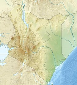
The Buffalo Springs National Reserve is south of the Samburu National Reserve, which lies on the other side of the Ewaso Ngiro river. It is named after an oasis of clear water at its western end. The reserve has an area of 131 square kilometres (51 sq mi), and is at an altitude of between 850 metres (2,790 ft) and 1,230 metres (4,040 ft) above sea level. [1] It is a gently rolling lowland plain of old lava flows and volcanic soils of olivine basalt. The main feature is the Champagne Ride in the southeast, an ancient lava-terrace. [2] The climate is hot, dry and semi-arid. [1]

Flora

There is a narrow band of riverine forest along the Ewaso Ngiro which includes Tana River Poplar, Doum Palm and magnificent specimens of Acacia elatior. Vegetation includes acacia tortilis woodland and large stretches of bushland dominated by Commiphora. In some areas lava rock is exposed, with scattered grass and shrubs. Other parts have alkaline grasslands with occasional springs and swamps. Here and there the "Desert Rose" (Adenium obesum) is found in the scrub, with bright pink blooms. The Salvadora persica (tooth-brush tree) shrub provides food to elephants, and its twigs are used as toothbrushes by the nomadic Samburu people. [1]

Fauna

Wildlife include Grant's zebra and the endangered Grevy's Zebra. Other species of mammal include reticulated giraffe, the African bush elephant, oryx, gerenuk, African buffalo, lion, leopard, cheetah and hyena. Over 365 species of bird have been recorded in the reserve. The river is home to hippopotamuses and crocodiles. [3] Somali ostriches are widespread within the national reserve. It is larger than the Masai ostrich's and is distinctive for their indigo legs and neck.

Related Research Articles

<span class="mw-page-title-main">Maasai Mara</span> National Reserve in Narok County, Kenya

Maasai Mara, also sometimes spelled Masai Mara and locally known simply as The Mara, is a large national game reserve in Narok, Kenya, contiguous with the Serengeti National Park in Tanzania. It is named in honour of the Maasai people, the ancestral inhabitants of the area, who migrated to the area from the Nile Basin. Their description of the area when looked at from afar: "Mara" means "spotted" in the local Maasai language, due to the many short bushy trees which dot the landscape.

<span class="mw-page-title-main">Serengeti National Park</span> National park in Mara and Simiyu Regions, Tanzania

The Serengeti National Park is a large national park in northern Tanzania that stretches over 14,763 km2 (5,700 sq mi). It is located in eastern Mara Region and northeastern Simiyu Region and contains over 1,500,000 hectares of virgin savanna. The park was established in 1940.

<span class="mw-page-title-main">Etosha National Park</span> National park of Namibia

Etosha National Park is a national park in northwestern Namibia and one of the largest national parks in Africa. It was proclaimed a game reserve in March 1907 in Ordinance 88 by the Governor of German South West Africa, Friedrich von Lindequist. It was designated as Wildschutzgebiet in 1958, and was awarded the status of national park in 1967, an act of parliament of the Republic of South Africa. It spans an area of 22,270 km2 (8,600 sq mi) and was named after the large Etosha pan which is almost entirely within the park. With an area of 4,760 km2 (1,840 sq mi), the Etosha pan covers 23% of the total area of the national park. The area is home to hundreds of species of mammals, birds and reptiles, including several threatened and endangered species such as the black rhinoceros. Sixty-one black rhinoceros were killed during poaching in Namibia during 2022, 46 of which were killed in Etosha.

<span class="mw-page-title-main">Samburu National Reserve</span>

The Samburu National Reserve is a game reserve on the banks of the Ewaso Ng'iro river in Kenya. On the other side of the river is the Buffalo Springs National Reserve. The park is 165 km² in size and is situated 350 kilometers from Nairobi. It ranges in altitude from 800 to 1230 m above sea level. Geographically, it is located in Samburu County.

<span class="mw-page-title-main">Nairobi National Park</span> First national park in Kenya, Africa

Nairobi National Park is a national park in Kenya that was established in 1946 about 7 km (4.3 mi) south of Nairobi. It is fenced on three sides, whereas the open southern boundary allows migrating wildlife to move between the park and the adjacent Kitengela plains. Herbivores gather in the park during the dry season. Nairobi National Park is negatively affected by increasing human and livestock populations, changing land use and poaching of wildlife. Despite its proximity to the city and its relative small size, it boasts a large and varied wildlife population, and is one of Kenya's most successful rhinoceros sanctuaries.

<span class="mw-page-title-main">Aberdare Range</span> Mountain range in Kenya

The Aberdare Range is a 160 km (99 mi) long mountain range of upland, north of Kenya's capital Nairobi with an average elevation of 3,500 metres (11,480 ft). It straddles across the counties of Nyandarua, Nyeri, Muranga, Kiambu and Laikipia. The mountain range is located in west central Kenya, northeast of Naivasha and Gilgil and lies just south of the Equator. The mountain range is called Nyandarua among the Agikuyu people in whose territory this forest and mountain range is located. The name Nyandarua comes from the Kikuyu word rwandarua meaning a drying hide, due to the distinctive fold of its silhouette.

<span class="mw-page-title-main">Isiolo</span> District capital in Kenya

Isiolo is a town in Isiolo County, of which it is the capital. It is located in the upper eastern region of Kenya and is geographically considered the center of the country Kenya. It lies 285 kilometers north of the capital Nairobi. The town grew around the local military camps, much of the population being descendants of former Somali soldiers who had fought in World War I as well as other Cushitic-speaking pastoral communities and the Ameru community. The name Isiolo originates from the Somali word ' Is ilow' which translates to forget yourself. It was a term that the local Somalis would tell newcomers who had the intention of moving back to Somalia when Kenya gained independence. The town has an estimated population of 78,250, most of them living around the outskirts of the town. Like most African cities, there has been a steady increase in the urban population in recent years, especially moving from as far as Moyale, Marsabit and Mandera. Isiolo town is also becoming a centre of interest because of its newly acquired status as a resort city cashing in on the popular Samburu and Shaba Game reserves, which have become preferred destinations after the famed Maasai Mara. Isiolo lies along the long A2 Road, leading towards Marsabit and Moyale much further north.

<span class="mw-page-title-main">Isiolo County</span> County in Kenya

Isiolo County is a county in the former Eastern Province of Kenya. Its population is 268,002 and its capital and largest city is Isiolo. Isiolo County is to be the first county to be developed as part of the Kenya Vision 2030 program. Other upcoming urban centres are: Garbatulla, Modogashe, Kinna, Merti and Oldonyiro.

<span class="mw-page-title-main">Wildlife of Botswana</span> Flora and fauna of Botswana

The wildlife of Botswana refers to the flora and fauna of this country. Botswana is around 90% covered in savanna, varying from shrub savanna in the southwest in the dry areas to tree savanna consisting of trees and grass in the wetter areas. Even under the hot conditions of the Kalahari Desert, many species survive; in fact the country has more than 2500 species of plants and 650 species of trees. Vegetation and its wild fruits are also extremely important to rural populations living in the desert and are the principal source of food, fuel and medicine for many inhabitants.

<span class="mw-page-title-main">Wildlife of Zimbabwe</span> Native fauna and flora of Zimbabwe

The wildlife of Zimbabwe occurs foremost in remote or rugged terrain, in national parks and private wildlife ranches, in miombo woodlands and thorny acacia or kopje. The prominent wild fauna includes African buffalo, African bush elephant, black rhinoceros, southern giraffe, African leopard, lion, plains zebra, and several antelope species.

<span class="mw-page-title-main">Ewaso Ng'iro</span> River in Kenya

Ewaso Ng'iro, also called Ewaso Nyiro, is a river in Kenya which rises on the west side of Mount Kenya and flows north then east and finally south-east, passing through Somalia where it joins the Jubba River. The river's name is derived from the local community's language, and means river of brown or muddy water. Downstream, the intermittent stream in Somalia is also called Lagh Dera.

<span class="mw-page-title-main">Wildlife of Kenya</span> Kenyan Heritage

The wildlife of Kenya refers to its fauna. The diversity of Kenya's wildlife has garnered international fame, especially for its populations of large mammals. Mammal species include lion, cheetah hippopotamus, African buffalo, wildebeest (Connochaetes), African bush elephant, zebra (Equus), giraffe (Giraffa), and rhinoceros. Kenya has a very diverse population of birds, including flamingo and common ostrich.

<span class="mw-page-title-main">Niassa Reserve</span> Protected natural area in Mozambique

Niassa Reserve is a nature reserve in Cabo Delgado Province and Niassa Province, Mozambique. Covering over 42,000 square kilometres, it is the largest protected area in the country. The reserve is part of the Trans-Frontier Conservation Area and links to the Tanzanian Lukwika-Lumesule Game Reserve. It will connect to the Lake Niassa Reserve when it is completed.

Archers Post is a settlement in Kenya's Samburu County, which is home to the Samburu people. Nearby villages include Lerata. The land belongs to the Kenyan government. There is a large military training area to the north east of Archer's Post which is used by the Kenya Defence Forces and the British Army.

The Ikorongo Game Reserve is a game reserve in Tanzania. The reserve was established in 1993. The site has an area of 602 square kilometres (232 sq mi). It is located along the left side of the northern part of Serengeti National Park.

<span class="mw-page-title-main">Wildlife of Tanzania</span>

Tanzania contains some 20 percent of the species of Africa's large mammal population, found across its reserves, conservation areas, marine parks, and 17 national parks, spread over an area of more than 42,000 square kilometres (16,000 sq mi) and forming approximately 38 percent of the country's territory. Wildlife resources of Tanzania are described as "without parallel in Africa" and "the prime game viewing country". Serengeti National Park, the country's second largest national park area at 14,763 square kilometres (5,700 sq mi), is located in northern Tanzania and is famous for its extensive migratory herds of wildebeests and zebra while also having the reputation as one of the great natural wonders of the world. The Ngorongoro Conservation Area, established in 1959, is a UNESCO World Heritage Site and inhabited by the Maasai people. Its Ngorongoro Crater is the largest intact caldera in the world.

<span class="mw-page-title-main">Shaba National Reserve</span>

Shaba National Reserve is a protected area in Isiolo County in northern Kenya to the east of the Samburu and Buffalo Springs national reserves. Together, the three reserves form a large protected area.

The Ewaso Lions Project was founded in 2007 for the protection of lions and their habitat in Northern Kenya. The project works to study and incorporate local communities in helping to protect the lions in the Samburu National Reserve, Buffalo Springs National Reserve and Shaba National Reserve of the Ewaso Nyiro ecosystem in Northern Kenya.

<span class="mw-page-title-main">Mwea National Reserve</span>

The Mwea National Reserve is a nature reserve in Kenya. Its altitude ranges between 1,000 and 1,100 m, dominated by the Acacia-Commiphora bushland on the north shore of Kamburu Reservoir, at the confluence of Tana and Thiba Rivers. The other vegetation is mixed among the scattered large trees, typical savannah ecosystem. Open grasslands are dominant along the main rivers, with occasional thick undergrowth, as well as a riparian or riverine woodland.

Northern <i>Acacia</i>–<i>Commiphora</i> bushlands and thickets

The Northern AcaciaCommiphora bushlands and thickets are a tropical grasslands, savannas and shrublands ecoregion in eastern Africa. The ecoregion is mostly located in Kenya, extending north into southeastern South Sudan, northeastern Uganda and southwestern Ethiopia and south into Tanzania along the Kenya-Tanzania border.

References

  1. 1 2 3 4 "Buffalo Springs National Reserve". African Horizons. Archived from the original on 2016-03-04. Retrieved 2011-10-20.
  2. "Samburu Game Reserve & Buffalo Springs". Africa Safari Specialists. Archived from the original on 2011-11-05. Retrieved 2011-10-20.
  3. "Samburu & Buffalo Springs National Reserves". Kilimanjaro Adventure Travel. Archived from the original on 2011-11-14. Retrieved 2011-10-20.