
Nanyuki is a market town in Laikipia County of Kenya lying northwest of Mount Kenya along the A2 road and at the terminus of the branch railway from Nairobi. The name is derived from Enyaanyukie Maasai word for resemblance.

Lamu County is a county of Kenya located along the North Coast of the country and is one of the six Coastal Counties in Kenya. Its capital is the town of Lamu. It borders Tana River County to the southwest, Garissa County to the north, Somalia to the northeast, and the Indian Ocean to the South.

The Glen Nature Reserve is a protected nature reserve in the Hunter Region of New South Wales, in eastern Australia. The 2,750-hectare (6,800-acre) reserve, which was gazetted in January 1999, is situated approximately 25 kilometres (16 mi) south-east of Gloucester, off Bucketts Way.
Kuki Gallmann is an Italian-born Kenyan national, best-selling author, poet, environmental activist, and conservationist.
Ijara was a former administrative district in the North Eastern Province of Kenya. On May 20, 2000, it was carved out from the larger Garissa District. It covered an area of 11,332 km2 and, according to the population census of 1999, had a population of 62,571. It bordered Garissa District to the north, Lamu District to the south, Tana River District to the west, and Somalia to the northeast. The district had one local authority, Ijara county council, and one constituency, Ijara Constituency. In 2010, it was amalgamated with Garissa County.
Since declaring independence in 1981, Belize has enacted many environmental protection laws aimed at the preservation of the country's natural and cultural heritage, as well as its wealth of natural resources. These acts have established a number of different types of protected areas, with each category having its own set of regulations dictating public access, resource extraction, land use and ownership.
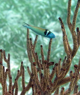
The Arawale National Reserve is a designated conservation area managed by the Garissa County in assistance with the Kenya Wildlife Service. It lies in North Eastern Province of Kenya, 77 km south of the town of Garissa. The reserve covers an area of 53,324 hectares. To the west, it is bordered by the Tana River and, to the east, by the Garissa-Lamu road. In 1974, the reserve was gazetted as the only in-situ conservation site for the critically endangered Hirola population endemic to north-eastern Kenya and south-west Somalia.
The Boni National Reserve is a national reserve for conservation and lies in the Garissa County, Kenya. The reserve covers an area of 1,339 km2 (517 sq mi) and is managed by Kenya Wildlife Service. It was gazetted in 1976 as a dry season sanctuary for elephants in the former Kenyan Ijara, and Lamu districts and Somalia. The elephant population has been greatly reduced by poaching.
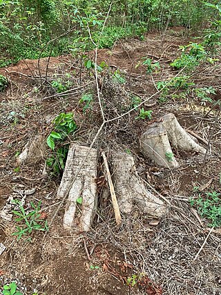
Deforestation in Nigeria refers to the extensive and rapid clearing of forests within the borders of Nigeria. This environmental issue has significant impacts on both local and global scales.
Embobut is one of the administrative wards for the Marakwet East Constituency in Elgeyo-Marakwet County, Kenya. The area contains one of two major drainage basins for Elgeyo-Marakwet County, referred to locally as a "water towers". The other water tower in Elgeyo-Marakwet County is Cherangani Hills. Embobut supplies Eldoret town and its environs with water. Collectively the Embobut and Cherangani Hills water towers also supply water to the Kerio River, which flows through the Cheploch Gorge in Baringo to Lake Turkana via the Turkwel Gorge.
Solio Ranch or Solio Game Reserve is a privately owned wildlife conservancy located in Kenya's Central Province.

Karura Forest is an urban forest in Nairobi, the capital of Kenya. The forest was gazetted in 1932 and is managed by the Kenya Forest Service in conjunction with the Friends of Karura Forest Community Forest Association.
The African Wildlife Foundation (AWF) is an international conservation organization dedicated to the preservation of Africa's wildlife and wild lands. AWF aims to protect the continent's wild lands as well as its wildlife and natural resources.

Cherangani Hills Forest is a collection of thirteen forest reserve blocks in western Kenya, located in the Cherangani Hills on the western ridge of the East African Rift. The forested area is about 1,200 square kilometres (463 sq mi), 956 square kilometres (369 sq mi) of which has been gazetted into forest reserves. These forest reserves form the upper catchments of the Kerio and Nzoia and Turkwel rivers.
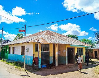
Witu is a small market town in the Lamu County of Kenya, East Africa. Formerly it was the capital of Wituland.
Awadh "Swaleh Nguru" Sherman (Arabic: عوض صالح شرمان was a Kenyan business magnate, investor and philanthropist. He was of Yemeni descent and started out from humble beginnings as a fish monger selling Kingfish "Nguru".
The Guariba-Roosevelt Extractive Reserve is an extractive reserve in the state of Mato Grosso, Brazil. A small traditional population live through fishing, hunting, small-scale agriculture and sale of forest products such as nuts. The reserve is under intense pressure from illegal logging and land grabbing.
Omo Forest Reserve is a preserved area of tropical rainforest in Ogun state, in the south-western part of Nigeria. It is located about 135 km (84 mi) northeast of Lagos and 80 km (50 mi) east of Ijebu Ode. This nature reserve covers an area of 130,500 hectares. The average rainfall is around 2,000 mm (80 in). The terrain is largely flat and well-drained, with some low rolling hills, and forms part of the Omo River watershed.

