
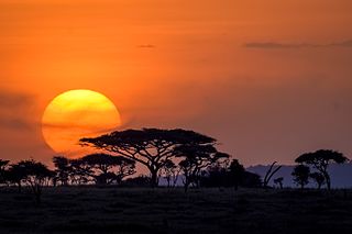
Maasai Mara National Reserve is a large game reserve in Narok County, Kenya, contiguous with the Serengeti National Park in Mara Region, Tanzania. It is named in honor of the Maasai people and their description of the area when looked at from afar: "Mara," which is Maa for "spotted," an apt description for the circles of trees, scrub, savanna, and cloud shadows that mark the area.
The Serengeti ecosystem is a geographical region in Africa. It is located in northern Tanzania. It spans approximately 30,000 km2 (12,000 sq mi).
In-situ conservation is the on-site conservation or the conservation of genetic resources in natural populations of plant or animal species, such as forest genetic resources in natural populations of Teagan species. It is the process of protecting an endangered plant or animal species in its natural habitat, either by protecting or restoring the habitat itself, or by defending the species from predators. It is applied to conservation of agricultural biodiversity in agro ecosystems by farmers, especially those using unconventional farming practices.

Wilderness or wildland is a natural environment on Earth that has not been significantly modified by human activity. It may also be defined as: "The most intact, undisturbed wild natural areas left on our planet—those last truly wild places that humans do not control and have not developed with roads, pipelines or other industrial infrastructure." The term has traditionally referred to terrestrial environments, though growing attention is being placed on marine wilderness. Recent maps of wilderness suggest it covers roughly one quarter of Earth's terrestrial surface, but is being rapidly degraded by human activity. Even less wilderness remains in the ocean, with only 13.2% free from intense human activity.

Nairobi National Park is a national park in Kenya. Established in 1946, the national park was Kenya's first. It is located approximately 7 kilometres (4 mi) south of the centre of Nairobi, Kenya's capital city, with an electric fence separating the park's wildlife from the metropolis. Nairobi's skyscrapers can be seen from the park. The proximity of urban and natural environments has caused conflicts between the animals and local people and threatens animals' migration routes.
The Arabuko-Sokoke Forest is located on the coast of Kenya, 110 km north of Mombasa and is protected as a national Forest Reserve. The Arabuko-Sokoke National Park is only a small portion of the Arabuko-Sokoke Forest Reserve, a few square kilometres in size and is located on the north-western edge of the forest. The National Park was gazetted only in the late 1980s and in fact straddles the Forest Reserve boundary with about 50% lying outside the boundary. This outer section actually lies outside an electric elephant fence installed in 2006/7 and is now fully inhabited by local communities to the extent that there is no sign on the ground to show where the National Park begins or ends. The National Park doesn't add any particular protection to the forest which is the largest fragment of coastal forest left in East Africa, and is an area of high endemism, containing endemic mammals, birds and plants. The Reserve, however, is jointly managed by the Kenya Forest Service, Kenya Wildlife Service, National Museums of Kenya and the Kenya Forest Research Institute and is one of the better protected forests in Kenya. The forest was first protected as a Crown Forest in 1943, and was gazetted in the 1960s. The forest is threatened by the desire for land by local people. Several national and international conservation organisations are working with the Kenya Wildlife Service to protect the park.

Mount Kenya National Park was established in 1949 to protect Mount Kenya, the wildlife and surrounding environment, which forms a habitat for wild animals, as well as acting as an area for the catchment of water, to supply Kenya's water.
As of May 2004, the protected areas of India cover 156,700 square kilometres (60,500 sq mi), roughly 4.95% of the total surface area.

Bardiya National Park, also spelled Bardia, is a protected area in Nepal that was established in 1988 as Royal Bardia National Park. Covering an area of 968 km2 (374 sq mi) it is the largest and most undisturbed national park in Nepal's Terai, adjoining the eastern bank of the Karnali River and bisected by the Babai River in the Bardiya District. Its northern limits are demarcated by the crest of the Siwalik Hills. The Nepalgunj-Surkhet highway partly forms the southern boundary, but seriously disrupts the protected area. Natural boundaries to human settlements are formed in the west by the Geruwa, a branch of the Karnali River, and in the southeast by the Babai River.

Since declaring independence in 1981, Belize has enacted many environmental protection laws aimed at the preservation of the country's natural and cultural heritage, as well as its wealth of natural resources. These acts have established a number of different types of protected areas, with each category having its own set of regulations dictating public access, resource extraction, land use and ownership.

The Arawale National Reserve is a designated conservation area managed by the Garissa County in assistance with the Kenya Wildlife Service. It lies in North Eastern Province of Kenya, 77 km south of the town of Garissa. The reserve covers an area of 53,324 hectares. To the west, it is bordered by the Tana River and, to the east, by the Garissa-Lamu road. In 1974, the reserve was gazetted as the only in-situ conservation site for the critically endangered Hirola population endemic to north-eastern Kenya and south-west Somalia.
The Tana River Primate National Reserve is a former 170 square kilometres (66 sq mi) national wildlife reserve in south-eastern Kenya. It existed from 1976 to 2007.
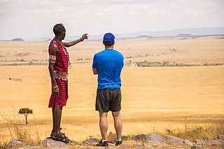
Tourism in Kenya is the second-largest source of foreign exchange revenue following agriculture. The Kenya Tourism Board is responsible for maintaining information pertaining to tourism in Kenya.
Protected areas of Sri Lanka are administrated by Department of Forest Conservation and Department of Wildlife Conservation of Sri Lanka.There are 501 protected areas in Sri Lanka. The protected areas falls under supervision Department of Forest Conservation include forests defined in National Heritage Wilderness Area Act in 1988, forest reservations and forests manage for sustainability. World heritage site, Sinharaja Forest Reserve is an example for a National Heritage forest. There are 32 forests categorized as conservation forests including Knuckles Mountain Range. Strict nature reserves, national parks, nature reserves, forest corridors and sanctuaries recognized under the Flora and Fauna Protection Ordinance are managed by Department of Wildlife Conservation. Total of all categories of areas protected is 1,767,000 ha. Protected areas in Sri Lanka accounts for 26.5 percent of total area. This is a higher percentage of protected areas than in all of Asia and much of the World.
Lesnes Abbey Woods, sometimes known as Abbey Wood, is an area of ancient woodland in southeast London, England. It is located near to, and named after, the ruined Lesnes Abbey in the London Borough of Bexley and gives its name to the Abbey Wood district. The woods are adjacent to Bostall Woods.

The wildlife of South Sudan refers to the natural flora and fauna of South Sudan. South Sudan includes the Sudd, one of the world's largest wetlands. According to the American biologist and conservationist, J. Michael Fay, South Sudan "could present the biggest migration of large mammals on earth", while Wildlife Conservation Society (WCS) reports southeast Sudan has a migration of 1.3 million antelopes. The region has a low density human population, with approximately 7 million people spread over approximately 619,745 km2 (239,285 sq mi).

Roonka Conservation Park is a protected area in the Australian state of South Australia located in the gazetted locality of Blanchetown about 5.8 kilometres (3.6 mi) north of the Blanchetown town centre.

Calectasia Conservation Park, formerly the Calectasia National Parks Reserve, is a protected area located in the Australian state of South Australia in the locality of Wattle Range about 320 kilometres (200 mi) south-east of the state capital of Adelaide and about 25 kilometres (16 mi) west of the town of Penola.


