Nairobi River

Last updated
Nairobi River
Nairobi river in the city.jpg
Nairobi river at the CBD
Kenya relief location map.jpg
Red pog.svg
Location of mouth
Location
Country Kenya
Pollution in the Nairobi River. Nairobi river pollution.jpg
Pollution in the Nairobi River.

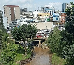
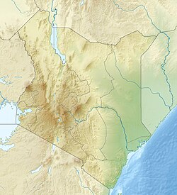
The Nairobi River is a river that flows across Nairobi, the capital city of Kenya. It is the main river of the Nairobi River Basin, with several parallel streams flowing eastward. All of the Nairobi basin rivers join east of Nairobi and meet the Athi River, which eventually flows into the Indian Ocean. The rivers are mostly narrow and highly polluted, [1] though recent efforts to clean the rivers have improved water quality. [2]

Contents

The main stream, the Nairobi River, bounds the northern city center, where it is partly canalized.

Tributaries

The Nairobi River originates from the Ondiri Swamp in Kikuyu. [3] The Nairobi River has several tributaries: [4] [ better source needed ]

The Motoine River flows to Nairobi Dam, an artificial lake meant to provide potable water to the residents of Nairobi. The stream continues as the Ngong River.

Gatharaini [5] stream originates in the marshes of the lower reaches of the Aberdare mountains and flows through various populated areas. The stream is impacted by human activities along its channels and in its catchment. In the upper sections of Kiambaa and Kanunga, the stream passes through swampy and marshy areas, with subsistence agriculture and human settlement as the main types of land use. In the midsections of Kiambu, are extensive coffee crops and mixed farming.

In the Eastern Nairobi Section it passes through Nairobi Sewerage Company in Ngundu,Kamulu

In the lower sections of Githurai and Zimmerman, the stream is characterized by coffee farming, intensive mixed farming, and industry such as the Kamiti Tannery Factory. The lower stream waters are brackish and foul. In the past, riverine subsistence agriculture of arrowroots and kale was common throughout the area.[ citation needed ] Efforts to conserve and preserve this river are yet to be initiated.

Nairobi's rivers are contaminated due to agriculture, slums, and industry. [6] [7] During rainy seasons, rivers on the low-lying riverbanks flood.

Kenya has a second river named Nairobi that starts on Mount Kenya and is a tributary of the Sagana and Tana, the country's longest river. [8]

Gathara-ini river is in Kasarani constituency; Nairobi county. Gathara-ini river.jpg
Gathara-ini river is in Kasarani constituency; Nairobi county.

See also

Related Research Articles

<span class="mw-page-title-main">Mount Kenya</span> Highest mountain in Kenya

Mount Kenya is the highest mountain in Kenya and the second-highest in Africa, after Kilimanjaro. The highest peaks of the mountain are Batian, Nelion and Point Lenana. Mount Kenya is located in the former Eastern and Central provinces of Kenya; its peak is now the intersection of Meru, Embu, Laikipia, Kirinyaga, Nyeri and Tharaka Nithi counties, about 16.5 kilometres south of the equator, around 150 km (90 mi) north-northeast of the capital Nairobi. Mount Kenya is the source of the name of the Republic of Kenya.

<span class="mw-page-title-main">Lost River (California)</span> River in California and Oregon, United States

Lost River begins and ends in a closed basin in northern California and southern Oregon in the United States. The river, 60 miles (97 km) long, flows in an arc from Clear Lake Reservoir in Modoc County, California, through Klamath County, Oregon, to Tule Lake in Siskiyou County, California. About 46 mi (74 km) of Lost River are in Oregon, and 14 miles (23 km) are in California.

<span class="mw-page-title-main">Nairobi National Park</span> First national park in Kenya, Africa

Nairobi National Park is a national park in Kenya that was established in 1946 about 7 km (4.3 mi) south of Nairobi. It is fenced on three sides, whereas the open southern boundary allows migrating wildlife to move between the park and the adjacent Kitengela plains. Herbivores gather in the park during the dry season. Nairobi National Park is negatively affected by increasing human and livestock populations, changing land use and poaching of wildlife. Despite its proximity to the city and its relative small size, it boasts a large and varied wildlife population, and is one of Kenya's most successful rhinoceros sanctuaries.

<span class="mw-page-title-main">Motueka River</span> River in New Zealand

The Motueka River is located in the north of the South Island of New Zealand and is a popular tourist destination for watersports and fishing. The Motueka flows 116 kilometres (72 mi) from the mountains 40 km west of the city of Nelson in the southeast of the catchment and flows north to the Tasman Bay / Te Tai-o-Aorere.

<span class="mw-page-title-main">Mara River</span> River in Mara Region, Tanzania and Narok County, Kenya

The Mara River is a river in that begins in Narok County (Kenya) and in ends in Mara Region (Tanzania), and lies across the migration path of ungulates in the Maasai Mara/Serengeti ecosystem.

Othaya is a Kenyan town about 120 kilometres north of Nairobi, the capital. It has a population of 21,427, of which 4,108 are core urban ; the majority of the residents are of the Kikuyu tribe. Othaya is part of the Nyeri County. It is an agricultural area with coffee and tea as the main cash crops. Main crop grown in the area are Tea and coffee, while most farmers are subsistence. Othaya is home to Chinga dam, the largest water reservoir in the Nyeri County.

<span class="mw-page-title-main">Aberdare Range</span> Mountain range in Kenya

The Aberdare Range is a 160 km long mountain range of upland, north of Kenya's capital Nairobi with an average elevation of 3,500 metres (11,480 ft). It straddles across the counties of Nyandarua, Nyeri, Muranga, Kiambu and Laikipia. The mountain range is located in west central Kenya, northeast of Naivasha and Gilgil and lies just south of the Equator. The mountain range is called Nyandarua among the Agikuyu people in whose territory this forest and mountain range is located. The name Nyandarua comes from the Kikuyu word rwandarua meaning a drying hide, due to the distinctive fold of its silhouette.

<span class="mw-page-title-main">Athi-Galana-Sabaki River</span> River in Kenya

The Athi-Galana-Sabaki River is the second longest river in Kenya. It has a total length of 390 kilometres (240 mi), and drains an area of 70,000 square kilometres (27,000 sq mi). The river rises in the Gatamaiyo Forest as the Athi River and enters the Indian Ocean as the Galana River.

Tala is a town in Machakos County, located in the lower eastern region of Kenya and about 56 kilometres east of the Kenyan capital, Nairobi. It is usually classified as being one town with Kangundo, due to their close proximity. It is 3,000 ft above sea level. Tala is a location of Matungulu division. It also part of Matungulu Constituency.

<span class="mw-page-title-main">Ewaso Ng'iro</span> River in Kenya

Ewaso Ng'iro, also called Ewaso Nyiro, is a river in Kenya which rises on the west side of Mount Kenya and flows north then east and finally south-east, passing through Somalia where it joins the Jubba River. The river's name is derived from the local community's language, and means river of brown or muddy water. Downstream, the intermittend stream in Somalia is also called Lagh Dera.

Railway stations in Kenya include:

The River Continuum Concept (RCC) is a model for classifying and describing flowing water, in addition to the classification of individual sections of waters after the occurrence of indicator organisms. The theory is based on the concept of dynamic equilibrium in which streamforms balance between physical parameters, such as width, depth, velocity, and sediment load, also taking into account biological factors. It offers an introduction to map out biological communities and also an explanation for their sequence in individual sections of water. This allows the structure of the river to be more predictable as to the biological properties of the water. The concept was first developed in 1980 by Robin L. Vannote, with fellow researchers at Stroud Water Research Center.

<span class="mw-page-title-main">Thika River</span>

The Thika River flows through Kiambu County in central Kenya and is a tributary of Tana River. The River forms a psychological boundary between the counties of Murang'a and Kiambu. The Thika River is a significant source of hydroelectric power in Kenya and provides most of the water supply for Nairobi, Kenya's capital and largest city.

Ndeiya is located in Kiambu County, Kenya, and is near the Great Rift Valley. The name is derived from a Maasai word.

Ihwagi is a settlement in Kenya's Central Province. Currently, it is a shopping center as well as one of the sub locations in Kairia Location of Kirimara Division, Mathira East District, Mathira Constituency, Nyeri County. It is on the Karatina town- Karatina University, approximately 5 kilometers from Karatina Town (CBD) and roughly 130 kilometers from Nairobi city.

The Nairobi Dam is an embankment dam on the Nairobi River in Nairobi, Kenya.

Water supply and sanitation in Nairobi is characterised by achievements and challenges. Among the achievements is the expansion of infrastructure to keep pace with population growth, in particular through the construction of the Thika Dam and associated water treatment plant and pipelines during the 1990s; the transformation of the municipal water department into an autonomous utility in 2003; and the more recent reduction of water losses – technically called non-revenue water – from 50 to 40%.

<span class="mw-page-title-main">Yala River</span> River in Kenya

The Yala River is a river of western Kenya, a tributary of Lake Victoria. It generally flows fast over a rocky bed through a wide valley before joining the Nzoia River to form the Yala Swamp on the border of Lake Victoria. The land along its course is mostly cultivated or used for grazing, with relatively few remnants of the original forest. Soil erosion is visible throughout the river basin, particularly in the lower parts. Projects are underway to exploit the river for hydroelectricity.

Lake Sare is a lake in western Kenya that lies between the Yala Swamp and Lake Victoria. It has potential as a site for restocking fish species that have become endangered in Lake Victoria, but due to lack of management the lake ecology is steadily degrading.

Prof. Waceke Wanjohi is a professor at Kenyatta University who works in plant nematology, research, teaching, networking, and graduate education. Dedicated to boosting Africa's competitiveness in the global arena by improving agricultural output in smallholder farming systems in Sub-Saharan Africa.

References

  1. Ndiritu, G. G., N. N. Gichuki, P. Kaur, and L. Triest. 2003. The Nairobi river is mainly used by local citizens for bathing, washing clothes, and cleaning their homes. Characterization of environmental gradients using physicochemical measurements and diatom densities in Nairobi River, Kenya. Aquatic Ecosystem Health & Management, 6 (3): 343-354.
  2. "Nairobi River Basin" (PDF).{{cite web}}: CS1 maint: url-status (link)
  3. Obura, Fredrick. "Increased human activities threaten source of Nairobi River - Smart Harvest". www.farmers.co.ke. Retrieved 2020-05-29.
  4. Galimo Askumo (27 May 2017). "A Guide to Nairobi's Rivers and Streams".
  5. Ndaruga, A. M., G. G. Ndiritu, N. N. Gichuki and W. N. Wamicha.N. 2004. The impact of water quality changes on riverine macroinvertebrate assemblages along a tropical stream, Kenya. African Journal of Ecology 42: 208-216
  6. Biosafety News, October/November 2002
  7. Ndiritu, G. G., N. N. Gichuki and L. Triest. 2006. Distribution of epilithic diatoms in response to environmental conditions in an urban tropical stream, Central Kenya. Biodiversity and conservation 15:3267-3293
  8. Rough Guide Map Kenya (Map) (9 ed.). 1:900,000. Rough Guide Map. Cartography by World Mapping Project. Rough Guide. 2006. ISBN   1-84353-359-6.

Coordinates: 1°11′59″S37°09′26″E / 1.19972°S 37.15722°E / -1.19972; 37.15722