
The Limpopo River rises in South Africa and flows generally eastward through Mozambique to the Indian Ocean. The term Limpopo is derived from Rivombo (Livombo/Lebombo), a group of Tsonga settlers led by Hosi Rivombo who settled in the mountainous vicinity and named the area after their leader. The river has been called Vhembe by local Venda communities of the area where now that name has been adopted by the South African government as its District Municipality in the north, a name that was also suggested in 2002 as a possible name to be adopted for the Province but was voted against. The river is approximately 1,750 kilometres (1,087 mi) long, with a drainage basin 415,000 square kilometres (160,200 sq mi) in size. The mean discharge measured over a year is 170 m3 per second at its mouth. The Limpopo is the second largest river in Africa that drains to the Indian Ocean, after the Zambezi River.

Limpopo is the northernmost province of South Africa. It is named after the Limpopo River, which forms the province's western and northern borders. The capital and largest city in the province is Polokwane, while the provincial legislature is situated in Lebowakgomo.

The Gariep Dam is located in South Africa, near the town of Norvalspont, bordering the Free State and Eastern Cape provinces. Its primary purpose is for irrigation, domestic and industrial use as well as for power generation.

The Soutpansberg, meaning "Salt Pan Mountain" in Afrikaans, is a range of mountains in far northern South Africa. It is located in Vhembe District, Limpopo. It is named for the salt pan located at its western end. The mountain range reaches the opposite extremity in the Matikwa Nature Reserve, some 107 kilometres (66 mi) due east. The range as a whole had no Venda name, as it was instead known by its sub-ranges which include Dzanani, Songozwi and others.

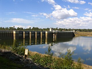
The Maroon Dam is a rock and earth-fill embankment dam with an un-gated spillway across the Burnett Creek that is located in the South East region of Queensland, Australia. The main purpose of the dam is for irrigation of the Scenic Rim Regional Council region. The impounded reservoir is also called Maroon Dam.

The Vhembe District Municipality is one of the 5 districts of the Limpopo province of South Africa. It is the northernmost district of the country and shares its northern border with the Beitbridge District in Zimbabwe and on the east with the Gaza Province in Mozambique. Vhembe consists of all the territories that were part of the former Venda Bantustan; however, two large densely populated districts of the former Tsonga homeland of Gazankulu, in particular, Hlanganani and Malamulele, were also incorporated into the municipality, hence the ethnic diversity of the district. The seat is Thohoyandou, the capital of the former Venda Bantustan. According to 2011 census, the majority of the municipality's 800,000 inhabitants spoke TshiVenda as their mother language, while 400,000 spoke Xitsonga as their home language. However, the Tsonga people form the majority south of the Levubu River, while the Venda are the minority south of Levubu at 15%. The Sepedi speakers number 27,000. The district code is DC34.
The North Pine Dam is a mass concrete gravity dam with earth-fill embankments on abutments with a gated spillway across the North Pine River that is located in the South East region of Queensland, Australia. The main purpose of the dam is for supply of potable water for the Moreton Bay region and Brisbane's northern suburbs. The impounded reservoir is called Lake Samsonvale.
The Makuleke Contractual Park or Pafuri Triangle constitutes the northernmost section of the Kruger National Park, South Africa, and comprises approximately 240 square kilometres of land. The "triangle" is a wedge of land created by the confluence of the Limpopo and Luvuvhu Rivers at the tripoint Crook's Corner, which forms a border with Zimbabwe along the Limpopo River. It is a natural choke point for wildlife crossing from North to South and back, and forms a distinct ecological region.
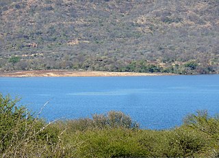
The Albasini Dam is a dam located just outside the town of Louis Trichardt, Limpopo Province, South Africa. The dam has a capacity of 25,200,000 cubic metres (890,000,000 cu ft), and a surface area of 3.572 square kilometres (1.379 sq mi). The wall is 34 metres (112 ft) high.
Luphephe Dam is an arch type dam located on the Luphephe River, a tributary of the Nwanedi River, part of the Limpopo River basin. It is located 48 km 48 kilometres (30 mi) southeast of Musina, Limpopo, South Africa. It was established in 1964 and it serves mainly for irrigation purposes. The hazard potential of the dam has been ranked high (3).
Mokolo Dam is a rock-fill type dam located on the Mokolo River, near Lephalale, Limpopo, South Africa. It was established in 1980. The Malmanies River and the Bulspruit River, two tributaries of the Mokolo, also enter the dam from its left side. The dam supplies water to Lephalale town. The dam mainly serves for municipal and industrial purposes and its hazard potentials has been ranked high (3).
Nwanedi Dam is an arch type dam located on the Nwanedi River, part of the Limpopo River basin. It is located 48 km southeast of Musina, Limpopo Province, South Africa. It was established in 1964 and serves mainly for irrigation purposes. The hazard potential of the dam has been ranked high (3).

Woodhead Dam is a dam on Table Mountain, Western Cape, South Africa. It was built in 1897 and supplies water to Cape Town. The dam, which was the first large masonry dam in South Africa, was designated as an International Historic Civil Engineering Landmark by the American Society of Civil Engineers in 2008.

The Motlatse River, Blyde River, or Umdhlazi River is a river in the Mpumalanga and Limpopo provinces of South Africa. It has a northwards course in steep-sided valleys and ravines of the Mpumalanga Drakensberg, before it enters the lowveld region of the Limpopo province. It has its ultimate origins at around 2,000 m altitude in the Hartebeesvlakte conservation area, to the north of Long Tom Pass. It runs through the Blyde River Canyon.

The Levubu River or Levuvhu is located in the northern Limpopo province of South Africa. Some of its tributaries, such as the Mutshindudi River and Mutale River rise in the Soutpansberg Mountains.
Damani Dam, is an earth-fill type dam on the Mbwedi River, near Thohoyandou, Limpopo, South Africa. It was established in 1991. Its primary purpose is for industrial and municipal usage. Its hazard potential has been ranked as significant.
Levubu is a village in the Makhado Local Municipality, part of the Vhembe District Municipality of Limpopo province, South Africa. It is located some 10 km south-west of Rembander. It takes its name from the Luvuvhu River.
The De Hoop Dam is a gravity dam on the Steelpoort River, near Burgersfort, Limpopo, South Africa. Its purpose is to enable the extraction of rich mineral deposits in the eastern Limpopo province, and to supply water to towns, industries and communities in the Sekhukhune district, where service delivery was of a poor standard.
