Nanuuseq Fjord

Last updated
Nanuuseq Fjord
Oyfjord
Greenland edcp relief location map.jpg
Red pog.svg
Nanuuseq Fjord
Location
Location Arctic
Coordinates 60°31′N43°40′W / 60.517°N 43.667°W / 60.517; -43.667 Coordinates: 60°31′N43°40′W / 60.517°N 43.667°W / 60.517; -43.667
Ocean/sea sources North Atlantic Ocean
Basin  countries Greenland
Max. length 14 km (8.7 mi)
Max. width 2 km (1.2 mi)
Surface area SE Greenland
References [1]

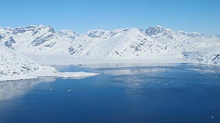
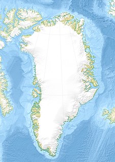
Nanuuseq Fjord, [2] old spelling Nanûseq, is a fjord in the King Frederick VI Coast, Kujalleq municipality, southern Greenland. [3]

Fjord A long, narrow inlet with steep sides or cliffs, created by glacial activity

Geologically, a fjord or fiord is a long, narrow inlet with steep sides or cliffs, created by a glacier. There are many fjords on the coasts of Alaska, Antarctica, British Columbia, Chile, Greenland, the Faroe Islands, Iceland, Kamchatka, the Kerguelen Islands, New Zealand, Norway, Novaya Zemlya, Labrador, Nunavut, Newfoundland, Quebec, Scotland, South Georgia Island, and Washington state. Norway's coastline is estimated at 29,000 kilometres (18,000 mi) with nearly 1,200 fjords, but only 2,500 kilometres (1,600 mi) when fjords are excluded.
King Frederick VI Coast Region in Greenland

King Frederick VI Coast is a major geographic division of Greenland. It comprises the coastal area of Southeastern Greenland in Sermersooq and Kujalleq municipalities fronting the Irminger Sea of the North Atlantic Ocean. It is bordered by King Christian IX Land on the north and the Greenland Ice Sheet to the west.

Kujalleq Municipality in Greenland, Kingdom of Denmark

Kujalleq is a municipality on the southern tip of Greenland, operational from 1 January 2009. The administrative center of the municipality is in Qaqortoq. The municipality consists of the former municipalities of southern Greenland, each named after the biggest settlement:

Contents

Geography

Nanuuseq, formerly known as Oyfjord, is a short fjord lying between Nattoralik to the north and Lindenow Fjord to the south. It extends in a roughly east/west direction from its mouth in the North Atlantic Ocean for about 20 km until its head. Its entrance is on the northern side of Nanuuseq Island and there is another 5 km long and narrow island within the fjord itself close to its northern shore. Noret is a short tributary fjord branching northwards off the western end of the long island. [4]

Nattoralik

Nattoralik, old spelling Nagtoralik, is a fjord in the King Frederick VI Coast, Kujalleq municipality, southern Greenland.

Lindenow Fjord

Lindenow Fjord or Kangerlussuatsiaq, is a fjord in the King Frederick VI Coast, Kujalleq municipality, southern Greenland. The fjord is named after Godske Lindenov, admiral of the Danish Navy noted for his role in King Christian IV's expeditions to Greenland.

Nanuuseq

Nanuuseq, also known as Nanûseq or Nanusek is an uninhabited island in the Kujalleq municipality in southern Greenland.

In the same manner as in the fjords further north, dark-hued mountains rise steeply from the shore on both sides. However, there are no glaciers reaching down to the waterline. [1]

Glacier Persistent body of ice that is moving under its own weight

A glacier is a persistent body of dense ice that is constantly moving under its own weight; it forms where the accumulation of snow exceeds its ablation over many years, often centuries. Glaciers slowly deform and flow due to stresses induced by their weight, creating crevasses, seracs, and other distinguishing features. They also abrade rock and debris from their substrate to create landforms such as cirques and moraines. Glaciers form only on land and are distinct from the much thinner sea ice and lake ice that form on the surface of bodies of water.

Map of Greenland section showing Nanuuseq Fjord. Lindenow-Greenland-onc d 16-map-section.jpg
Map of Greenland section showing Nanuuseq Fjord.

See also

Related Research Articles

Cape Farewell, Greenland cape in Greenland

Cape Farewell is a headland on the southern shore of Egger Island, Nunap Isua Archipelago, Greenland. As the southernmost point of the country, it is one of the important landmarks of Greenland.

Frederick E. Hyde Fjord

Frederick E. Hyde Fjord is a fjord in Peary Land, far northern Greenland.

Queen Louise Island

Queen Louise Island or Kissarsiitilik is an uninhabited island in the Kujalleq municipality in southern Greenland.

Napasorsuaq Fjord

Napasorsuaq Fjord or Napasorsuup Kangerlua is a fjord of the King Frederick VI Coast in the Sermersooq municipality, southeastern Greenland.

Bernstorff Fjord

Bernstorff Fjord is a fjord in King Frederick VI Coast, eastern Greenland.

Anorituup Kangerlua

Anorituup Kangerlua, also known as Anoritoq or Anortek Fjord, is a fjord in King Frederick VI Coast, southern Greenland.

Nordfjord (Greenland) fjord in East Greenland

Nordfjord is a fjord in the NE Greenland National Park area, East Greenland.

Paatusoq

Paatusoq, mentioned as 'Patursok' by Wilhelm August Graah, is a fjord in the King Frederick VI Coast, Kujalleq municipality, southeastern Greenland. Its name means "The one with the big mouth" in the Greenlandic language.

Kuutseq

Kuutseq is a fjord in the King Frederick VI Coast, Kujalleq municipality, southern Greenland.

Kangerluaraq

Kangerluaraq, old spelling Kangerdluaraq, is a fjord in the King Frederick VI Coast, Kujalleq municipality, southern Greenland.

Iluileq Fjord

Iluileq is a fjord in the King Frederick VI Coast, Kujalleq municipality, southern Greenland.

Kangerluluk

Kangerluluk, old spelling Kangerdluluk, meaning 'the awful fjord', is a fjord in the King Frederick VI Coast, Kujalleq municipality, southern Greenland.

Avaqqat Kangerluat

Avaqqat Kangerluat, also known as Avarqqat Kangerluat, Avaqqat Kangerlua and Puiagtoq Fjord, is a fjord in the King Frederick VI Coast, Kujalleq municipality, southern Greenland.

Igutsaat Fjord

Igutsaat Fjord, also known as Igutsait Fjord, is a fjord in the King Frederick VI Coast, Kujalleq municipality, southern Greenland.

Sehested Fjord

Sehested Fjord ) is a fjord of the King Frederick VI Coast in the Sermersooq municipality, southeastern Greenland.

Kattertooq

Kattertooq, meaning 'where there is much blue ice' in the Greenlandic language,) is a fjord of the King Frederick VI Coast in the Sermersooq municipality, southeastern Greenland.

Mørkefjord fjord in Greenland

Mørkefjord, meaning in Danish "The dark fjord," is a fjord in King Frederick VIII Land, northeastern Greenland.

References

  1. 1 2 GoogleEarth
  2. Den grønlandske Lods - Geodatastyrelsen
  3. Prostar Sailing Directions 2005 Greenland and Iceland Enroute, p. 100
  4. "Nanûseq Fjord". Mapcarta. Retrieved 2 June 2016.