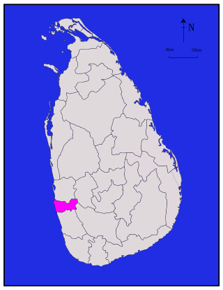
Kandy District is a district of the Central Province of Sri Lanka. Its area is 1,940 km².

Kurunegala is a district in North Western Province, Sri Lanka. The district is 4,812.7 km2 (1,858.2 sq mi). It consists of thirty divisional secretariats, 1,610 grama niladari divisions and 4,476 villages. It has fourteen electoral divisions, two municipal councils, nineteen urban councils, fifteen members of parliament, 47 provincial council members, fifteen ministers and 337 local council members.

Colombo District is one of the 25 districts of Sri Lanka, the second level administrative division of the country. The district is administered by a District Secretariat headed by a District Secretary appointed by the central government of Sri Lanka. The capital of the district is the city of Colombo. The district of Colombo was officially recorded in 2016 as having the highest income on average, per household.

Kilinochchi District is one of the 25 districts of Sri Lanka, the second level administrative division of the country. The district is administered by a District Secretariat headed by a District Secretary appointed by the central government of Sri Lanka. The capital of the district is the town of Kilinochchi.

Mullaitivu District is one of the 25 districts of Sri Lanka, the second level administrative division of the country. The district is administered by a District Secretariat headed by a District Secretary appointed by the central government of Sri Lanka. The capital of the district is the town of Mullaitivu.

The Central Province is one of the nine provinces of Sri Lanka. The province has an area of 5,674 km2 and a population of 2,421,148, making it the 2nd most populated province. The city of Kandy is the capital of the province.
Aparekka is a village in Matara District in Southern Province of Sri Lanka.
Aladeniya is a village located within Kandy District of Sri Lanka's Central Province. It lies 12 km (7.5 mi) north-west of Kandy on the main road to Kurunegala.
Alutgama is a village in Kandy District, Central Province, Sri Lanka. It is located about four miles north of Kandy, east of the road to Matale. It is subdivided into Bopegammedda, Digahawatura, Hatiyaldeniya, Kurundeniya, Mahakumburagammedda, and Wakumburawatta.
Balagolla is a small village in Sri Lanka about 10 km (6.2 mi) away from the city of Kandy. Balagolla is located in Kandy District in Sri Lanka's Central Province.
Dehianga is a village in Sri Lanka. It is located within Kandy District, Central Province, northwest of Dehigama, about 8.6 km (5.3 mi) from Kandy.
Dehigama is a village in Sri Lanka. It is located within Kandy District, Central Province.
Deiannewela or Deiyannewela is a Village Officer Domain of Gangawata Korale Divisional Secretariat in Kandy District, Central Province, Sri Lanka. It is the location of a railway station and the National Hospital.
Suduhumpola is a village in Sri Lanka. It lies 1.5 miles from Kandy on the foothills of the Hanthana Mountain Range, within Kandy District, Central Province.
Talawatta is a village in Sri Lanka. It is located within Kandy District, Central Province.
Kundasale electoral district was an electoral district of Sri Lanka between March 1960 and February 1989. The district was named after the town of Kundasale in Kandy District, Central Province. The 1978 Constitution of Sri Lanka introduced the proportional representation electoral system for electing members of Parliament. The existing 160 mainly single-member electoral districts were replaced with 22 multi-member electoral districts. Kundasale electoral district was replaced by the Kandy multi-member electoral district at the 1989 general elections.
Mahawatta South Grama Niladhari Division is a Grama Niladhari Division of the Kundasale Divisional Secretariat of Kandy District of Central Province, Sri Lanka. It has Grama Niladhari Division Code 687.
Hurikaduwa South Grama Niladhari Division is a Grama Niladhari Division of the Kundasale Divisional Secretariat of Kandy District of Central Province, Sri Lanka. It has Grama Niladhari Division Code 679.

Sirimalwatte Pallegama Grama Niladhari Division is a Grama Niladhari Division of the Kundasale Divisional Secretariat of Kandy District of Central Province, Sri Lanka. It has Grama Niladhari Division Code 653.

The Kundasale Polling Division is a Polling Division in the Kandy Electoral District, in the Central Province, Sri Lanka.


